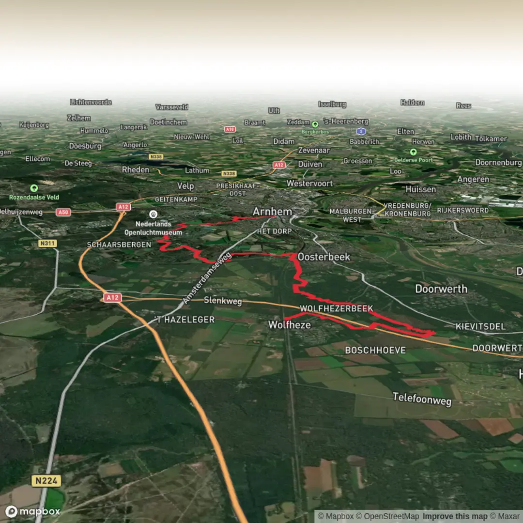
Wolfheze to Arnhem Centraal via Wolfhezerheide, Vijverberg and Gulden Bodem
Download
3D Flyover
Add to list
More
19.7 km
~4 hrs 5 min
91 m
Point-to-Point
“From wind-brushed heath and whispering pines to pond-dotted parks, this gentle drift ends at Arnhem Centraal.”
This point-to-point walk links quiet heathland and pine woods west of Arnhem with some of the city’s most classic green spaces, finishing right at Arnhem Centraal. At roughly 20 km / 12.4 mi with about 100 m / 330 ft of total ascent, it’s mostly gentle underfoot, with a few short sandy rises on the heaths and low, rolling bumps in the parks and wooded estates.
Getting to the start (Wolfheze) + where to begin
Start area (nearest landmark): Wolfheze railway station (Station Wolfheze), Wolfheze, Netherlands—this is the simplest, most recognizable start point for “Wolfheze to Arnhem Centraal” routes.
- By train (recommended): Take a train to Station Wolfheze (it’s on the corridor between Ede-Wageningen and Arnhem). From the platforms you can step straight into village lanes and forest-edge paths within minutes.
- By car: Aim for parking near Station Wolfheze (small local parking) or nearby public parking in the village. Arrive early on weekends—this area is popular with walkers and cyclists.
- Finish logistics: You end at Arnhem Centraal (major rail hub), so returning by train is straightforward—no need to loop back unless you want to.
Before you set off, load the route in HiiKER; the heathland sections can have multiple parallel sandy tracks where it’s easy to drift onto a bike line or a wildlife path.
Wolfhezerheide: open heath, sandy tracks, and big skies
From Wolfheze you’ll quickly trade streets for mixed woodland and open heath. The Wolfhezerheide is the first “signature” landscape: broad, open, often wind-brushed heath with sandy, pale trails and scattered pines/birches. Expect:
- Underfoot: firm sand and compacted grit; after dry spells it can feel a little “draggy,” but gradients stay mild.
- Exposure: little shade on the heath itself—sun and wind can be more intense than you expect for an “easy” hike.
- Wildlife: this region of the Veluwe fringe is known for deer and wild boar presence in the wider area. You’re more likely to see tracks, rooting marks, and birds than large mammals in daylight, but early/late walkers sometimes spot deer at heath edges. Keep dogs leashed where required and give any large animal plenty of space.
Distance guide: Plan roughly 5–7 km / 3.1–4.3 mi from Wolfheze to the point where the route begins to feel more “estate/park-like” as you angle toward Arnhem’s western green belt. Elevation gain here is gradual—small sandy rises rather than sustained climbs.
Vijverberg and Gulden Bodem: estate woods, ponds, and a softer landscape
As you leave the more open heath, the walk becomes more sheltered and varied: wooded lanes, park paths, and estate-like clearings. The names Vijverberg (“pond hill/pond area”) and Gulden Bodem (“golden ground”) fit the feel—expect water features, damp hollows, and richer soils compared with the heath.
- Vijverberg area: Look out for ponds and wet woodland edges—these can attract waterfowl and amphibians in the warmer months. Paths may be muddy after rain, especially where leaf litter hides puddles.
- Gulden Bodem: This is one of Arnhem’s beloved green spaces, with mature trees, gentle slopes, and a more landscaped character. It’s a good place for a snack stop because it’s scenic and usually has multiple benches/edges to sit on.
Distance guide: From the end of the heathland feel to the Gulden Bodem zone is often another 6–8 km / 3.7–5.0 mi, depending on the exact lines you take through the woods and parks. The “up and down” here accounts for much of the hike’s modest total ascent—short rises of a few meters at a time.
Into Arnhem: parks to city streets, then Arnhem Centraal
The final leg transitions from green corridors into a more urban setting. You’ll likely follow well-made park paths first, then paved sidewalks/cycleways as you approach the station.
- Crowds and shared paths: Near Arnhem, expect more cyclists and runners. Stay alert on wider multi-use paths and keep right where appropriate.
- Wayfinding: Urban edges can be the trickiest for navigation because of intersecting paths, underpasses, and road crossings—keep HiiKER handy for the last few kilometers.
- Finish landmark: Arnhem Centraal Station is unmistakable and well signed once you’re close.
Distance guide: From Gulden Bodem into Arnhem Centraal is typically 4–6 km / 2.5–3.7 mi. The terrain is mostly flat to gently rolling, with the easiest footing of the day.
What to pack and what to watch for (practical planning)
- Footwear: Light hiking shoes or trail runners work well. Choose something with decent grip for sand on the heath and mud/leaf-slick paths in the wooded sections.
- Layers: The heath can feel cooler/windier; the woods can feel still and humid. A light shell is useful year-round.
- Water/food: You’re walking from a small station area into a city—services are more reliable near Arnhem, but

Surfaces
Unknown
Ground
Asphalt
Sand
Unpaved
Gravel
Concrete
Paved
Dirt
Cobblestone
Wood
Comments and Reviews
User comments, reviews and discussions about the Wolfheze to Arnhem Centraal via Wolfhezerheide, Vijverberg and Gulden Bodem, Netherlands.
average rating out of 5
0 rating(s)