Download
3D Flyover
Add to list
More
18.1 km
~3 hrs 39 min
25 m
Loop
“A reflective loop from heath-bright skies to pine hush and Rhine floodplains, gently rolling.”
This loop sits on the south edge of the Veluwe near the Rhine, linking open heath, quiet pine-and-oak woodland, estate lanes, and the river’s floodplain landscape around Doorwerth. Although it’s often described as “flat,” expect gentle but frequent undulations where the Veluwe’s sandy ridge drops toward the Neder-Rijn—small rises rather than long climbs.
Key stats (approx.): ~17 km / 10.6 mi.
Elevation gain: plan for low-to-moderate rolling gain (often ~100–150 m total / ~330–490 ft on similar local loops), even though no single climb is big. (routeyou.com)
Difficulty: Easy for regular walkers; “easy-moderate” if it’s wet, windy on the heath, or if you’re not used to sandy paths.
Getting to the start (public transport + car)
A very practical start for this loop is Station Wolfheze (6874 AH Wolfheze), which is a common trailhead for 17 km circuits that connect the Doorwerth area and nearby heaths. (visitarnhem.com)
- By train: Take NS rail to Wolfheze Station (on the Arnhem–Ede-Wageningen line). From the platform you can step straight onto quiet village lanes and forest paths within minutes. (visitarnhem.com)
- By car: If you prefer a landmark car start with facilities, a popular alternative is Kasteel Doorwerth, Fonteinallee 2B, 6865 ND Doorwerth (parking nearby; café on-site). (glk.nl)
For navigation, load the route in HiiKER and keep it handy at junction-dense forest sections where side paths can look equally “right,” especially after storms or forestry work.
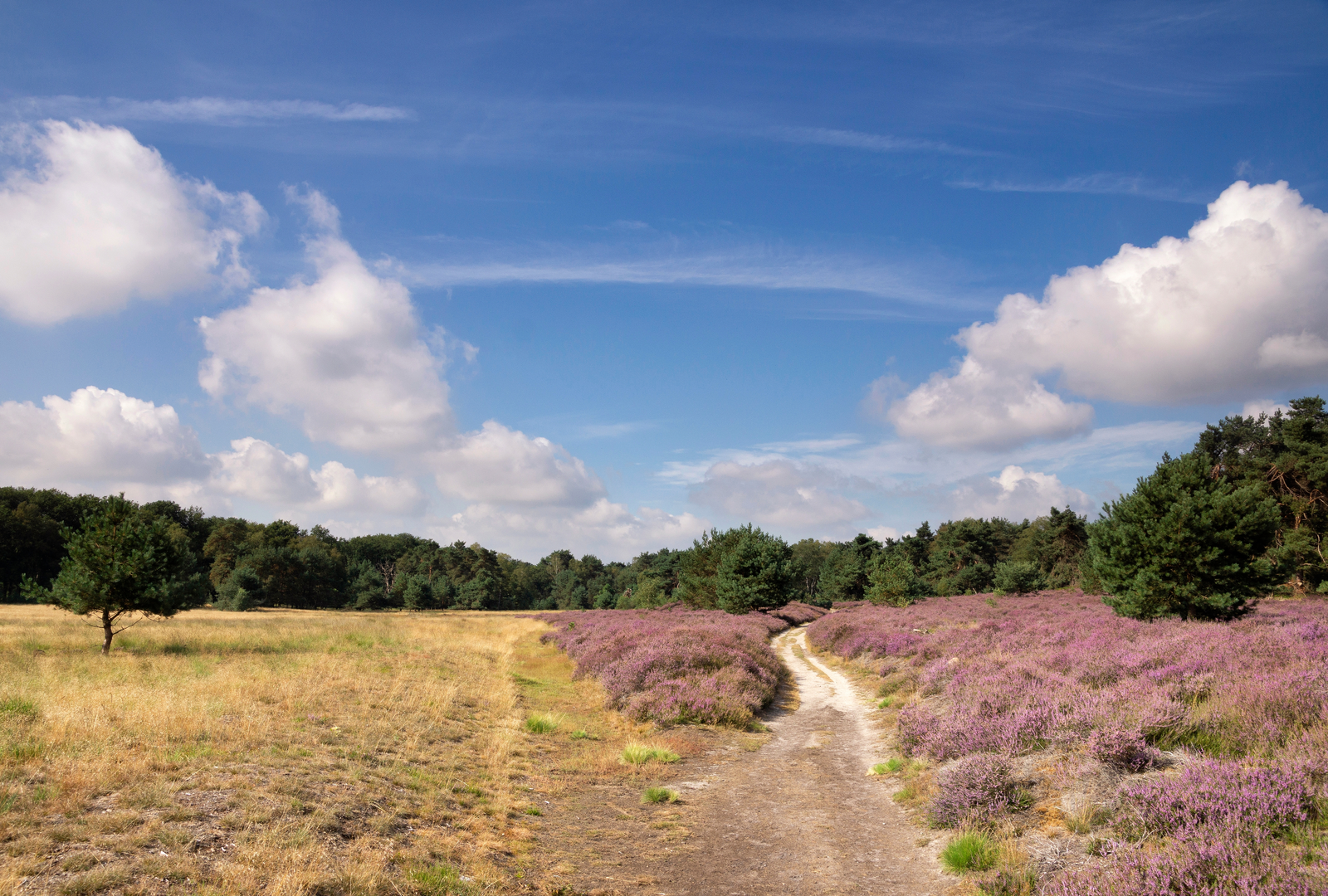
You’ll begin on easy surfaces—pavement or compact gravel—then quickly transition to Veluwe sand and needle-covered singletrack. Early on, the landscape opens into heath and scrub: wide skies, low vegetation, and long sightlines. In late summer, heather can color the area, while in other seasons it’s a textured palette of sand, moss, and tawny grasses.
As you move between heath patches and woodland, watch for: - Soft sand that can slow pace and stress calves/ankles (trekking poles help if you use them). - Fast cyclists on shared wider tracks—listen behind you on straight forest lanes. - Ticks in heath-edge grasses and bracken (long socks and a post-hike check are worth it).
Heath, woodland, and “wildwissel” crossings
The middle kilometers are a classic Veluwe mix: pine plantations, older mixed stands, and small clearings. “Wildwissel” in Dutch commonly refers to wildlife crossings/paths—you’ll often notice subtle animal trails cutting through the undergrowth, especially where forest meets open heath. Dawn and dusk are prime times to spot roe deer slipping across these edges; foxes are possible but usually fleeting.
You’ll also encounter the region’s characteristic sprengenbeken (man-made spring-fed streams) in the broader area—channels historically engineered to provide reliable water flow for mills and estates. On related routes nearby, the Wolfhezer Beek is specifically noted as a sprengenbeek with centuries of history. (veluwe.nl)
Toward Doorwerth: castle, estates, and river landscapes
As the loop trends toward Doorwerth, the feel becomes more “estate-like”: straighter lanes, older tree lines, and occasional formal plantings. A standout landmark is Kasteel Doorwerth—a substantial medieval castle complex that anchors many walks here and makes a natural break point (water, toilets/café when open). (glk.nl)
Not far from the castle, the route character can shift again toward the Doorwerthsche Waarden (Rhine floodplain). These lower areas can be: - Muddy after rain and slick on clayey patches. - Exposed to wind coming off the river corridor. - Seasonally sensitive for wildlife—stay on paths and respect any temporary restrictions.

Surfaces
Unknown
Ground
Asphalt
Sand
Concrete
Dirt
Grass
Paved
Unpaved
Comments and Reviews
User comments, reviews and discussions about the Renkumse Heide, Wildwissel and Doorwerthsche Loop, Netherlands.
average rating out of 5
0 rating(s)