Download
3D Flyover
Add to list
More
78.1 km
~3 days
67 m
Multi-Day
“A patient, mostly flat day linking Bekendelle’s cool swampy shade to Willinks Weust’s sunlit limestone edges.”
This is a long, low-relief ramble through the eastern Achterhoek around Winterswijk, linking two very different Natura 2000 landscapes: the wet, shady stream-forest of Bekendelle and the open, lime-influenced grasslands and quarry-edge habitats of Willinks Weust. At ~78 km (≈48.5 mi) with only ~100 m (≈330 ft) of total ascent, the challenge is almost entirely about time-on-feet, pacing, and staying comfortable through many hours of flat walking rather than climbing.
Where the hike starts (nearest known place)
“Wooldseweg” in this context is on the south side of Winterswijk (Gelderland). A commonly used start reference for routes in the Woold area is Wooldseweg 103, 7108 AA Winterswijk, Netherlands (startpoint approximation used by regional walking-node route listings). (wandelknooppunt.be)
Another well-known nearby trailhead/parking reference in the same corridor is TOP Berenschot (Wooldseweg 74, 7108 AB Winterswijk), often used as a local starting hub for longer walks in Woold. (geertwevers.blogspot.com)
Getting to the start (car + public transport)
- By car: Aim for the Woold hamlet south of Winterswijk and park at/near a designated trailhead such as TOP Berenschot (Wooldseweg 74) or along the route’s indicated start near Wooldseweg 103 (use HiiKER to confirm the exact start pin and the closest legal parking). (geertwevers.blogspot.com)
- By public transport: The practical rail/bus hub is Winterswijk. From Winterswijk you’ll typically connect by local bus, taxi, or a short bike ride to the Wooldseweg corridor south of town (again, use HiiKER to match the route start to the nearest stop and walking approach).
What the terrain feels like over 78 km / 48.5 mi
Expect a patchwork of: - Farm lanes and quiet country roads through the classic Achterhoek “coulissenlandschap” (hedgerows, tree lines, small fields, and scattered farmsteads). - Unpaved woodland and riverside paths where the ground can turn soft after rain—especially near Bekendelle’s stream and seepage zones. - Open reserve tracks around Willinks Weust where wind exposure is higher and shade is limited.
Because the elevation gain is so low (~100 m / 330 ft), your feet and joints will notice surface changes more than hills: long stretches of hard pavement can fatigue soles and hips, while sandy or muddy sections can slow your pace late in the day.
Navigation (keep it simple, keep it consistent)
This is the kind of route where it’s easy to drift onto the “wrong-but-parallel” farm track. Keep HiiKER open and: - Check your position at every major junction and whenever you pass from paved lane to field-edge track. - Watch for short connectors between landscape blocks (small bridges, culverts, and narrow rights-of-way) that are easy to miss.
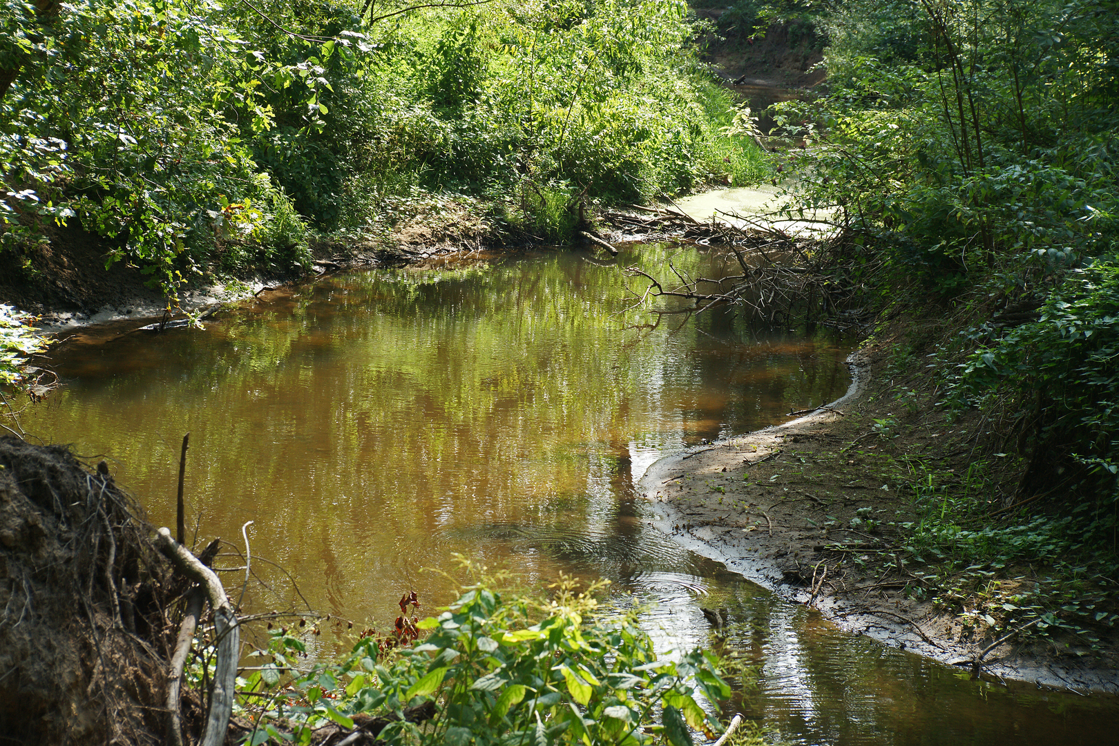
Bekendelle: wet woodland, meanders, and a rare Dutch “swamp forest” feel
Bekendelle is widely described as an old riparian deciduous forest with the Boven-Slinge meandering through it, and it’s noted as one of the few swamp forests in the Netherlands. (detweebruggen.com)
On the ground, that translates to:
- Cool, shaded corridors under broadleaf canopy.
- Water-shaped microterrain: little side channels, seep lines, and damp hollows.
- Seasonal mud: even in otherwise dry periods, the lowest lines can stay slick.
What to look for - The character of the Boven-Slinge’s bends and undercut banks (subtle, but it’s the “engine” of the reserve). - Spring and early summer are typically the most botanically interesting in these wet woods; late summer can feel greener but more uniform.
Practical cautions - After rain, expect slippery roots and greasy clay in shaded sections. - In warm months, bring insect protection—wet woodland edges can be buggy at dawn/dusk.
Willinks Weust: limestone influence, restoration grasslands, and the quarry edge
Willinks Weust is a Natura 2000 area near Winterswijk that has undergone habitat restoration to expand species-rich grasslands and heath-related communities; restoration work was reported as completed in 2022 with ongoing positive development afterward. (staatsbosbeheer.nl)
A defining nearby feature is the Winterswijk Quarry, where Muschelkalk limestone layers are exposed and are described as ~240 million years old; notable fossil finds include Nothosaurus remains.

Surfaces
Asphalt
Unknown
Paved
Concrete
Wood
Comments and Reviews
User comments, reviews and discussions about the Bekendelle and Willinks Weust via Wooldseweg, Netherlands.
average rating out of 5
0 rating(s)