Download
3D Flyover
Add to list
More
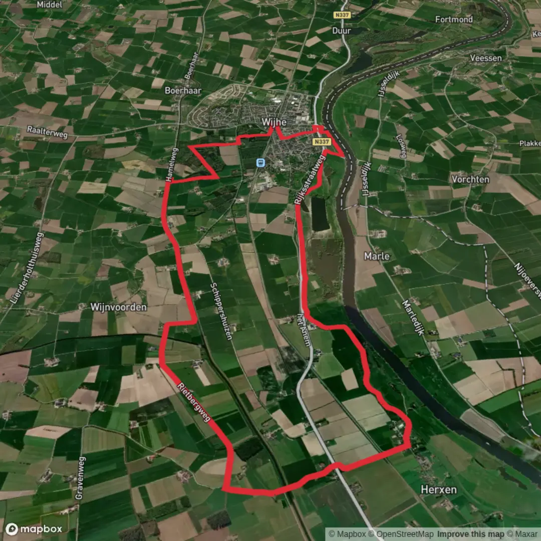
15.6 km
~3 hrs 8 min
13 m
Loop
“Wander through meadows, forests, and blooming heath as Dutch history and nature gently unfold around you.”
Trail Overview
Embarking on the Gelderblok, De Zwarte Slurink, and De Waardman Loop offers a serene 16-kilometer (approximately 10-mile) journey through the picturesque Dutch countryside. With virtually no elevation gain, this easy-rated trail is ideal for hikers of all levels seeking a leisurely exploration of the region's natural beauty.
Getting to the Trailhead
The trailhead is conveniently located near the town of Woudenberg in the province of Utrecht. For those traveling by car, parking is available at Stationsweg Oost 243, 3931 EP Woudenberg. If you prefer public transport, Woudenberg is accessible via regional bus services from nearby cities such as Amersfoort and Utrecht. Upon arrival in Woudenberg, the trailhead is a short walk from the town center.
Trail Highlights
Gelderblok: As you commence your hike, you'll traverse the Gelderblok area, characterized by its lush meadows and traditional Dutch farmhouses. This section provides a glimpse into the agricultural heritage of the region, with fields that have been cultivated for centuries.
De Zwarte Slurink: Continuing along the loop, you'll enter De Zwarte Slurink, a serene forested area. The dense canopy of oak and beech trees offers ample shade, making it a pleasant stretch during warmer months. Keep an eye out for native wildlife, including deer and various bird species that inhabit this woodland.
De Waardman: The final segment of the loop takes you through De Waardman, an open heathland interspersed with small ponds and wetlands. This diverse ecosystem supports a variety of flora and fauna, including heather plants that bloom vibrantly in late summer. Birdwatchers will appreciate the opportunity to spot species such as the European stonechat and the common snipe.
Historical Significance
The region surrounding Woudenberg is steeped in history. Notably, the trail skirts areas that were once part of the Grebbe Line, a series of water-based defenses used during various periods in Dutch history, including World War II. Remnants of these fortifications can still be observed, offering a tangible connection to the past.
Navigation and Trail Conditions
The trail is well-marked with yellow signs in the shape of a clog, guiding hikers through the various terrains. While the path is predominantly flat and easy to navigate, it's advisable to wear sturdy footwear, especially after rain, as some sections may become muddy. For detailed maps and real-time navigation assistance, consider using HiiKER, which provides comprehensive trail information and user reviews.
Amenities and Considerations
Facilities: Restrooms and picnic areas are available at the trailhead and at designated spots along the route.
Wildlife: While the trail is safe, always maintain a respectful distance from wildlife and refrain from feeding animals.
Weather: The Dutch climate can be unpredictable. It's recommended to check the weather forecast before your hike and dress in layers to accommodate changing conditions.
By preparing accordingly and respecting the natural environment, hikers can fully enjoy the tranquil beauty and historical richness of the Gelderblok, De Zwarte Slurink, and De Waardman Loop.

Surfaces
Unknown
Asphalt
Concrete
Grass
Sand
Comments and Reviews
User comments, reviews and discussions about the Gelderblok, De Zwarte Slurink and De Waardman Loop, Netherlands.
average rating out of 5
0 rating(s)