Download
3D Flyover
Add to list
More
24.7 km
~4 hrs 55 min
0 m
Loop
“Wander through a patchwork of wildflowers, woodlands, and historic farms on this tranquil countryside loop.”
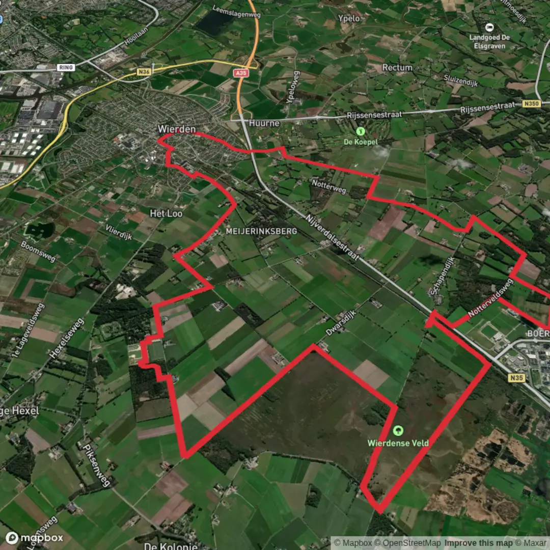
Starting out near the village of Notter in the Overijssel province of the Netherlands, this 25 km (15.5 mile) loop hike weaves through the tranquil landscapes of the Vossenbos, Wulpen, Nottervelds, and Wittebelts areas. With virtually no elevation gain, this route is ideal for those seeking a leisurely day out, suitable for most fitness levels and perfect for both seasoned hikers and families.
Getting There
The trailhead is easily accessible by car, with parking available near Notter, close to the intersection of Notterveldweg and Notterweg. For those using public transport, take a train to Rijssen station, then transfer to a local bus toward Notter. From the bus stop, it’s a short walk to the starting point. Always check current schedules, as rural bus services may be infrequent.
Trail Overview and Navigation
The route is a well-marked circuit, but carrying a digital map on HiiKER is highly recommended for seamless navigation, especially as the paths occasionally intersect with local farm tracks and forest roads. The terrain is predominantly flat, with a mix of forest trails, open heathland, and quiet rural lanes.
Natural Highlights
Forests and Heathland
The Vossenbos and Nottervelds sections are characterized by dense woodlands of oak, birch, and pine, providing ample shade and a peaceful atmosphere. In spring and summer, the forest floor bursts with wildflowers and ferns, while autumn brings a vibrant display of changing leaves. The Wittebelts area is known for its open heath, where purple heather blooms in late summer, attracting butterflies and bees.
Wildlife Encounters
Keep an eye out for roe deer, foxes, and a variety of woodland birds such as woodpeckers, nuthatches, and jays. Early mornings or late afternoons are the best times for wildlife spotting. The wetlands and ponds scattered along the route are home to frogs, dragonflies, and occasionally herons.
Cultural and Historical Significance
The region around Notter has a rich agricultural history, with traditional Dutch farmhouses dotting the landscape. Some of these farms date back to the 18th and 19th centuries, and you may spot old windmills and barns along the way. The area was historically important for peat extraction, which shaped much of the local environment and economy. Informational signs along the route provide insights into the land’s transformation from wild heath to cultivated fields.
Points of Interest
- At approximately 8 km (5 miles), you’ll pass through the heart of the Nottervelds, where a small picnic area offers a perfect rest stop.
- Around the 15 km (9.3 mile) mark, the trail skirts the edge of the Wittebelts heath, with expansive views and benches for a scenic break.
- Near the end of the loop, the path passes close to the Notter village church, a charming example of rural Dutch architecture.
Facilities and Preparation
There are limited facilities directly on the trail, so bring enough water and snacks for the day. Public toilets and small cafés can be found in Notter and nearby Rijssen. The flat, well-maintained paths are suitable for sturdy walking shoes or lightweight hiking boots. Weather can be changeable, so pack a rain jacket and check the forecast before setting out.
This gentle, scenic hike offers a wonderful introduction to the natural and cultural heritage of Overijssel, with easy access and plenty of opportunities to enjoy the peaceful Dutch countryside.

Surfaces
Asphalt
Unknown
Sand
Ground
Comments and Reviews
User comments, reviews and discussions about the Vossenbos Weg, Wulpen Weg, Nottervelds Weg and Wittebelts Weg, Netherlands.
average rating out of 5
0 rating(s)