Download
3D Flyover
Add to list
More
14.2 km
~2 hrs 50 min
0 m
Loop
“A flat, dike-top wander through reedbeds and willow flood-forest—easy-going, until wind and mud bite.”
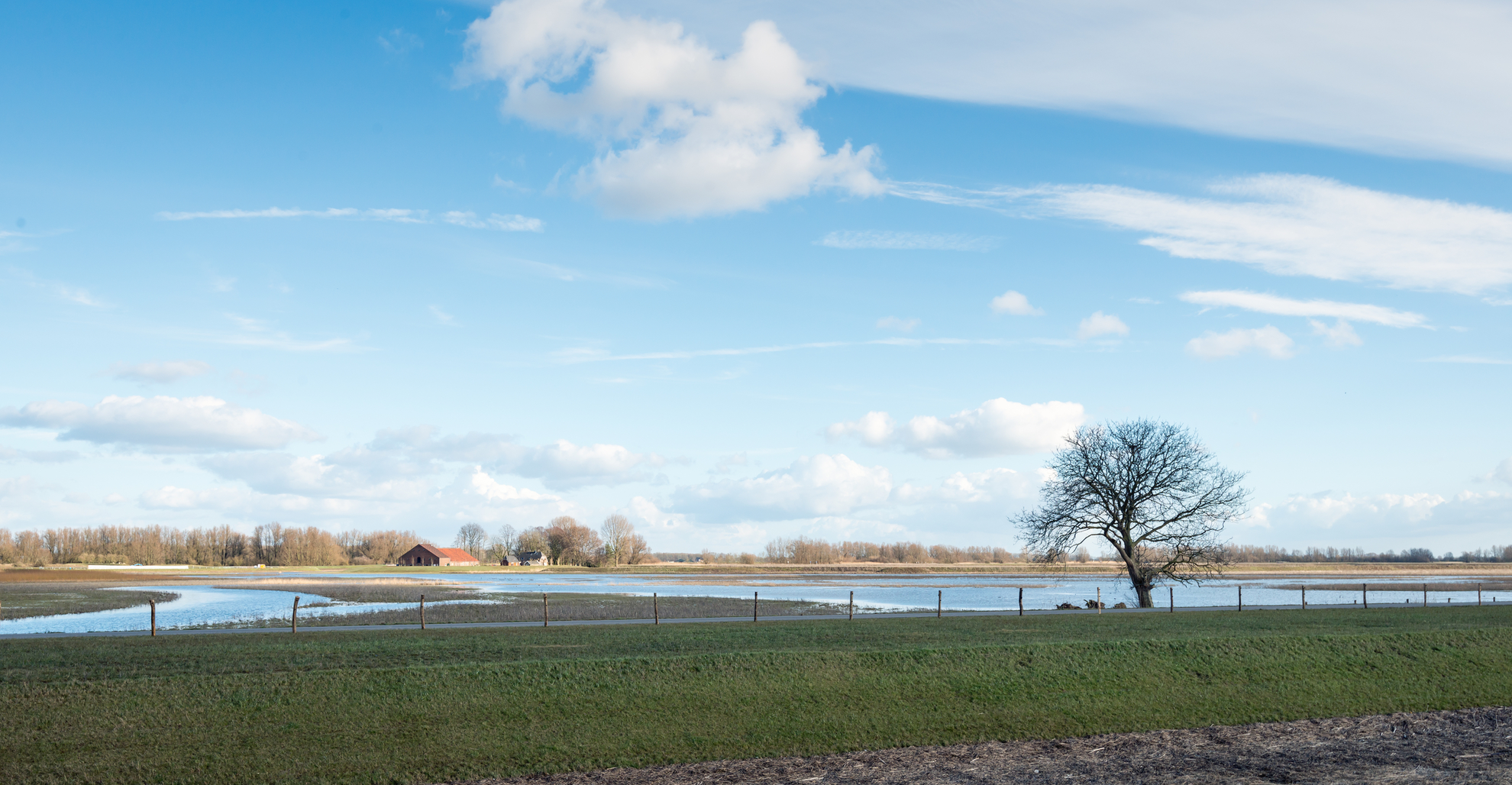
This is a flat, water-shaped loop through the northern edge of Nationaal Park De Biesbosch—more “dike-top panoramas, reedbeds, creeks, and willow flood-forest” than classic woodland hiking. At around 14 km (8.7 mi) with roughly 0 m (0 ft) of climbing, it’s physically easy, but it can feel more committing than the stats suggest because mud, wind, and high water can slow you down.
Getting to the start (car + public transport)
Best practical start point: Spieringsluis / Jachthaven van Oversteeg, near Deeneplaatweg 5, 4251 MR Werkendam, Netherlands (a well-known access point for longer Biesbosch loops). Parking is typically straightforward here, and you’re immediately on the dikes and paths that stitch the polders together.
Another common alternative is Biesbosch MuseumEiland (Hilweg 2, Werkendam), which adds distance if you connect it into a longer circuit.
- By car: Navigate with HiiKER to Spieringsluis (Deeneplaatweg 5, Werkendam). From the A27 corridor, you’ll approach Werkendam and then follow local roads out toward the marina/sluice area.
- By public transport: The nearest larger rail hubs are Dordrecht and Breda; from there, you’ll typically use regional buses toward Werkendam, then a short taxi/ride-share or a longer walk to reach Spieringsluis. Check same-day bus routing before you go—service frequency can be limited outside peak hours.
What the terrain is like (and why “0 m gain” can still feel wild)
Expect a mix of: - Dike-top gravel/asphalt (fast walking, exposed to wind) - Narrow earthen paths along reed margins and willow scrub - Occasionally soft, churned sections where water lingers—after rain or in winter, waterproof footwear is a big upgrade
Because this is a freshwater tidal wetland, water levels can change and low spots can stay saturated. Even when the route is officially “open,” you may find short detours around puddled or slick sections.
On the loop: landmarks, nature, and what to watch for
0–3 km (0–1.9 mi): Dike views and the first “polder edge” feel
From the Spieringsluis area you’ll quickly settle into the Biesbosch rhythm: straight lines of dike, big skies, and water on both sides. The first few kilometers are ideal for getting your bearings on HiiKER—there are many intersecting tracks and water-side spurs that look tempting but can dead-end at reedbeds or drainage channels.
Wildlife cues: early on, scan the reed edges for marsh birds and listen for sudden splashes in side creeks. This landscape is built for birdwatching—bring binoculars if you have them.
3–8 km (1.9–5.0 mi): Jantjesplaat—old vs. “new” Biesbosch
As you arc onto/around (Polder) Jantjesplaat, the scenery shifts between: - Older willow flood-forest: dense, tangled, “green tunnel” sections with rougher understory - More open, water-rich areas created through modern landscape works tied to dike improvement and excavation, which left behind clear-water channels and wet basins that now attract birds
This contrast is one of the most interesting parts of the walk: you can feel how the Biesbosch is both a natural system and a human-managed delta.
What to look out for - Mud and slick clay on shaded path segments (especially where willows keep the ground damp) - Wind exposure on open dikes—on a breezy day, it can feel much colder than inland - Ticks in warmer months along grassy dike edges; long socks help
8–12 km (5.0–7.5 mi): Ruiters Plaat—quiet waterlines and big-sky walking
The Ruiters Plaat portion tends to

Surfaces
Grass
Unknown
Asphalt
Unpaved
Concrete
Paved
Comments and Reviews
User comments, reviews and discussions about the Polder Jantiesplaat and Ruiters Plaat Loop, Netherlands.
average rating out of 5
0 rating(s)