Download
3D Flyover
Add to list
More
23.3 km
~4 hrs 39 min
0 m
Loop
“A flat riverside loop of big skies, reedbeds and dikes—serene, yet testing in wind and wet.”
This is a flat, waterside loop of about 23 km (14.3 miles) with essentially 0 m (0 ft) of climbing, threading together riverine nature reserves, open polder, and small dike-top paths. Expect big skies, long sightlines, and a steady rhythm of walking on levees, farm tracks, and short paved connectors—easy on the lungs, but potentially demanding in wind, sun exposure, and wet underfoot conditions after rain.
Getting to the start (public transport + car)
Because your start point is listed only as “near …”, the most reliable way to pinpoint the exact trailhead is to open the route in HiiKER and use the start coordinate shown there. If you share the lon/lat, I can convert it to the nearest known address or landmark and tailor the directions precisely.
In the meantime, this loop’s place names (Keizersguldenwaard / Polder De Kroon / De Zalm / De Wassende Maan) strongly suggest a Dutch river-and-polder landscape where trailheads are typically reached from a nearby village dike road or a small nature-area parking pull-off:
- By car: Plan for a small, unsigned parking area near a dike or reserve entrance. In these areas, parking is often limited and shared with local access roads—arrive early on weekends. Bring a backup option (another dike access point within 1–3 km / 0.6–1.9 mi).
- By public transport: The usual pattern is train to the nearest larger town, then a regional bus to a village stop, followed by a 1–4 km (0.6–2.5 mi) walk to the dike/reserve entrance. Check the last return bus time before you start; rural services can be infrequent.
What the route feels like, kilometre by kilometre
0–5 km (0–3.1 mi): dike-top walking and first wetland edges
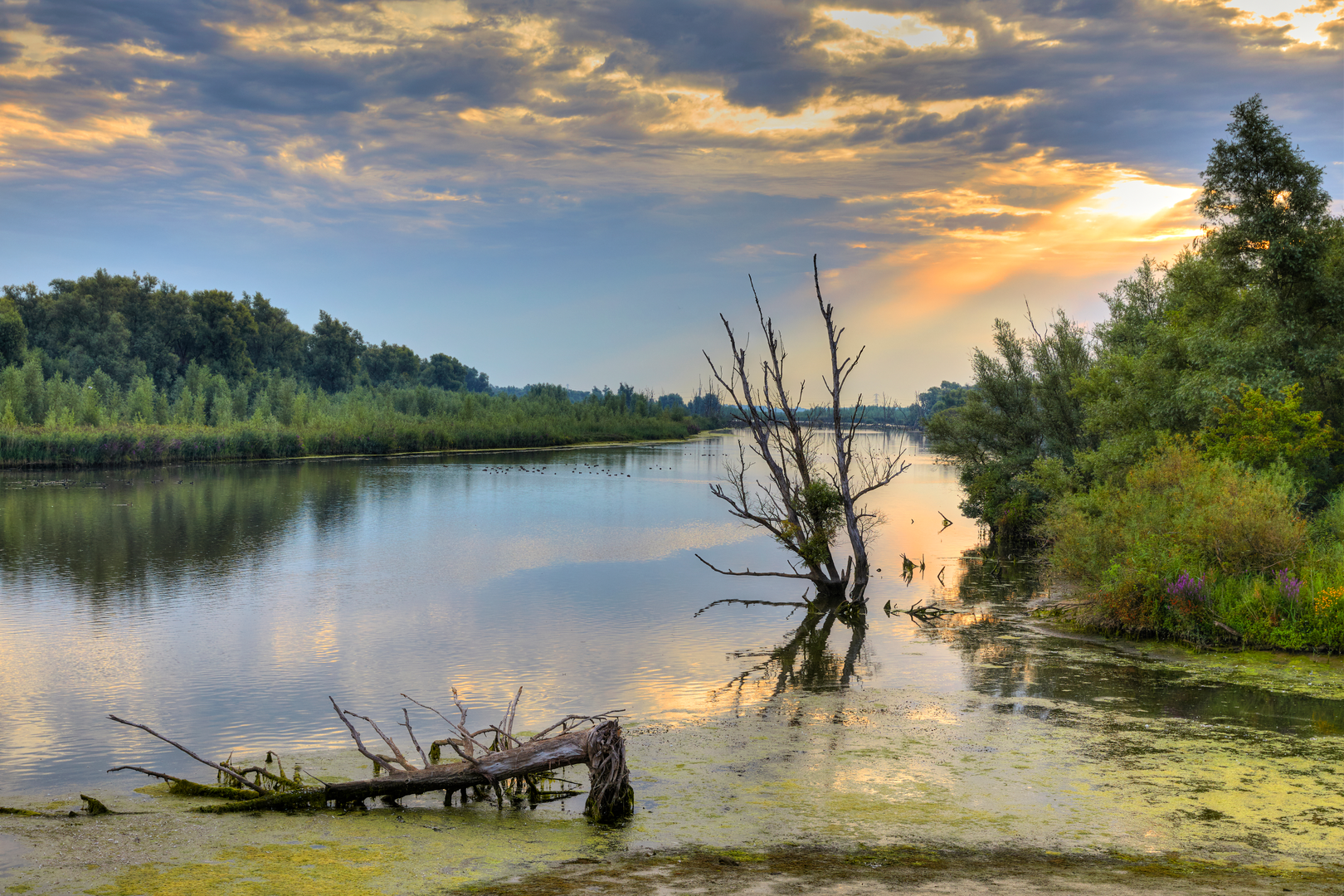
You’ll likely begin on a levee or raised embankment with water on one side and polder fields on the other. The walking is straightforward and flat, but the surface can vary from short grass to compacted gravel. Early on, you’ll get your first sense of the area’s character: reedbeds, willow scrub, and shallow backwaters that are prime habitat for waterbirds.
5–12 km (3.1–7.5 mi): polder crossings and long straight farm tracks
As you move into Polder De Kroon and adjacent reclaimed land, the route typically becomes more geometric: straight drainage canals, sluices, and field boundaries. This is where the “easy” rating can still feel taxing if there’s a headwind—there’s often little shelter. Footing is usually firm, but after wet weather, expect muddy tractor ruts and slick grassy edges along canals.
12–18 km (7.5–11.2 mi): river nature reserve sections (Keizersguldenwaard / De Zalm)
These reserve-like segments tend to be the most scenic: floodplain woodland patches, seasonal wet meadows, and side channels that change with water levels. You may pass grazed areas managed for biodiversity—sometimes with cattle or hardy grazers used to keep vegetation open. Keep to marked paths and give animals space; they’re usually calm but can be protective if calves are present.
18–23 km (11.2–14.3 mi): return along dikes and open water views (De Wassende Maan)
The final stretch often returns to dike-top panoramas and broad water views. Late in the day, bird activity can pick up again, and the light across the polder can be striking. Surfaces may alternate between paved dike roads and grassy levee paths, so footwear that handles both is ideal.
Landmarks, nature, and wildlife to look out for
- Dikes, sluices, and pumping infrastructure: These are the defining “landmarks” of polder country—functional, historic, and still actively used to manage water levels. You’ll likely see culverts, weirs, and small pumping stations controlling canals and floodplain inlets.
- Floodplain ecology: Expect reeds, sedges, willow stands, and wet grassland. In spring and early summer, meadows can be lively with songbirds; in autumn and winter, the area often hosts large flocks of geese and ducks.
- Birdlife: Common sightings in river-and-polder landscapes include herons, egrets, swans, geese, ducks, and raptors hunting over open fields. Bring binoculars if you enjoy wildlife—this is a route where they’ll get used.
- Aquatic edges: Along canals and side channels, watch for steep, undercut banks and slippery vegetation. Keep children and dogs close near water.
Historical significance (why the landscape looks like this)
This kind of route is a walk through a living system of land reclamation and flood management. Polders are engineered landscapes—land made usable through dikes, drainage canals, and controlled water levels—and many river “waard” areas are floodplains shaped by centuries of managing high water. The result is a patchwork where agriculture, nature restoration, and flood storage often coexist. Even when the terrain is flat, the history is written into the infrastructure: every embankment and canal alignment reflects long-term efforts to

Surfaces
Unknown
Asphalt
Paved
Grass
Comments and Reviews
User comments, reviews and discussions about the Keizersguldenwaard, Polder De Kroon en de Zalm and De Wassende Maan Loop, Netherlands.
average rating out of 5
0 rating(s)