Download
3D Flyover
Add to list
More
26.7 km
~5 hrs 20 min
0 m
Loop
“A wind-swept lowland loop of canals and fields—big skies, birdlife, and steady, unhurried strides.”
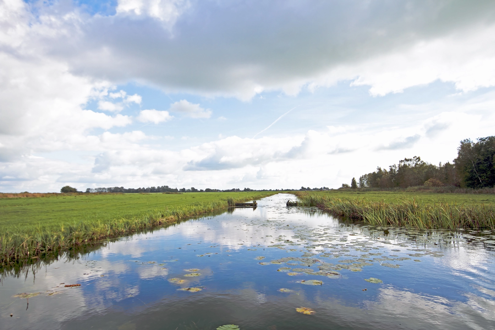
A flat, lowland loop of roughly 27 km (16.8 mi) with essentially 0 m (0 ft) of climbing, this route is all about easy pacing, big skies, and long stretches of path beside water and fields. Expect a mix of paved cycle paths, compacted gravel towpaths, and short sections of quiet lane, with very little elevation change—great for steady walking, but it can feel longer than the profile suggests if you’re facing wind or if surfaces are wet.
Getting to the start (car + public transport)
Because the start point is listed only as “near” (with no coordinates), the most useful way to plan is to anchor your start at a clear, well-known local landmark close to the loop’s namesakes:
- Best practical start landmark: the De Wassende Maan area (commonly associated with the Waasland region in East Flanders, Belgium) and the Altena area (often referenced locally as a polder/lowland landscape name).
- If you share the lon/lat, I can convert it to the nearest known address or significant landmark and tailor the directions precisely.
By car: plan for a start at a public car park near a trailhead access point (often by a canal/river path or a recreation access). In this landscape, parking is typically straightforward near recreation domains, small marinas, or village centers—but check local signage for time limits and market-day restrictions.
By public transport: the easiest approach is usually:
1) Train to a larger hub town in the region,
2) Bus onward to a village stop near the waterway or recreation domain,
3) Walk 0.5–2 km (0.3–1.2 mi) to the loop.
If you tell me the nearest town name you’re aiming for (or provide coordinates), I’ll map the cleanest transit approach and the most logical “first step” onto the loop.
What the terrain feels like (and what to wear)
With negligible elevation gain, the main variables are surface, wind exposure, and water-edge conditions:
- Footing: mostly smooth and fast. Road shoes can work in dry weather, but light hiking shoes are better if you expect muddy edges or puddled towpaths.
- Wind: open polders and canal corridors can be surprisingly windy. A light shell can matter more than you’d think on a “flat easy” day.
- Wet sections: after rain, the edges of towpaths can soften; keep to the firm center line and watch for slick algae on concrete near locks/bridges.
- Cyclists: these paths are often shared. Walk single-file when needed and stay alert at blind corners and bridge ramps.
Route flow and pacing (approximate breakdown)
At 27 km (16.8 mi), most hikers will want to plan 5.5–7.5 hours of moving time depending on pace and stops. A simple way to think about the loop:
0–6 km (0–3.7 mi): Settling in along water and fields
You’ll likely start on a broad path where the landscape opens quickly—ditches, canals, and straight lines typical of reclaimed lowland. This is where you’ll feel the “easy” rating: no climbs, no technical tread, just steady forward motion.6–14 km (3.7–8.7 mi): Long, straight lowland corridors
Expect extended straightaways—great for rhythm, but mentally it helps to break it into landmarks: bridges, locks, farm clusters, and occasional stands of willow or poplar. If the route passes any sluices/locks, take extra care on narrow bridge decks and damp concrete.14–21 km (8.7–13.0 mi): Village edges and crossings
The loop often brushes the edges of settlements where you may find benches, small cafés, or a convenience shop. This is the best zone to plan a water refill if available. Watch for short on-road connectors: they’re usually calm, but visibility can be limited by hedges and parked cars.21–27 km (13.0–16.8 mi): Return leg with big-sky views
The final stretch tends to feel the most exposed. If the wind is up, it can be the toughest part despite being flat. Keep an eye on time here—flat routes can tempt you to underestimate how long the last 6 km (3.7 mi) can take.
Landmarks, nature, and wildlife to look for
This kind of lowland loop is defined by water management landscapes—canals, drainage ditches, embankments, and fields—so the “highlights” are often subtle but rewarding:
- Water infrastructure: small locks, sluices, pumping stations, and canal bridges are common. They’re not just functional; they tell the story of how the land is kept workable and dry.
- Birdlife: expect strong chances of waterfowl and waders—ducks, geese, coots, herons, and depending on season, migrating species using the waterways and wet margins as corridors. Early morning and late afternoon are best for activity.
- Field-edge wildlife: hares and rabbits are typical; you may also spot raptors (kestrels and buzzards) hunting over open ground.
- Vegetation: willows, reeds, and wetland grasses dominate near water; poplar lines and hedgerows appear near farms and lanes.
If you’re hiking in spring/summer, insects can be noticeable

Surfaces
Asphalt
Unknown
Grass
Concrete
Wood
Comments and Reviews
User comments, reviews and discussions about the De Wassende Maan and Altena Loop, Netherlands.
average rating out of 5
0 rating(s)