Download
3D Flyover
Add to list
More
30.3 km
~6 hrs 3 min
0 m
Loop
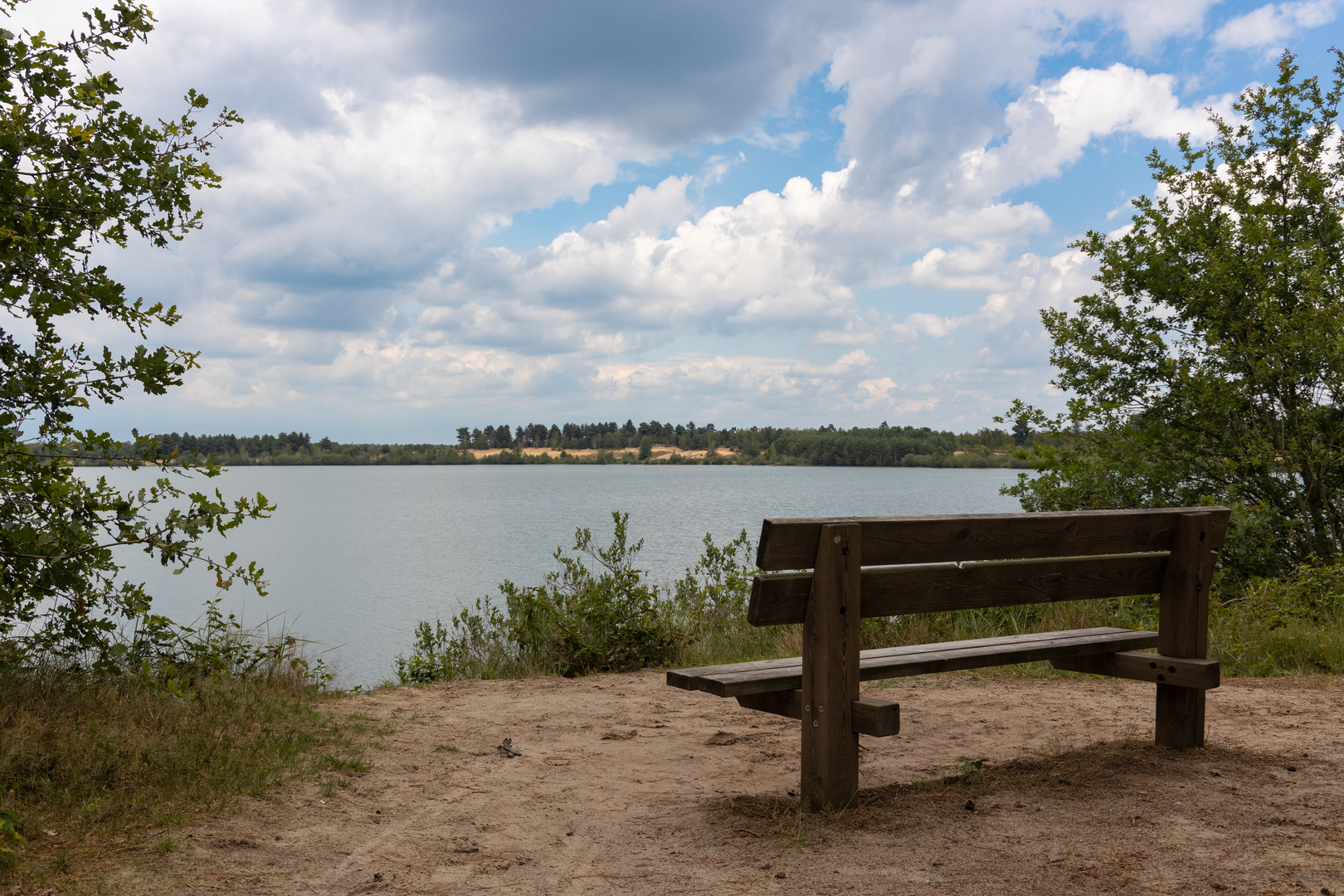
“A big-sky Maasduinen loop of lakes, heath, pines and sand—flat yet potentially tiring in wind.”
This is a long, low-relief loop of roughly 30 km (18.6 mi) with essentially 0 m (0 ft) of sustained climbing, ideal for steady pacing and big-sky walking through a mix of water, heath, pine woodland, and sandy Maasduinen landscapes. Even without “elevation,” expect your effort to come from distance, soft sand sections, and exposed stretches where wind and sun can add fatigue.
Getting to the start (and what “near …” likely means)
Your start point is listed only as “near,” so the most reliable way to plan is to anchor the hike to a known access point in/around Nationaal Park De Maasduinen and the Reindersmeer area (a well-known lake within the park). Common practical start anchors hikers use here are:
- A main trailhead/parking area near Reindersmeer (often signed for the lake and nature reserve access), or
- A visitor-oriented access point on the Maasduinen edge near the park’s villages (e.g., around Well / Nieuw-Bergen / Afferden depending on the exact loop variant).
If you share the GPX or the start coordinates, I can convert them to the nearest specific address/landmark and tailor the transport directions precisely.
By car - Plan for a signed nature-area car park close to the Reindersmeer/Maasduinen access. Arrive early on weekends—these lots can fill quickly in good weather. - Bring coins/cards as some regional nature parking areas use pay stations.
By public transport - The Maasduinen region is typically reached by train to a nearby regional station and then bus/taxi to a village on the park edge, followed by a short walk to the trail access. - Because bus frequencies can be limited outside peak hours, build in buffer time and check the last return service before you commit to the full 30 km (18.6 mi).
Route character and what you’ll see (with planning distances)
Because this loop links Reindersmeer, Berkenkamp, and Maasduinen, you can expect three distinct “chapters” that repeat in different orders depending on the exact track.
Reindersmeer section (approx. 0–10 km / 0–6.2 mi)
You’ll likely begin on firm, well-maintained paths near the lake, with frequent openings through trees to water views. Reindersmeer is part of a landscape shaped by sand, water, and human land use—many lakes in this region are tied to historical extraction and land management, later reclaimed by nature and protected as reserves.
What to look out for - Water-edge footing: roots, damp boards, and muddy pinch points after rain. - Birdlife: expect waterfowl and reedbed species; bring binoculars if you like wildlife spotting. - Ticks: common in heath/edge habitats—use repellent and do a check after the hike.
Landmarks & nature - Lake viewpoints and reed margins are the “headline” here. Early morning and late afternoon tend to be best for wildlife activity.
Berkenkamp transition (approx. 10–20 km / 6.2–12.4 mi)
This middle portion often feels more “inland,” threading through mixed woodland and heath patches. The walking can alternate between compact forest track and narrower single-file trail.
Underfoot and pacing - Even with negligible elevation gain, you may hit short sandy stretches that slow pace noticeably. - If the loop crosses open heath, wind exposure can make it feel cooler than expected—pack a light layer even on mild days.
Navigation - Trail junctions can be frequent in managed forests and dune-edge networks. Load the route in HiiKER and keep an eye on turns where multiple tracks run parallel.
Maasduinen dunes and open sands (approx. 20–30 km / 12.4–18.6 mi)
The Maasduinen are known for long, river-parallel dune formations—a distinctive Dutch landscape where “dunes” aren’t coastal but shaped by wind and river processes. This is where you’re most likely to encounter: - Wider sandy paths - Open pine stands - Heathland clearings with long sightlines
What to look out for - Soft sand fatigue: it can feel like a gentle hill even when the elevation profile is flat. Shorten stride and keep cadence steady. - Sun exposure: open dune/heath sections can be bright and reflective—sunglasses and sunscreen matter. - Dry conditions: in warm spells, these sandy areas can be surprisingly dehydrating—carry more water than you’d expect for a “flat” hike.
Difficulty, timing, and practical pacing
Although rated Easy, the distance makes it a full-day outing for most hikers.
- Distance: ~30 km (18.6 mi)
- Elevation gain: ~0 m (~0 ft)
- Typical moving time: ~6–8 hours depending on sand, stops, and navigation
- Total time with breaks: often 7–9 hours
A good strategy is to plan a midpoint break around 15 km (9.3 mi) and a shorter reset around 22–24 km (13.7–14.9 mi) before the final push.
Water, food, and facilities
- Don’t assume reliable water taps on-trail. Carry at least 1.5–2.5 L depending on season and your pace.
- Pack enough calories for a full day: sandwiches + salty snacks + quick sugars.
- Facilities (

Surfaces
Unknown
Asphalt
Gravel
Concrete
Sand
Dirt
Comments and Reviews
User comments, reviews and discussions about the Reindersmeer, Berkenkamp and Maasduinen Loop, Netherlands.
average rating out of 5
0 rating(s)