
Download
3D Flyover
Add to list
More
16.6 km
~3 hrs 21 min
18 m
Loop
“Stroll serene shores, traverse shaded dunes, and savor the tranquil beauty of Maasduinen’s diverse landscapes.”
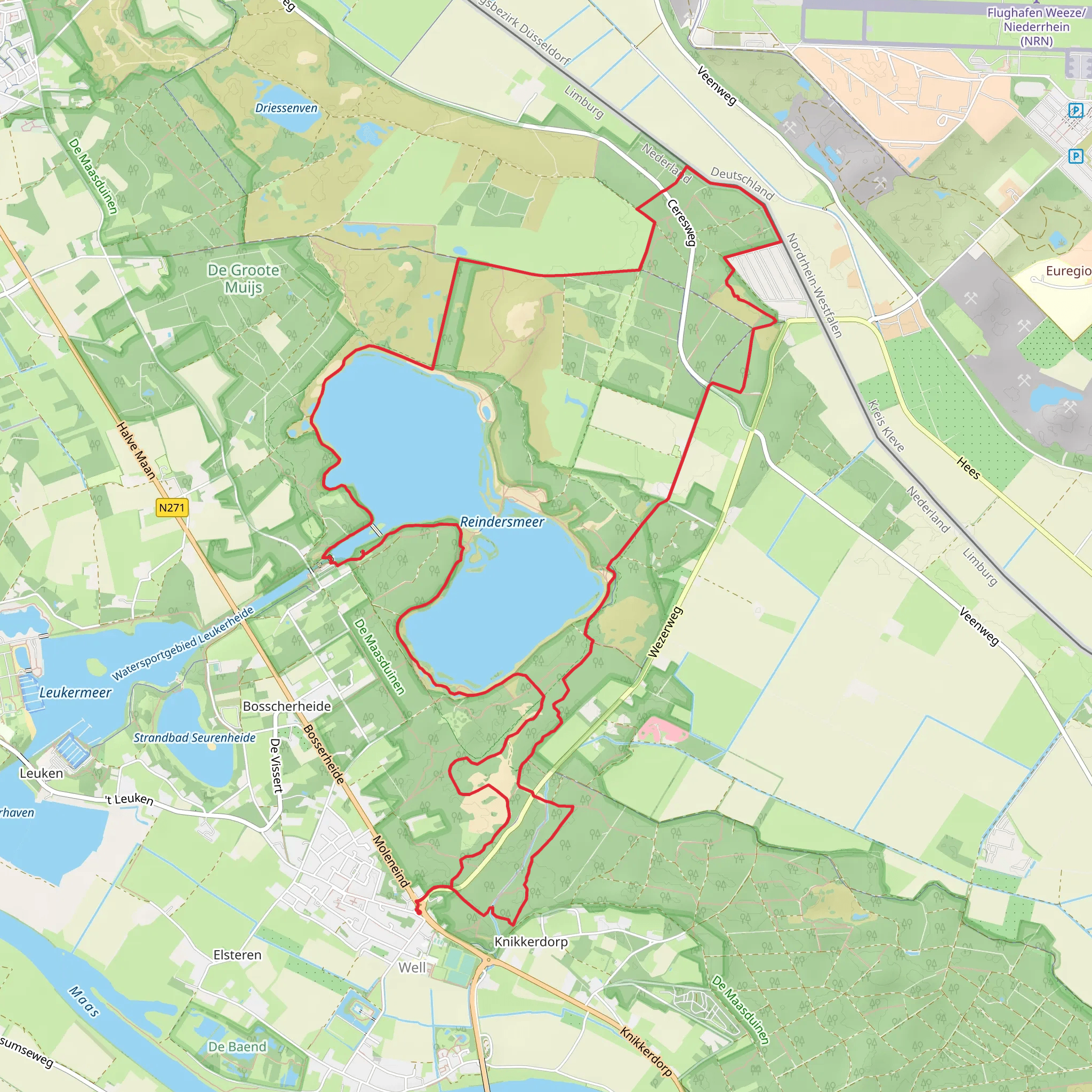
Embarking on the approximately 17-kilometer (10.5-mile) Reindersmeer and Wolfsvensche Berg hike via Reinderslooi Weg offers a serene journey through the diverse landscapes of North Limburg's Maasduinen National Park. With minimal elevation gain, this easy trail is suitable for hikers of all levels.
Starting Point and Access
The hike begins at the Bezoekerscentrum De Maasduinen, located at Bosserheide 3E, 5855 EA Well, Netherlands. This visitor center provides ample parking and serves as an excellent starting point for exploring the area. For those using public transportation, the nearest train stations are in Venlo and Nijmegen. From these stations, regional buses connect to Well; however, services may be limited, so it's advisable to check current schedules in advance.
Trail Overview
From the visitor center, the trail leads you along the Reindersmeer, an artificial lake formed from sand and gravel extraction between 1971 and 2001. The lake's clear waters and surrounding heathlands create a picturesque setting. The path is well-marked and predominantly unpaved, offering a peaceful experience away from urban noise.
Key Landmarks and Natural Features
Reindersmeer: As you traverse the trail, you'll enjoy continuous views of this expansive lake. The area is rich in flora and fauna, with opportunities to spot various bird species, including the kingfisher and marsh harrier. The lake's shores are adorned with heather and grasses, adding to the scenic beauty.
Trekpontje (Hand-Pulled Ferry): Approximately halfway through the hike, you'll encounter a manually operated ferry that allows you to cross the Reindersmeer. This unique feature adds an element of adventure to your journey. The ferry can accommodate up to ten people and requires some physical effort to operate. Using the ferry can shorten the route to about 4 kilometers (2.5 miles) if desired. (parkhotelhorst.nl)
Wolfsvensche Berg: Continuing on, the trail leads you through the Wolfsvensche Berg area, characterized by its rolling dunes and dense forests. This section offers a contrast to the open landscapes around the lake, providing shaded paths and a chance to experience the region's diverse ecosystems.
Historical Significance
The Reindersmeer area has a rich history tied to its past as a sand and gravel extraction site. The extraction activities led to the creation of the lake, which has since been transformed into a thriving natural habitat. The region's history is also marked by its proximity to the German border, with various cultural influences evident in the local architecture and traditions.
Practical Information
Navigation: The trail is well-marked with colored posts. For detailed maps and real-time navigation, consider using the HiiKER app, which provides comprehensive trail information and offline maps.
Amenities: Restrooms and a café are available at the visitor center. Approximately 7 kilometers (4.3 miles) into the hike, you'll find De Wellsche Hut, a restaurant offering a place to rest and enjoy local cuisine. (wandelknooppunt.nl)
Safety and Regulations: Swimming and fishing in the Reindersmeer are prohibited to protect the area's ecological balance. Stick to designated paths to minimize environmental impact. Be aware that some sections of the trail may be shared with cyclists and horseback riders.
This hike offers a harmonious blend of natural beauty, historical context, and well-maintained trails, making it a delightful experience for those seeking to explore the unique landscapes of the Maasduinen region.
AI Planner
Days planned around your pace, with somewhere to stay each night.
Surfaces
Unknown
Sand
Asphalt
Dirt
Unpaved
Gravel
Paved
Wood
Concrete
Comments and Reviews
User comments, reviews and discussions about the Reindersmeer and Wolfsvensche Berg via Reinderslooi Weg, Netherlands.
average rating out of 5
0 rating(s)


