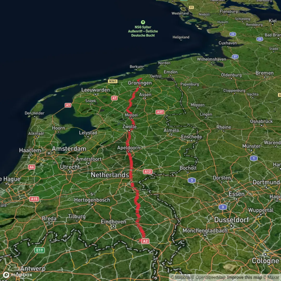
Weert to Uithuizen via Helmondseweg, Letlesingel, Milhezerweg, Apeldoornseweg and Trekweg
Download
3D Flyover
Add to list
More
294.9 km
~10 days
218 m
Multi-Day
“A big-sky Dutch lowland odyssey of canals, towpaths, and wind—more endurance than ascent.”
This is a long, mostly flat, point-to-point lowland trek across the southern and central Netherlands, linking towns, canals, and agricultural landscapes rather than steep hills. At roughly 294 km (183 miles) with only about 200 m (656 ft) of total ascent, the physical challenge is less about climbing and more about time on feet, weather exposure, and staying comfortable through many consecutive days.
Because the start is listed only as “near,” the most practical assumption for planning is that the hike begins in/near Weert (Limburg, Netherlands)—typically around Weert railway station (Stationsplein, Weert) as the most obvious public-transport anchor—and finishes in/near Uithuizen (Groningen, Netherlands)—again commonly anchored by Uithuizen railway station (Stationsweg area, Uithuizen). If you share the exact coordinates for the start (“Hike head”), I can pin it to the nearest specific street address or landmark.
Getting to the start (Weert) and back from the finish (Uithuizen)
By public transport (recommended for a point-to-point): - Start: Weert is well connected by Dutch rail. Plan to arrive at Weert Station and begin walking from there (easy resupply immediately nearby). - Finish: Uithuizen also has rail service; from Uithuizen Station you can connect onward toward Groningen and the national network.
By car: - If you drive to Weert, use a long-stay car park near the station or town center (rules vary by zone). Because the finish is far away, most hikers either: - arrange a pickup at Uithuizen, or - use rail to return to Weert to retrieve the car.
What the route feels like day to day
With 183 miles / 294 km total, most hikers break this into 10–14 days depending on pace and rest days: - 20–25 km/day (12–16 mi/day): ~12–14 hiking days - 25–30 km/day (16–19 mi/day): ~10–12 hiking days
The terrain is typically paved lanes, farm tracks, towpaths, and quiet roads. The named roads—Helmondseweg, Letlesingel, Milhezerweg, Apeldoornseweg, and Trekweg—suggest a route that threads through settled areas and between towns, so expect frequent transitions: village edges → open fields → canal corridors → small industrial fringes → town centers.
Underfoot and pacing
- Surface: a high proportion of hard surface is likely. Plan footwear for road and mixed-surface comfort (cushioning matters more than aggressive tread).
- Elevation: the “gain” is minimal overall (~200 m / 656 ft), but you’ll still feel micro-undulations, bridges, dikes, and overpasses.
- Rhythm: the biggest fatigue driver is often repetition and impact, not steepness—build in short breaks and consider alternating socks/shoes if you’re prone to blisters.
Navigation and wayfinding (keep it simple, keep it consistent)
This kind of long, linear route is easiest when you treat navigation as a daily routine: - Load the full line in HiiKER, then also save daily segments (so you can quickly see “today’s finish” and nearby bail-out points). - In towns, pay attention to cycle-lane splits, roundabouts, and canal crossings—these are where people most often drift off-route. - In open farmland, windbreaks and drainage ditches can make paths look similar; confirm you’re on the correct side of a canal or ditch before committing to a long straight section.
Landscapes, landmarks, and what to look for
Southern start: Weert and the Limburg/North Brabant transition
Leaving Weert, you’re in a region shaped by peaty lowlands, managed waterways, and a long history of agriculture and trade routes. Even when you’re not in a designated nature reserve, you’ll notice: - Drainage canals and ditches controlling water levels - Poplar lines and hedgerows acting as windbreaks - Farmsteads and small chapels typical of the Catholic south
Wildlife is often subtle but present: hares, pheasants, waterfowl, and in wetter pockets herons and egrets. Early mornings and evenings are best for sightings.
Mid-route: canal corridors, towpaths, and “Trekweg” character
A “Trekweg” is historically associated with towpaths—routes where horses (and people) towed barges along canals. Even when modernized, these corridors still feel like linear greenways: - Long, straight sightlines - Frequent bridges and locks (where present) - A steady presence of boats, anglers, and cyclists
These canal-side stretches are often the most pleasant for steady mileage, but they’re also where you can be most exposed to wind and sideways rain. In the Netherlands, wind can be the “hidden elevation gain.”
Northern approach: toward Groningen and Uithuizen
As you push north, the landscape tends to open further into big-sky farmland with long distances between sheltering tree lines. Near Uithuizen, you’re approaching the Groningen clay and coastal-influenced lowlands, where: - Fields can feel expansive and very open - Weather changes can be abrupt - Straight roads can make distance feel longer than it is
Uithuizen itself is known

Surfaces
Asphalt
Unknown
Concrete
Gravel
Paved
Wood
Sand
Unpaved
Comments and Reviews
User comments, reviews and discussions about the Weert to Uithuizen via Helmondseweg, Letlesingel, Milhezerweg, Apeldoornseweg and Trekweg, Netherlands.
average rating out of 5
0 rating(s)