Download
3D Flyover
Add to list
More
39.5 km
~2 days
7 m
Multi-Day
“A wind-swept, dune-to-lakes loop where sandy paths reward patient navigation and long, reflective hours.”
This is a long, flat coastal-and-lakeside ramble through South Holland’s “between city and sea” landscapes: dune ridges and sandy paths near The Hague, then a big sweep inland to the Vlietland recreation lakes by Leidschendam/Voorschoten, before looping back. At around 39 km / 24.2 mi with roughly 0 m / 0 ft of climbing, the challenge is less about elevation and more about time on feet, wind exposure, and staying oriented through a web of dune tracks and cycle routes.
Where the hike starts (nearest landmark) + getting there
Because the route name centers on Prinsenberg and Oostduinen, the most practical “hike head” is near the dune access around Meijendelseweg (Wassenaar)—a common gateway into the Meijendel/Oostduinen dune system within Nationaal Park Hollandse Duinen. A well-known nearby reference point is the Meijendel area on Meijendelseweg 40–42, 2243 GN Wassenaar. (holland.com)
By public transport: aim for tram/bus connections into the northern The Hague / Wassenaar edge, then walk to the dune entrances around Meijendelseweg. The area is well-served by The Hague’s network; from central hubs you’ll typically have a short final walk to the dunes.
By car: park near the Meijendel/Oostduinen access points off Meijendelseweg (follow local signage for dune entrances/parking). Arrive early on weekends—this coastline-adjacent greenbelt is popular year-round.
Use HiiKER to load the loop and keep it handy: the dune section has many “choose-your-own-adventure” junctions where multiple sandy tracks look equally correct.
What the terrain feels like (and why “easy” still takes planning)
Even with minimal elevation gain, expect constant micro-undulation in the dunes: short sandy rises, shallow bowls, and occasional firmer shell paths. Underfoot alternates between: - Compacted multi-use paths (fast, but shared with cyclists in places) - Loose sand (slower, more tiring over distance) - Gravel/park paths as you transition toward urban edges and then inland
Because it’s a 39 km / 24.2 mi day, plan it like an endurance walk: - Time: many hikers will take 8–10+ hours depending on pace and sand conditions. - Wind: coastal winds can be relentless; even mild temperatures can feel cold. - Water: don’t assume reliable taps in the dunes—some areas can have seasonal shutoffs, so carry what you need between resupply points. (wanderlog.com)
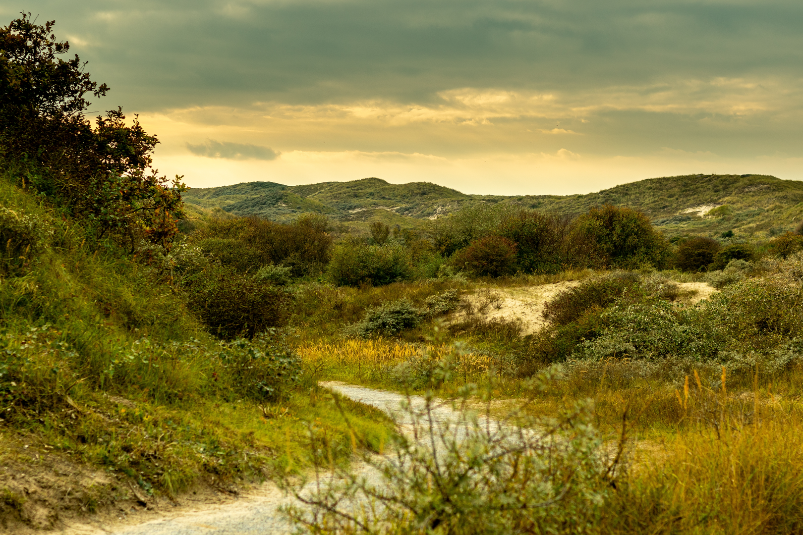
Dunes section: Prinsenberg + Oostduinen (approx. 0–18 km / 0–11 mi)
Early on, the route threads into the dune belt that forms part of Hollandse Duinen National Park, a long coastal strip of dunes, forests, and polders that functions as both habitat and natural coastal defense. (holland.com)
Within the first several kilometers you’ll be moving through classic dune scenery: wind-shaped sand, scrub, and pockets of woodland. The highlight here is Uitkijkpunt Prinsenberg—a recognized viewpoint in South Holland near other dune high points. It’s one of the better places on this loop to pause, get your bearings, and take in the broader dune-and-sea context before turning inland. (mapcarta.com)
What to look out for - Navigation traps: dune junctions can be unsigned or signed for multiple user groups. Stay disciplined with HiiKER—don’t “follow the nicest-looking track” for long. - Shared-use traffic: cyclists and occasional horse riders can appear quickly on curving dune paths; keep right and stay alert, especially where vegetation limits sightlines. (wanderlog.com) - Sand fatigue: if you’re sinking, shift to parallel firmer tracks where possible—even small changes in surface can save a lot of energy over 39 km.
Nature and wildlife Hollandse Duinen is noted for high biodiversity across dunes, wet slacks, and coastal woodland mosaics. Depending on season, you may notice a lot of bird activity and the characteristic dune vegetation gradients from scrub to more sheltered woodland pockets.

Surfaces
Asphalt
Unknown
Concrete
Cobblestone
Grass
Gravel
Sand
Comments and Reviews
User comments, reviews and discussions about the Prinsenberg, Oostduinen and Vlietland Loop, Netherlands.
average rating out of 5
0 rating(s)