Download
3D Flyover
Add to list
More
85.5 km
~3 days
73 m
Multi-Day
“A big-sky polder loop of dikes, lanes and wartime echoes—easy gradients, demanding wind and hours.”
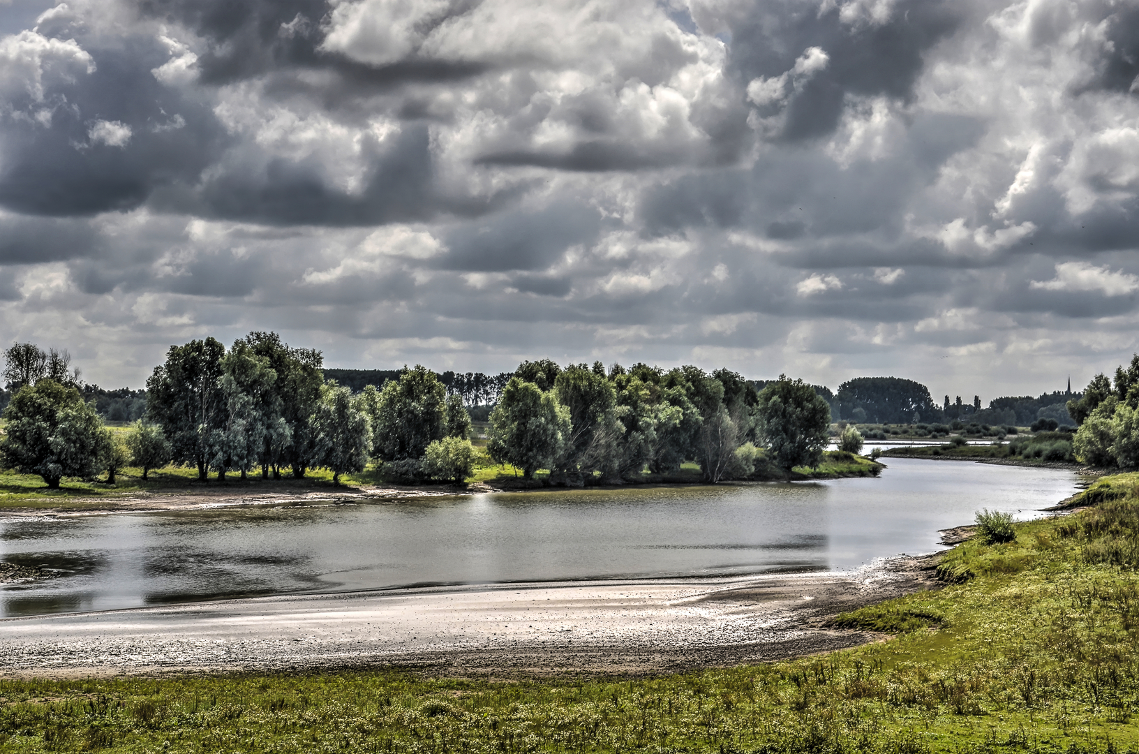
This is a long, mostly flat lowland loop of about 86 km (53.4 mi) with only around 100 m (328 ft) of total climbing—so the effort comes from time on feet, wind exposure, and surface variety rather than steep gradients. Expect a mix of dike-top paths, farm lanes, riverside tracks, and village pavements linking the Grebbeberg area, the Rijksstraatweg corridor, and the open polder landscape of the Ochtensche Buitenpolder.
Because your start point is listed only as “near”, I can’t reliably convert coordinates to a nearby address or landmark yet. If you share a lon/lat (or a HiiKER link), I’ll pin it to the nearest recognizable place (e.g., a station, church, ferry landing, or trailhead) and tailor the access directions and the first/last kilometres precisely.
Getting to the start (general, works well for this region)
- By public transport: In this part of the central Netherlands, the most practical approach is usually train to a larger rail hub (commonly Ede-Wageningen or Rhenen, depending on which side of the Grebbeberg/Grebbe line you begin), then bus toward the smaller villages along the main road network. From there, you typically have a short walk (0.5–3 km / 0.3–1.9 mi) to reach dikes or field tracks.
- By car: Plan for all-day parking near a town centre car park, a sports complex, or a riverside/dike access point. In polder villages, parking is often limited on narrow streets; aim for signed public lots rather than roadside verges (which can be soft or restricted).
If you tell me the intended “Hike head” town (even just the nearest village name), I can give a much tighter “park here / get off the bus here” plan.
You’ll want to load the route in HiiKER and keep an eye on: - Dike junctions and farm-track splits (easy to drift onto a parallel service road) - Seasonal closures or diversions around floodplains and nature reserves - Ferry crossings if the loop uses one (some operate limited hours)
What the terrain feels like over 86 km (53.4 mi)
The elevation gain—about 100 m (328 ft) total—usually shows up as: - Short ramps up onto dikes - Occasional overpasses/underpasses near busier roads - Small rises where older river dunes or embankments sit slightly above the polder
Underfoot, expect long stretches of: - Hard-packed gravel or brick/paved cycleway (fast but repetitive) - Grass dike tops (can be slick when wet, and uneven from hoof prints) - Farm tracks (muddy after rain; dustier in dry spells)
Even on an “Easy” profile, 86 km is an ultra-distance day for most hikers. Many people will plan it as: - A very long single day (12–18 hours moving time depending on pace and stops), or - A 2-day outing with an overnight in a village along the route
Landmarks, landscape, and the “Grebbe” story
This loop’s character is shaped by the river landscape and reclaimed polder—big skies, straight drainage lines, and long sightlines broken by tree belts, farmsteads, and dike crests.
The Grebbeberg / Grebbe line area is one of the most historically significant landscapes in the Netherlands. The Grebbe Line (a defensive waterline system) and the Grebbeberg are closely associated with World War II fighting in May 1940, when the area became a focal point of the German invasion and Dutch defense. As you pass through or near this zone, you may encounter: - Memorials and cemeteries - Interpretive signs about the waterline and wartime positions - Older embankments, inundation features, and defensive earthworks that read like “odd” rises in an otherwise flat landscape
Even if the route only skirts the core sites, the feeling is distinct: wooded rises and structured terrain transitions into open polder where water management is the dominant “architecture.”
Nature and wildlife (what to look for)
The Ochtensche Buitenpolder portion is classic floodplain/polder habitat. Depending on season, you’re likely to see: - Waterfowl and waders: geese, ducks, herons, and (in migration periods) mixed flocks feeding in wet fields - Raptors over open ground: kestrels and buzzards are common in these landscapes - Reedbed and ditch-edge life: frogs, dragonflies, and small fish in clear drainage channels - Grazing livestock (often cattle or sheep) used for vegetation management on dikes and grasslands
Key etiquette and safety points here: - Stay on the marked line where grazing is present; give animals space and don’t cut across fields. - Ticks can be an issue in grassy dike sections and field margins in warmer months—long socks and checks at breaks help. - Wind exposure is the big “hidden difficulty.” With few windbreaks, a headwind can add hours and increase dehydration even in cool weather.
Food, water, and resupply strategy
For an 86 km (53.4 mi) loop, plan like an endurance event: - Carry enough water capacity

Surfaces
Unknown
Asphalt
Dirt
Grass
Concrete
Comments and Reviews
User comments, reviews and discussions about the Grebbeweg, Rijksstraatweg and Ochtensche Buitenpolder Loop, Netherlands.
average rating out of 5
0 rating(s)