Download
3D Flyover
Add to list
More
15.2 km
~3 hrs 1 min
0 m
Loop
“A gentle loop from sandy pine-heath to hushy lakeside singletrack—flat, textured, quietly wild.”
This easy, mostly level loop (about 15 km / 9.3 mi with roughly 0 m / 0 ft of elevation gain) threads together the sandy pine-and-heath landscapes of Brouwhuissche Heide with the quieter woodland-and-water edges around the Buntven and the De Rakt area on Helmond’s east side. Expect a classic North Brabant mix: straight forest lanes that make navigation simple, plus narrower, more winding singletrack where the scenery feels more intimate.
Getting to the start (car + public transport)
- By train (simplest): Aim for Helmond Brouwhuis railway station (on the Eindhoven–Venlo line). From the platforms you can walk straight into the neighborhood edge and quickly reach the forest paths leading into Brouwhuissche Heide. (prorail.nl)
- By car: A practical parking landmark for the “De Rakt/Buntven” side is Parkeerplaats Buntven, reached via the parallel road by Het Plantenpark, Raktseweg 2 (a well-known local reference point for accessing the lake and Zandbos trails). (ivn.nl)
If you prefer starting closer to the heath/forest interior, local meet-up points are also used near the rail crossing by Helmondsingel 131 (Van Iersel Compost) on the Deurne side of the woods. (helmondnu.nl)
For navigation, load the route in HiiKER and keep an eye on where the loop transitions from wide forestry lanes to smaller, more braided paths near water and heath openings.
What the terrain feels like underfoot
You’ll be on a very “Dutch lowland” surface profile—no climbs, but plenty of texture: - Firm sandy tracks and compacted forest roads through planted pine stands (easy cruising, good for steady pacing). - Narrow, rooty woodland paths where the trail meanders and can hold moisture after rain. - Grassy edges and field-side connectors in the more open sections; these can get overgrown in summer and feel slower than the map suggests. (Long pants help when vegetation is high.)
Because the route is flat, the main effort variable is surface condition: after wet weather, expect soft sand pockets and muddy low spots near ditches and streamlets.
The walk, section by section (approximate distances)
0.0–3.5 km (0.0–2.2 mi): Settling into Brouwhuissche Heide
You’ll quickly leave the built-up edge and enter the Brouwhuissche Heide woodland—historically a sandy area that was planted (notably with Scots pine) in the early 20th century to stabilize drifting sands, creating the long, straight lanes you’ll notice today. (helmondnu.nl)
Look for small open sandy patches (“stuifzand” feel) that break up the forest texture; these openings are great for spotting animal tracks in softer ground.
3.5–7.5 km (2.2–4.7 mi): Heath edges, mixed woodland, and wildlife sign
As the forest structure varies, you’ll see more mixed stands (conifer with increasing broadleaf) rather than uniform plantation. Local nature groups describe the area as a mosaic of conifer, deciduous, and mixed woodland now, rather than a single-species block. (helmondnu.nl)
Wildlife is often subtle but present: roe deer are commonly noted by their tracks and “runs” through the undergrowth, and small mammal burrows can be visible along path edges. (helmondnu.nl)
You may also notice that at times you’re not far from the Helmond–Deurne rail line, so occasional train sound can carry through the trees depending on wind direction. (routiq.com)
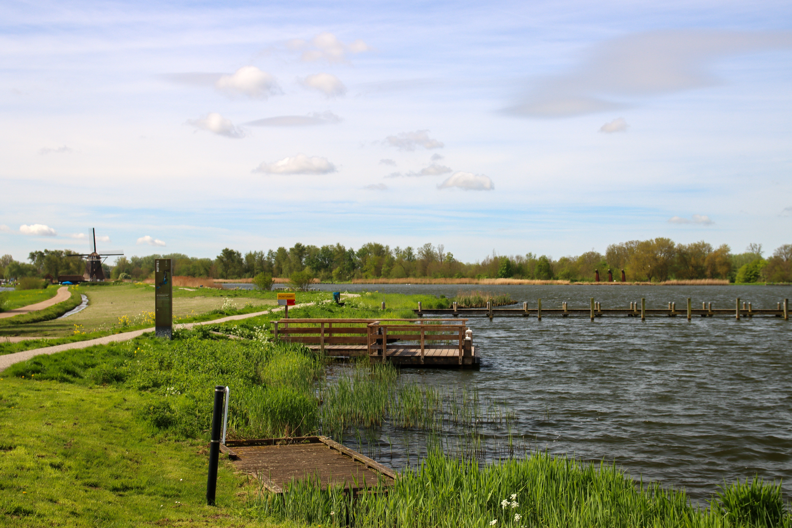
7.5–11.5 km (4.7–7.1 mi): De Rakt side and the Buntven/Zandbos waters The loop’s character shifts toward water and woodland margins. The Buntven is the standout landmark here: a calm lake edge where the trail often runs close to the shoreline through reeds and grasses. IVN notes that

Surfaces
Unknown
Asphalt
Unpaved
Comments and Reviews
User comments, reviews and discussions about the Brouwhuissche and De Rakt Loop, Netherlands.
average rating out of 5
0 rating(s)