Download
3D Flyover
Add to list
More
14.7 km
~2 hrs 58 min
12 m
Loop
“Wander Vledder’s pond-speckled forests and peat edges—easy-going, if you’re ready for mud and wind.”
You’ll be walking in the flat, water-shaped landscape between Vledder and Vledderveen (municipality of Westerveld, province of Drenthe), where sandy forest paths, old peatland edges, and small “vennen” (heathland ponds) alternate with quiet farm tracks. At roughly 15 km / 9.3 mi with about 0 m / 0 ft of climbing, this loop suits an easy-paced half-day—more about time-on-feet than effort, with the main variables being mud, wet ground, and wind exposure around open patches. The area is part of the wider mosaic around Nationaal Park Drents-Friese Wold, known for its mix of woodland, heath, and wetlands. (alltrails.com)
Getting to the start (car + public transport)
Because “Blauwe Gat” is used as a place name in multiple parts of the Netherlands, the most reliable start for this specific loop is near Vledderveen (Drenthe)—close to the Middenweg area and the pond itself, which is commonly referenced as Blauwe Gat, 8385GM Vledderveen. (routiq.com)
- By car: Aim for parking near Middenweg (Vledderveen) and walk a short connector to the Blauwe Gat pond area. In this region, roadside parking pockets and small pull-ins are common near trail access points; arrive earlier on weekends in spring/summer when day-walkers are out for the vennen and forest. (routiq.com)
- By public transport: The broader Vledder/Vledderveen area is served by regional buses; one commonly used stop for nearby walks is bushalte “Hertenkamp, Vledder”, from which you can link into the same network of paths and ponds. Check connections and walking approach in HiiKER so you can see the exact approach distance from your chosen stop. (mooisteroutes.nl)
What the route feels like underfoot
Expect a predominantly lowland, sandy-soil walk with frequent transitions:
- Forest singletrack and sandy lanes: Often firm in dry spells, but can turn soft and churned where bikes and walkers share the same corridor.
- Wetland margins near the vennen: After rain, the “easy” rating can feel deceptive—short sections may be slick, puddled, or boggy, especially where the path skirts reedier edges or dips into shaded hollows. (routiq.com)
- Farm tracks and field edges: These provide faster, straighter walking and help the loop cover distance without feeling repetitive.
Plan on 3.5–4.5 hours of walking time for most hikers at an easy pace (longer if you stop often at the ponds for photos or birdwatching).
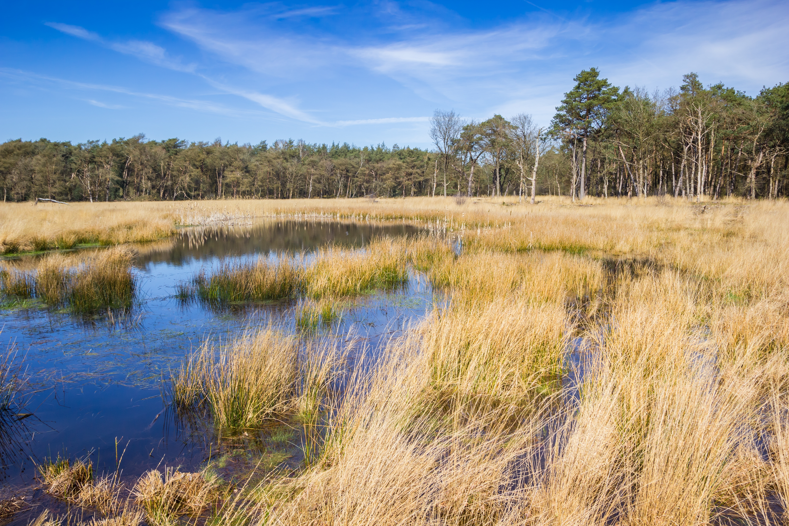
Key landmarks: Blauwe Gat, Vlasveen, and the “vennen” chain
The character of this loop is defined by its small waters—quiet, dark-stained ponds and clearer openings that appear suddenly between trees.
- Blauwe Gat: This is one of the signature water features on the walk—typically approached via forest paths where the trees thin and the shoreline opens up. The edges can be soft, and in windy weather you’ll feel the temperature drop near the water. It’s a natural place to pause, but keep to established paths to avoid trampling fragile wetland vegetation. (In route listings for this area, Blauwe Gat is repeatedly highlighted as a main waypoint/feature.) (routiq.com)
- Vlasveen: “Veen” indicates peatland; even when it looks dry from a distance, the ground can be spongey. This section tends to be the most seasonally variable: in late winter and spring, expect standing water and mud, while late summer can be comparatively firm but

Surfaces
Unknown
Sand
Asphalt
Grass
Gravel
Concrete
Comments and Reviews
User comments, reviews and discussions about the Blauwe Gat and Vlasveen Loop, Netherlands.
average rating out of 5
0 rating(s)