Download
3D Flyover
Add to list
More
5.9 km
~1 hrs 10 min
0 m
Loop
“Wander through wetlands and history, where wildflowers, waterways, and hidden forts paint Amsterdam’s peaceful edge.”
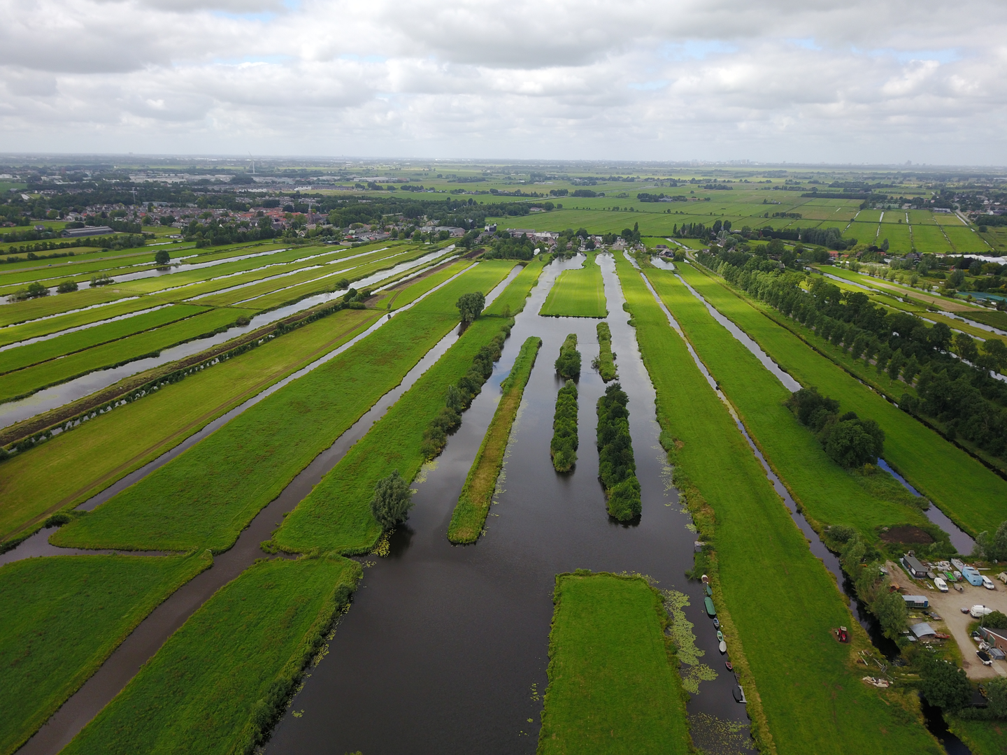
Starting from the vicinity of Nellesteinse Brug, close to the intersection of Gaasperplas and the Amsterdam-Zuidoost area, this loop trail covers approximately 6 km (about 3.7 miles) with virtually no elevation gain, making it accessible for hikers of all abilities. The route is well-suited for families, casual walkers, and anyone seeking a peaceful escape into nature without strenuous climbs.
Getting There
Reaching the trailhead is straightforward. By public transport, take the Amsterdam Metro to Gaasperplas station, which is just a short walk from the starting point near Nellesteinse Brug. For those arriving by car, parking is available at the Gaasperplas recreational area, with clear signage leading to the bridge and surrounding green spaces.
Trail Experience and Navigation
The path meanders through a blend of urban parkland and historic Dutch polder landscape. Navigation is simple, with well-marked paths and signage throughout the loop. For precise route tracking and wayfinding, HiiKER provides detailed maps and GPS guidance, ensuring you stay on course.
Landmarks and Points of Interest
Nellesteinse Brug
The trail begins at Nellesteinse Brug, a modern bridge spanning a canal that forms part of the intricate water management system in this region. The bridge itself is a testament to Dutch engineering, blending seamlessly into the surrounding wetlands and offering views of the tranquil water below.
Fort aan de Winkel
Roughly halfway through the loop, you’ll encounter Fort aan de Winkel, a 19th-century fortification that is part of the UNESCO-listed Stelling van Amsterdam (Defence Line of Amsterdam). This ring of forts was constructed to protect the city by controlling water levels and flooding the surrounding land in times of conflict. The fort is surrounded by lush meadows and mature trees, and while the interior is not always open to the public, the exterior and its earthworks are impressive and photogenic.
Nature and Wildlife
The route passes through a mosaic of wetlands, reed beds, and open water, providing habitat for a variety of bird species such as herons, grebes, and swans. In spring and summer, wildflowers line the path, and dragonflies dart above the water. The area is also home to rabbits and the occasional fox, especially in the quieter stretches near the fort.
Trail Surface and Facilities
The loop follows mostly paved and gravel paths, making it suitable for strollers and bicycles as well as walkers. Benches are scattered along the route, particularly near scenic viewpoints and water features. Public toilets and picnic areas are available at Gaasperplas park, close to the start and end of the hike.
Historical Context
The landscape here is shaped by centuries of Dutch water management, with canals, dikes, and pumping stations visible along the way. The proximity to the Stelling van Amsterdam adds a layer of historical intrigue, as this defensive ring is a unique example of military engineering adapted to the low-lying Dutch terrain.
This easy, flat loop offers a blend of history, nature, and accessibility, making it a rewarding outing for anyone exploring the green edges of Amsterdam.

Surfaces
Grass
Asphalt
Gravel
Unknown
Wood
Paved
Concrete
Comments and Reviews
User comments, reviews and discussions about the Nellesteinse Brug and Fort aan de Winkel Loop, Netherlands.
average rating out of 5
0 rating(s)