Download
3D Flyover
Add to list
More
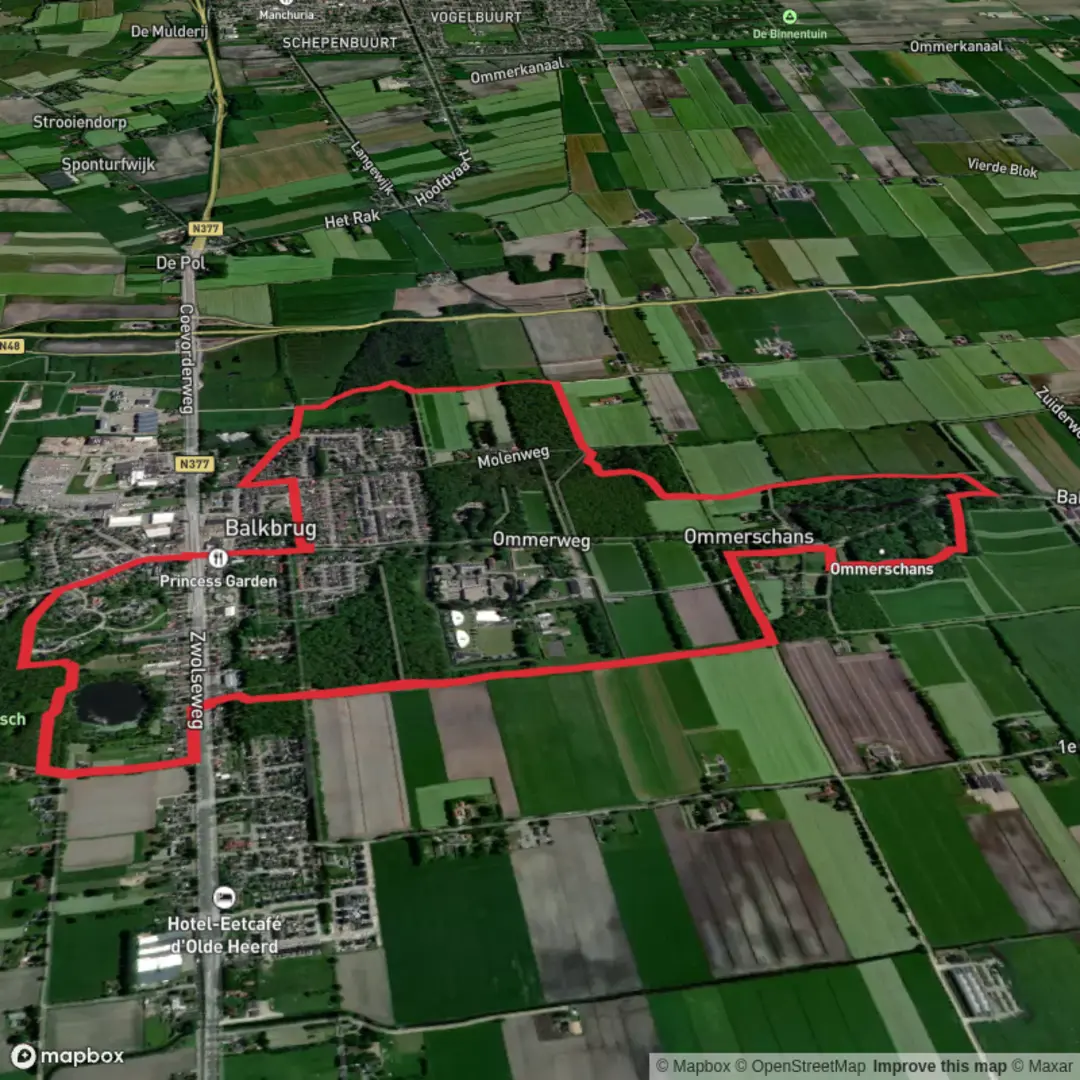
7.1 km
~1 hrs 26 min
13 m
Loop
“Step into a tapestry of blooming heath, woodland whispers, and echoes of Dutch history on this scenic loop.”
Starting from the vicinity of Ommerschans, a small hamlet near Balkbrug in the Dutch province of Overijssel, this 7 km (about 4.3 miles) loop offers a flat and accessible route with virtually no elevation gain, making it ideal for hikers of all abilities, including families and those seeking a gentle walk. The trailhead is easily reached by car, with parking available near the Ommerschans monument, or by public transport via bus connections from Zwolle or Hoogeveen to Balkbrug, followed by a short walk or cycle to the starting point.
Historical Significance and Landmarks
The route circles the historic Ommerschans, a former fortress and later a 19th-century labor colony. The area is steeped in Dutch history, with remnants of the old fortifications visible along the path. Interpretive signs provide insight into the site's past as a defensive structure and its later use as a social experiment for the poor and vagrants, part of the Society of Benevolence’s efforts to reform society through agricultural labor. The Ommerschans monument and the restored canal are key highlights, both located within the first 2 km (1.2 miles) of the loop.
Nature and Wildlife
The trail meanders through a patchwork of heathland, open meadows, and mixed woodland. In spring and summer, the heath bursts into color with wildflowers and heather, attracting butterflies and bees. Birdwatchers will appreciate the presence of skylarks, buzzards, and woodpeckers, especially in the quieter stretches between 3 and 5 km (1.8 to 3.1 miles). Roe deer and foxes are occasionally spotted at dawn or dusk, particularly near the forest edges.
Trail Conditions and Navigation
The path is well-marked and mostly follows wide, sandy or gravel tracks, with some grassy sections that can become muddy after rain. Sturdy walking shoes are recommended, especially outside the summer months. There are no significant climbs or descents, and the terrain remains level throughout, with a total elevation gain of less than 5 metres (16 feet). For navigation, the entire loop is mapped on HiiKER, which provides GPS guidance and up-to-date trail conditions.
Facilities and Practical Tips
There are limited facilities directly on the trail, so bring water and snacks. The nearest cafes and restrooms are in Balkbrug, about 2 km (1.2 miles) from the trailhead. Benches are scattered along the route, particularly near the historical sites, offering pleasant spots for a break. Dogs are allowed but should be kept on a leash due to grazing livestock in some areas.
This loop is a gentle introduction to the Dutch countryside, blending natural beauty with a fascinating glimpse into the region’s social and military history.

Surfaces
Unknown
Dirt
Sand
Asphalt
Gravel
Unpaved
Grass
Comments and Reviews
User comments, reviews and discussions about the Ommerschans Loop, Netherlands.
average rating out of 5
0 rating(s)