Download
3D Flyover
Add to list
More
54.9 km
~2 days
0 m
Multi-Day
“An unhurried, all-day meander through old lanes, heath edges, and muddy field tracks—navigation needed.”
This is a long, low-relief loop of about 55 km (34 mi) with roughly 0 m (0 ft) of climbing, linking a patchwork of old lanes, heath/woodland edges, and agricultural tracks. Even with minimal elevation change, the distance makes it an all-day outing for most hikers—plan for 10–14 hours depending on pace and breaks. Underfoot is typically a mix of paved farm roads, compacted gravel, sandy tracks, and occasional muddy sections after rain.
Because the route name references multiple local place-names (De Oude Baan, Muggenberg, Molenheide, Luikerweg), expect frequent junctions where one quiet lane blends into another; keep HiiKER handy for confirming turns at field-edge crossings and where tracks run parallel.
Getting to the start (car + public transport)
You’ve listed the hike head as “near” but didn’t include coordinates or a town. If you share a lon/lat (or a map screenshot), I can convert it to the nearest recognizable address or landmark and tailor the approach precisely.
Until then, the most practical way to plan access for a rural Belgian/Dutch-style loop like this is:
- By car: Aim for a signed public car park near a village center, church square, sports complex, or a nature-area trailhead (common near heath/woodland blocks such as “-heide” areas). These usually provide all-day parking and a clear landmark to return to after a long loop.
- By public transport: Use rail to the nearest larger town, then a regional bus to a village stop (often “Kerk/Church,” “Gemeentehuis/Town Hall,” or “Station”). For a 55 km day, prioritize a start point with early buses and a late return option in case you finish after dark.
If you tell me the nearest town name (even approximate), I can suggest the most likely station/bus corridor and the kind of stop name to search for.
What the terrain feels like over 55 km
Although the elevation gain is essentially flat, the challenge comes from repetition and surface changes:
- Hard surfaces (pavement/concrete farm lanes): Efficient walking but can punish feet and hips over 34 miles—consider cushioned footwear and proactive blister care.
- Sandy or fine gravel tracks: Common around heath/forest margins; they can feel slower and subtly more tiring late in the day.
- Field-edge paths: Can be narrow, overgrown in summer, and slick after rain—watch for hidden ruts and uneven tractor impressions.
- Drainage ditches and small bridges/culverts: These create frequent micro-obstacles; they’re easy to step over early on and easy to misstep when fatigued.
Because the route strings together multiple named lanes, you’ll likely encounter long straight segments with limited shade. In warm weather, heat management matters more than climbing.
Landmarks and the character of the area
Place-names like “Oude Baan” (Old Road) and “Luikerweg” (Liège Road) often indicate historic through-routes—old trading or connecting roads that predate modern highways. Even when today they’re quiet local lanes, they can still read like “purpose-built” corridors: straight alignments, consistent width, and a sense of moving between settlements rather than wandering.
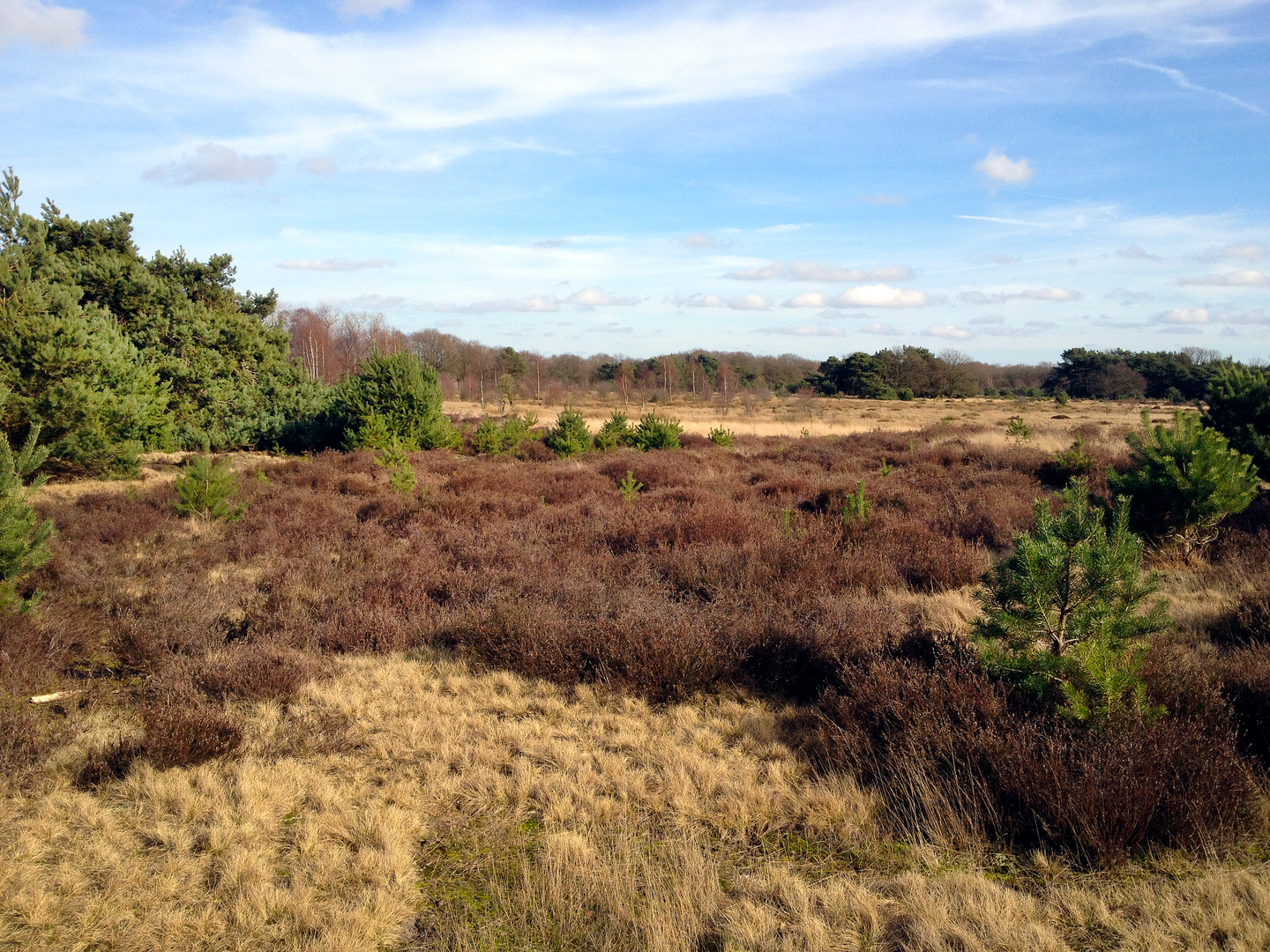
Molenheide (“mill heath”) suggests a landscape historically shaped by heathland use—grazing, turf cutting, and wind exposure—often later planted with pine or mixed woodland. Muggenberg (“mosquito hill”) is a classic low-country hint at wet ground nearby: marshy pockets, ponds, or poorly drained soils that breed insects in warm months.
What to look for as you move through: - Old lane architecture: roadside tree lines, drainage channels, and occasional older farmsteads set back from the road. - Heath/woodland edges: transitions from open fields to scrub, then to pine or mixed forest; these edges are often the most wildlife-active. - Water features: ditches, small streams, ponds, and wet hollows—important for navigation because paths sometimes “dogleg” to cross at the only bridge.
Nature and wildlife you may encounter
In flat, mixed rural landscapes, wildlife sightings are often about timing (early/late) and quiet movement:
- Birdlife: Expect common farmland and woodland-edge species—corvids, finches, woodpeckers in wooded sections, and raptors cruising over open fields. Wet pockets can hold ducks, herons, or other waders.
- Mammals: Roe deer are typical in woodland margins; hares and foxes are possible in open country. In some regions, wild boar can occur—rarely aggressive, but give space if encountered, especially near dense cover.
- Insects: If “Muggen-” is true to its name, mosquitoes and midges can be intense near dusk and around standing water from late spring through early autumn. Pack repellent and consider long sleeves for the final hours.
Seasonal notes: - Spring: softer ground, more mud at field edges; birds active. - Summer: long daylight helps; heat and insects become the main hazards. - Autumn: best visibility and cooler temps; leaf litter can hide slick roots on forest tracks. - Winter: short days—carry a headlamp; frozen ruts can be ankle-twisting.
Planning: pacing, food, water, and resupply
For 55 km / 34 mi, plan like an endurance day even if the route is “

Surfaces
Asphalt
Unknown
Concrete
Ground
Unpaved
Dirt
Gravel
Sand
Comments and Reviews
User comments, reviews and discussions about the De Oude Baan, Muggenberg, Molenheide and Luikerweg Loop, Netherlands.
average rating out of 5
0 rating(s)