Download
3D Flyover
Add to list
More
12.0 km
~2 hrs 24 min
0 m
Loop
“From sparkling lakeshores to art-filled parklands, this vibrant loop offers Utrecht’s greenest urban escapes.”
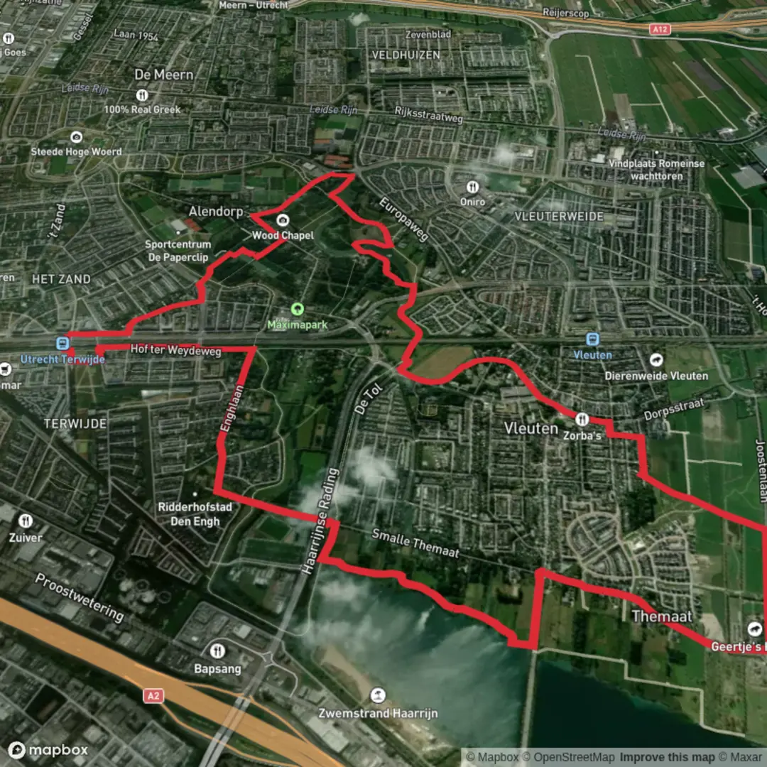
Starting from the northern edge of Utrecht, the loop begins near the Haarrijnse Plas, a popular recreational lake just west of the city. The trailhead is easily accessible by public transport: take a bus from Utrecht Centraal Station towards Vleuten, alighting at the Haarrijnse Plas stop, which is adjacent to the lake’s main entrance and parking area. For those arriving by car, parking is available at Strand Haarrijn, located at Haarrijnseplas, 3545 Utrecht.
Haarrijnse Plas: Urban Nature and Water Views
The first section of the loop traces the shoreline of Haarrijnse Plas, a large, clear-water lake surrounded by grassy beaches and reed beds. This area is a haven for waterfowl, including grebes, coots, and herons, especially in spring and autumn. The flat, well-maintained paths make for easy walking, and the open landscape offers wide views across the water, with Utrecht’s skyline visible in the distance. After about 2 km (1.2 miles), the route leaves the lakeside, heading south through a patchwork of meadows and small woodlands.
Transition to Maximapark: Green Corridors and Art Installations
Crossing under the A2 motorway via a pedestrian tunnel, the trail enters the lush green corridors that connect Haarrijnse Plas to Maximapark. This section, around 3 km (1.9 miles) into the hike, is characterized by tree-lined paths and wildflower meadows, frequented by songbirds and butterflies. The route follows the scenic Lint, a 7 km (4.3 mile) circular path that forms the backbone of Maximapark, one of the largest urban parks in the Netherlands.
Maximapark: Gardens, History, and Modern Design
Maximapark itself is a highlight, blending modern landscape architecture with natural beauty. The park is named after Queen Máxima and was developed on former agricultural land, with a design that incorporates water features, ornamental gardens, and open lawns. Notable landmarks include the Vlinderhof, a renowned perennial garden designed by Piet Oudolf, located about 6 km (3.7 miles) into the loop. The park also features several art installations and playgrounds, making it a lively spot for families and nature lovers alike.
The area has historical significance as part of the reclamation projects that shaped the Utrecht region, transforming wetlands and farmland into urban green space. Interpretive signs along the route provide insights into the park’s development and the local flora and fauna.
Return to Haarrijnse Plas: Open Fields and Canal Views
Leaving Maximapark, the loop heads north along the Amsterdam-Rijnkanaal, a major waterway that has been vital to Dutch trade and transport since the 19th century. The canal’s towpath offers a peaceful stretch with views of passing barges and occasional glimpses of kingfishers darting along the water. After approximately 10 km (6.2 miles), the route turns west, crossing open fields and returning to the starting point at Haarrijnse Plas.
Trail Conditions and Navigation
The entire loop covers about 12 km (7.5 miles) with negligible elevation gain, making it suitable for all fitness levels and ideal for families or those seeking a leisurely walk. Surfaces are a mix of paved and gravel paths, accessible year-round. Navigation is straightforward, but for added confidence and up-to-date route information, use HiiKER’s digital maps and trail guides.
Public amenities, including restrooms and cafés, are available at both Haarrijnse Plas and Maximapark. The route is well-served by public transport, with frequent buses connecting both ends of the loop to Utrecht city center.

Surfaces
Unknown
Asphalt
Grass
Unpaved
Gravel
Concrete
Wood
Comments and Reviews
User comments, reviews and discussions about the Haarrijnse Plas and Maximapark Loop, Netherlands.
average rating out of 5
0 rating(s)