Download
3D Flyover
Add to list
More
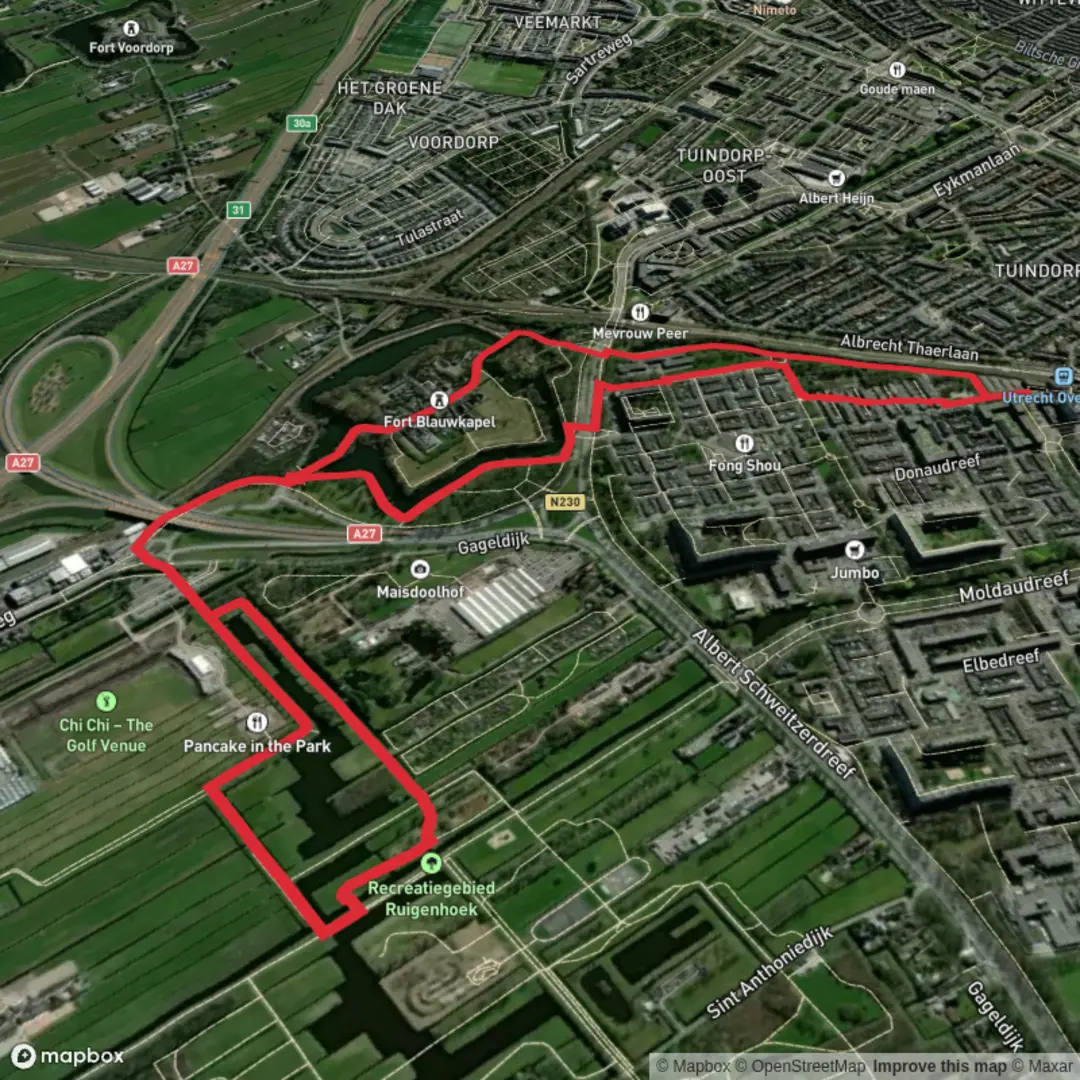
5.7 km
~1 hrs 8 min
0 m
Loop
“Stroll amid wildflowers and waterways, tracing centuries-old Dutch defenses beneath Utrecht’s peaceful skyline.”
Starting from the outskirts of Utrecht, the trailhead for this 6 km (about 3.7 miles) loop is easily accessible near Fort Blauwkapel, a historic fortress just northeast of Utrecht’s city center. The area is well-served by public transport: take a train to Utrecht Centraal, then transfer to a local bus heading toward Blauwkapel or Voordorp. For those arriving by car, parking is available near Fort Blauwkapel, close to the intersection of Blauwkapelseweg and Fort Blauwkapel.
Historic Fortifications and Waterways
The route follows a section of the Waterliniepad, a long-distance trail tracing the Dutch Waterline, a unique defensive system that used controlled flooding to protect the heart of the Netherlands. Fort Blauwkapel itself is a striking 19th-century fortification, surrounded by a moat and lush greenery. As you set off, you’ll notice the low elevation—there’s virtually no elevation gain, making this hike suitable for all fitness levels.
Within the first kilometer (0.6 miles), you’ll pass the fort’s brick ramparts and grassy embankments, often dotted with wildflowers in spring and summer. The fort is not always open to the public, but the exterior and surrounding parkland are accessible year-round. Interpretive signs along the way provide insight into the fort’s role in Dutch military history.
Nature and Wildlife Along the Waterliniepad
The trail soon leads you along quiet towpaths and tree-lined dikes, with the canal on one side and open meadows on the other. This area is a haven for birdlife—look for herons, coots, and the occasional kingfisher darting along the water’s edge. In the early morning or late afternoon, you might spot rabbits or deer grazing in the fields.
About halfway through the hike, at roughly 3 km (1.9 miles), you’ll cross a small bridge near the Voordorpse Dijk, a scenic spot to pause and enjoy views of the Utrecht skyline in the distance. The path here is flat and well-maintained, suitable for families and those with limited mobility.
Navigational Tips and Points of Interest
Navigation is straightforward, with clear waymarking for the Waterliniepad. For detailed maps and real-time navigation, use the HiiKER app, which provides up-to-date trail information and points of interest. The route loops back toward Fort Blauwkapel, passing through a mix of woodland and open pasture.
As you approach the end of the loop, take time to explore the fort’s surroundings, where remnants of old bunkers and sluices hint at the area’s strategic past. The final stretch brings you back to your starting point, with easy access to public transport or your parked car.
This gentle, historically rich walk offers a unique glimpse into Dutch heritage, set amid tranquil natural scenery just minutes from the city.

Surfaces
Asphalt
Unknown
Grass
Paved
Cobblestone
Wood
Gravel
Comments and Reviews
User comments, reviews and discussions about the Fort Blauwkapel via Waterliniepad, Netherlands.
average rating out of 5
0 rating(s)