Download
3D Flyover
Add to list
More
55.8 km
~2 days
7 m
Multi-Day
“A big-sky, wind-exposed wander linking terp villages, polder lanes and Lauwersmeer reeds to Holwerd’s Wadden edge.”
This is a long, flat, big-sky walk across the northern Netherlands’ coastal plain, linking small terp (mound) villages, wide agricultural polders, and the open water-and-reed landscapes around Lauwersmeer before finishing on the Wadden Sea coast near Holwerd. At roughly 56 km / 35 mi with about 0 m / 0 ft of climbing, the challenge is less about elevation and more about wind exposure, long straight sections, and managing food/water between settlements.
Getting to the start (Ulrum) and leaving from the finish (Holwerd)
Start access (Ulrum, Groningen province) - By public transport: The most practical approach is usually train to Groningen (the main rail hub in the region), then a regional bus toward Ulrum. Plan the final bus leg carefully—service can be less frequent outside peak times and on Sundays. Use HiiKER to confirm the exact start point you’ve chosen in/near Ulrum and match it to the nearest bus stop. - By car: Ulrum is reachable via regional roads from Groningen city and the A7 corridor. Parking is typically easiest on the edge of the village near public streets; be considerate of farm access and narrow lanes.
Finish access (Holwerd, Friesland province) - Holwerd is a known gateway for the Ameland ferry (even if you’re not taking it, it’s a useful landmark for orientation and services). From Holwerd you can usually connect by regional bus to larger towns (often via Dokkum/Leeuwarden corridors depending on the route). If you’re car-shuttling, Holwerd has clearer “destination” parking patterns because of ferry traffic—still, check local signage.
What the route feels like underfoot
Expect a mix of quiet paved farm lanes, compacted gravel/dike-top paths, and occasional roadside walking. Because the terrain is essentially at or near sea level, surfaces matter more than gradients: - Footwear: Road-to-trail hybrids or cushioned walking shoes work well; waterproofing helps after rain because verge grass and low-lying paths can stay wet. - Wind: With few trees, wind can be the biggest energy drain. A light shell and a cap that won’t blow off are more useful than you might expect on an “easy” profile. - Navigation: The landscape can look repetitive—long straight lines, canals, and fields—so keep HiiKER handy for confirming junctions and avoiding accidental detours onto private farm tracks.
Segment-by-segment planning (approximate)
Distances below are approximate to help you pace the day; your exact split will depend on the line you follow around Lauwersmeer and which Strandweg sections you choose.
1) Ulrum to the Lauwersmeer approach — ~18–22 km / 11–14 mi (0 m / 0 ft) You’ll leave Ulrum through classic Groningen clay-country: broad fields, drainage ditches, and scattered farmsteads. Many villages here historically developed on terpen—artificial dwelling mounds built to stay above storm tides before large-scale diking. Even when you can’t “see” the mound, you’ll often notice the subtle rise where the church and older houses sit.
What to look for: - Canals and sluices: Small water-control structures are everywhere; they’re part of the centuries-long engineering effort that made stable settlement possible on land that naturally wants to be marsh. - Birdlife over fields: Depending on season, you may see geese, lapwings, and raptors hunting over open ground. In spring, farmland edges can be busy with nesting activity—give birds space and keep to the path.
Resupply notes: - Ulrum has basic services, but once you’re out in the polders, options can thin out quickly. Carry enough water for a long, exposed stretch.
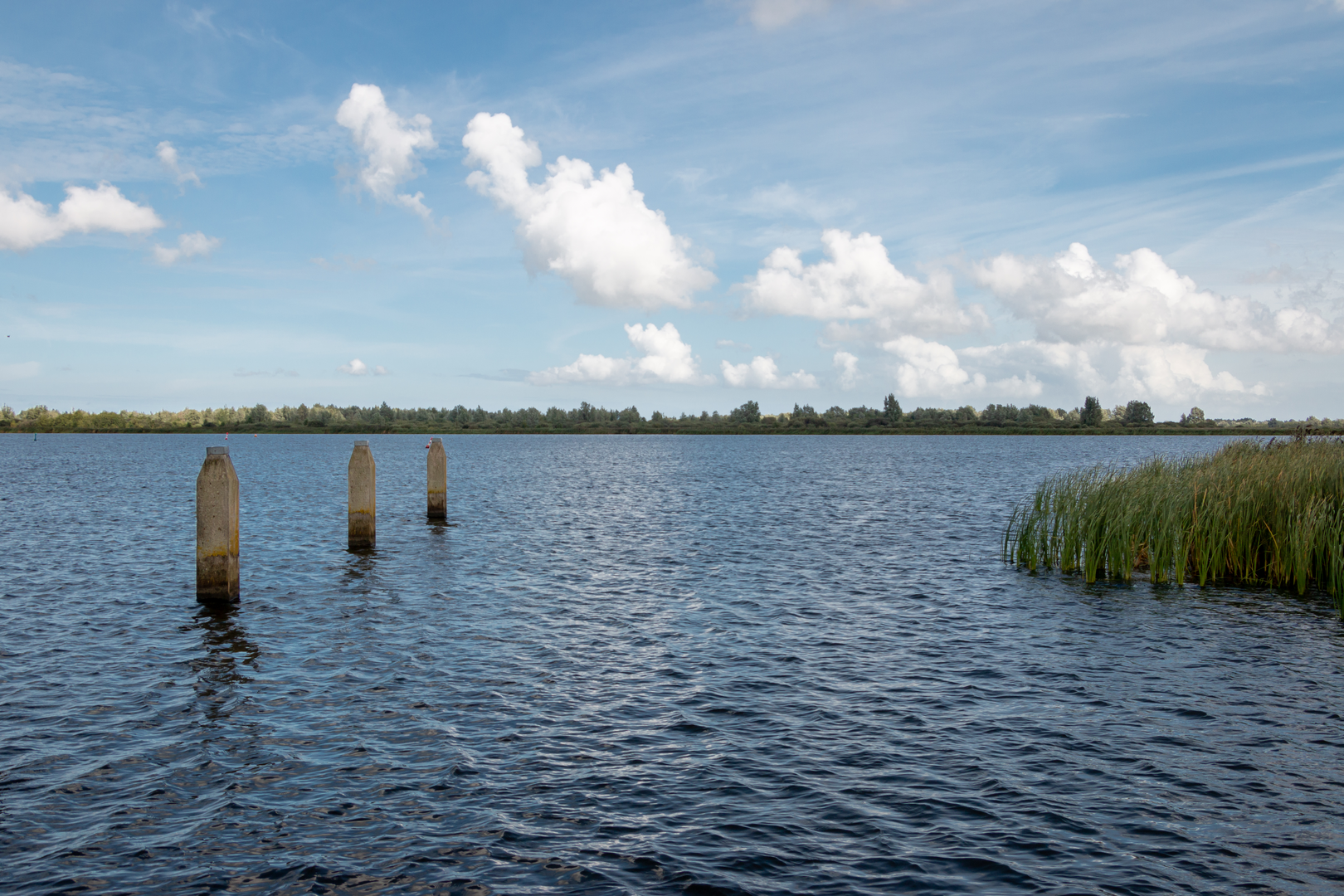
2) Lauwersmeer National Park area — ~16–22 km / 10–14 mi (0 m / 0 ft) This is the most “nature-forward” portion. Lauwersmeer was created after the Lauwerszee inlet was closed off by a dam in 1969, transforming saltwater tidal dynamics into a freshwater lake and wetland mosaic. The result is a major habitat for birds and a landscape that feels much wilder than the surrounding farmland.
What to expect: - Big horizons and reedbeds: Long views across water, reed fringes, and wet grasslands. - Dikes and service roads: You’ll likely use dike-top lines or straight access roads—easy walking, but very exposed. - Wildlife: This is prime territory for waterfowl, waders, and birds of prey. In migration periods, the variety can be remarkable. Early morning and late afternoon are often the most active times.
What to look out for: - Weather changes: With open water nearby, conditions can shift quickly—wind can spike and rain can sweep in fast. - Insects: In warmer months, wetland edges can mean mosquitoes/gnats; a small repellent can make breaks more pleasant. - Limited shade: Plan sun protection even on cooler days; reflection off water can add to exposure.
Landmarks and context: - The dam and waterworks around Lauwersmeer are a living reminder of Dutch coastal history—this region sits within the broader story of land reclamation, flood defense, and the constant negotiation between sea and settlement.
3) Toward Holwerd via Strandweg and coastal approaches — ~14–20 km / 9–12 mi (0 m / 0 ft)

Surfaces
Asphalt
Unknown
Concrete
Grass
Gravel
Wood
Comments and Reviews
User comments, reviews and discussions about the Ulrum to Holwerd via Lauwersmeer and Strandweg, Netherlands.
average rating out of 5
0 rating(s)