Download
3D Flyover
Add to list
More
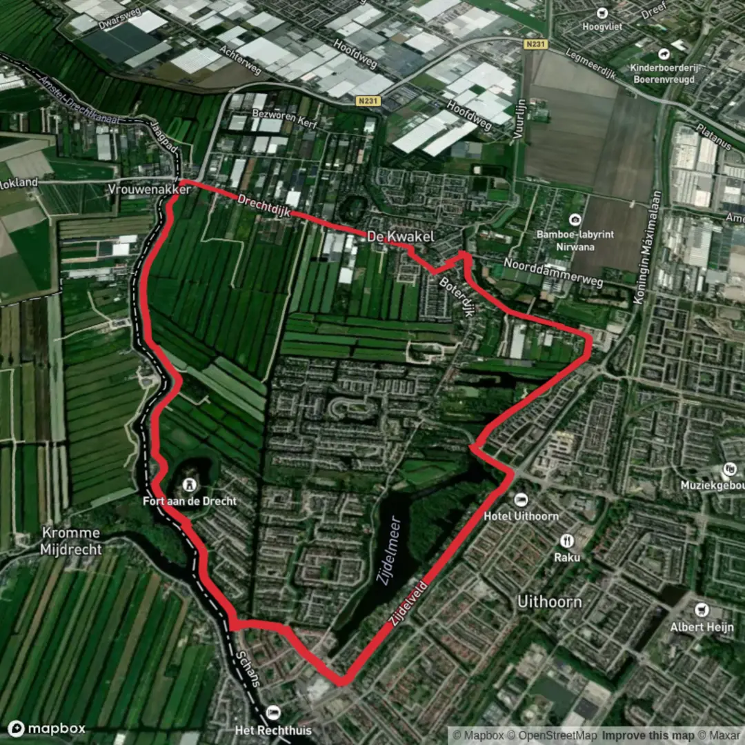
8.7 km
~1 hrs 44 min
0 m
Loop
“Wander through meadows, canals, and history on this tranquil Dutch loop, alive with birdsong and wildflowers.”
Starting from the outskirts of Uithoorn, a small town southwest of Amsterdam, the Fortenpad and Zijdelveld Loop offers a gentle 9 km (about 5.6 miles) circuit with virtually no elevation gain, making it accessible for hikers of all abilities. The trailhead is conveniently located near the Zijdelveld area, close to the intersection of Zijdelveld and Randweg, just a short walk from the Uithoorn bus station. For those arriving by public transport, frequent buses connect Uithoorn to Amsterdam and other nearby towns. Drivers will find parking options near the Zijdelveld or at the shopping center on Amstelplein.
Navigating the Route
The loop is well-marked and follows a combination of dike paths, rural lanes, and grassy embankments. For precise navigation, HiiKER provides an up-to-date digital map of the route, ensuring you stay on track through the open Dutch polder landscape.
Landmarks and Historical Features
Within the first kilometer, the route passes close to Fort aan de Drecht, one of the 19th-century forts forming part of the Stelling van Amsterdam, a UNESCO World Heritage site. This defensive ring was constructed to protect the city and is a testament to Dutch ingenuity in water management and military engineering. The fort itself is not always open to the public, but its imposing structure and surrounding moat are visible from the path.
Continuing along the Zijdelveld, the trail meanders through a patchwork of meadows and waterways typical of the Groene Hart (Green Heart) region. At around 3 km (1.9 miles), you’ll cross several wooden bridges spanning narrow canals, offering excellent vantage points for spotting waterfowl such as herons, grebes, and swans. The area is also known for its rich plant life, with reed beds and wildflowers lining the ditches in spring and summer.
Nature and Wildlife
The open fields are home to grazing cattle and sheep, and in the quieter stretches, you may catch sight of hares darting through the grass. The Zijdelmeer, a small lake near the halfway point, is a hotspot for birdwatchers, especially during migration seasons. Benches along the water’s edge provide a peaceful spot for a break.
Trail Conditions and Facilities
The entire loop is flat, with a total elevation gain of less than 5 metres (16 feet), and the surfaces range from paved dike roads to grassy tracks. Waterproof footwear is recommended after rain, as some sections can become muddy. There are no steep climbs or technical challenges, making this route suitable for families and casual walkers.
Restrooms and refreshments are available in Uithoorn town center, about 1 km (0.6 miles) from the start and finish. The route itself passes through mostly rural areas, so carrying water and snacks is advisable.
Planning Your Visit
The Fortenpad and Zijdelveld Loop is best enjoyed from late spring to early autumn, when the fields are lush and the wildlife most active. Dogs are allowed on leash, but be mindful of livestock and nesting birds. Cyclists may share some sections of the dike paths, so stay alert at junctions.
For those interested in extending their walk, the nearby Amstel River offers additional scenic routes, and the Stelling van Amsterdam forts can be explored further by following connecting trails mapped on HiiKER.

Surfaces
Unknown
Concrete
Grass
Gravel
Asphalt
Paved
Comments and Reviews
User comments, reviews and discussions about the Fortenpad and Zijdelveld Loop, Netherlands.
average rating out of 5
0 rating(s)