Download
3D Flyover
Add to list
More
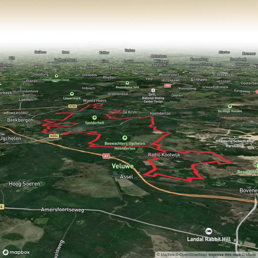
52.8 km
~2 days
251 m
Point-to-Point
“A steady Veluwe loop of pines, heath, and sandy lanes—varied, reflective, and quietly demanding.”
This is a long, low-relief loop through the Veluwe’s classic mosaic of pine and mixed woodland, heath, sandy tracks, and estate lanes—more about steady forward progress and variety than steep climbing. At ~53 km (33 mi) with roughly ~300 m (985 ft) of ascent, it suits hikers who are comfortable being on their feet for most of a day (or who plan it as a relaxed two-day outing). Even though the elevation profile is gentle, the distance and the amount of unpaved walking can make it feel more demanding than an “Easy” label suggests—especially in wet weather when sandy sections turn energy-sapping.
Getting to the start (car + public transport)
Because your start is listed only as “near,” the most practical way to pin it down is to use the most recognizable access point on the Waterbergweg side of the central Veluwe. A common, well-served jumping-off area for routes that stitch together Ugchelen / Hoog Buurlo / Spelderholt / Waterbergweg is Hoog Buurlo (near Apeldoorn)—a small hamlet and trail hub on the Veluwe, close to the Hoog Buurlo parking areas and trailheads used for heath and forest walks. If you’re navigating in HiiKER, choose the route’s official start point and then match it to the nearest signed parking area or bus stop.
- By car: Aim for Hoog Buurlo (Apeldoorn area) and use the nearest marked forest/heath car park (often signed locally as a “P” for Veluwe trail access). Arrive early on weekends—this region is popular with walkers and cyclists.
- By public transport: The easiest rail hub is Apeldoorn. From Apeldoorn, local buses and a short taxi ride can get you close to Hoog Buurlo/Hoenderloo edges depending on the day/time. If you want a fully transit-based plan, pick the route start in HiiKER and work backward to the nearest bus stop shown on the map, then check the current bus timetable for that stop.
What the terrain feels like over 53 km / 33 mi
Expect a mix of: - Wide forest roads (fast, forgiving underfoot) - Sandy tracks (slower; can be tiring late in the day) - Heathland paths (often firm, sometimes rutted) - Estate lanes near Spelderholt (more manicured, occasional pavement)
The ~300 m (985 ft) of gain is typically spread out in small rises—old drift dunes, subtle ridgelines, and gentle undulations rather than “hills.” Your pacing will be dictated more by surface (sand vs. firm track) and how often you stop to check junctions than by climbing.
Navigation and wayfinding (keep it simple, keep it consistent)
This is the kind of Veluwe route where intersections can look deceptively similar—multiple straight forest roads meeting at right angles, with long stretches that feel the same. Use HiiKER as your primary navigation tool and plan to: - Download the route for offline use before you lose signal under dense canopy. - Watch for parallel tracks: it’s easy to drift onto a cycle track or forestry road that runs alongside your intended line. - Confirm direction at major junctions rather than “following the most walked line,” because sand and bike traffic can create misleading desire paths.
Landmarks and character: Ugchelen → Hoog Buurlo → Spelderholt → Waterbergweg
Ugchelen area
Ugchelen sits on the edge of Apeldoorn and is historically tied to water and paper-making in the region—springs and brooks on the Veluwe’s flanks powered mills and supported early industry. As you move away from the built-up edge, the landscape quickly becomes quieter: taller pines, mixed deciduous pockets, and long straight lanes that hint at managed forestry.
Hoog Buurlo and the open Veluwe feel
Around Hoog Buurlo you’ll notice more open heath and a bigger sky. This is one of the most “Veluwe” sections of the day: sandy soils, heather, and scattered trees shaped by centuries of land use—grazing, sod-cutting, and later reforestation. In late summer, heather can color the landscape; in other seasons it’s more muted but still expansive.
Spelderholt / estate landscapes
Near Spelderholt the tone often shifts toward estate grounds and more structured lanes. You may pass areas that feel more cultivated—edges trimmed, paths more formal—before you’re back into wilder-feeling forest. This contrast is a nice mental reset late in a long hike.
Waterbergweg stretch
The Waterbergweg portion typically reads as steady, efficient walking—good for making distance. It’s also where monotony can creep in if you’re tired: long straightaways, repeating junctions, and subtle turns. This is where disciplined HiiKER checks pay off.
Nature and wildlife to look out for (and how to behave around it)
The Veluwe is one of the Netherlands’ best-known wildlife regions. Even on a route that stays on public tracks, you’re moving through habitat used by large mammals.
- Red deer and roe deer: Most likely at dawn/dusk or in quieter stretches. You may see tracks in sand long before you see the animals.
- Wild boar: Present in many Veluwe areas. Give them space, don’t approach, and keep moving calmly if you spot one. Be especially cautious if you see piglets.
- Birdlife: Woodland species are common; open heath edges can be good for raptors and ground-nesting birds (season

Surfaces
Unknown
Concrete
Sand
Asphalt
Ground
Unpaved
Dirt
Gravel
Grass
Comments and Reviews
User comments, reviews and discussions about the Ugchelsche, Hoog Buurlosche and Spelderholt via Waterbergweg, Netherlands.
average rating out of 5
0 rating(s)