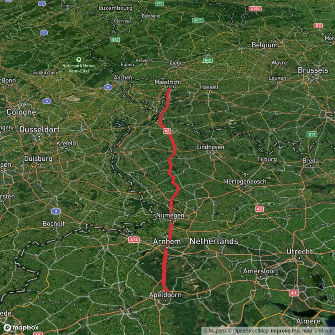
Ugchelen to Maastricht via Arnhemseweg, Apeldoornseweg and Campusbaan
Download
3D Flyover
Add to list
More
167.6 km
~6 days
131 m
Multi-Day
“A long, flat Dutch odyssey from Ugchelen’s mill-fed lanes to Maastricht’s campus streets—paced, not peaked.”
You’re looking at a long, low-relief point-to-point walk of roughly 167 km / 104 mi with only about 100 m / 330 ft of total ascent—so the challenge is almost entirely time-on-feet, pacing, and foot care, not climbing. Expect a predominantly paved or hard-packed surface for big stretches (roads, cycleways, campus/urban connectors), with frequent transitions between village edges, farmland, and built-up areas.
Start location (nearest known landmark/address): Ugchelen is a village just southwest of Apeldoorn in Gelderland. A practical “meet-up” landmark to aim for in Ugchelen is the Ugchelen village church (Kerk in Ugchelen) area, which sits in the historic village core. Ugchelen is also known for its historic relationship with paper-making and watermills (the area historically had numerous mills), which helps explain the presence of streams, mill races, and older industrial traces around the village landscape. (en.wikipedia.org)
Finish location (nearest known landmark/address): “Campusbaan” in Maastricht is associated with the Randwyck/campus district. A reliable end-point landmark in that area is Maastricht University, Duboisdomein 30, 6229 GT Maastricht (a well-known visiting address on the campus side of the city). (maastrichtuniversity.nl)
Getting to the start (Ugchelen) and leaving the finish (Maastricht)
By public transport (start): - The simplest rail hub is Apeldoorn (major station with frequent national connections). From Apeldoorn you’ll typically use a local bus toward Ugchelen and then walk a short distance into the village core. Local neighborhood bus services operate in the Ugchelen area (timetables can be seasonal), so check the day/time carefully before committing to an early start. (buurtbusugchelen.nl)
By car (start): - Ugchelen sits immediately southwest of Apeldoorn; parking is usually easiest on residential streets near the village core or at small local pull-ins. Because this is a long point-to-point, many hikers either (1) arrange a drop-off, or (2) park at the finish and take public transport to the start.
Finish onward (Maastricht): - From the Randwyck/campus side (Duboisdomein area), you can connect by city bus/taxi back to Maastricht station and the historic center. Maastricht is a major regional hub with onward rail links.
What the route feels like, section by section (with planning distances)
Because the named roads include Arnhemseweg and Apeldoornseweg (both common Dutch road names that appear in multiple towns), treat this hike as a corridor-style route: you’ll be stitching together long, straight connectors, then threading through towns and campuses. Build your plan around daily distance blocks and reliable resupply points rather than expecting a continuous “trail” feel.
A sensible breakdown for an “easy” multi-day pace: - 4 days: ~42 km / 26 mi per day (very long days; doable for strong walkers on flat ground) - 5 days: ~33 km / 21 mi per day (still big, but more forgiving) - 6 days: ~28 km / 17 mi per day (comfortable for many hikers if feet hold up)
Early kilometers: Ugchelen out to the Apeldoorn edge (0–15 km / 0–9 mi)
You’ll start in a landscape shaped by Gelderland’s village-and-woods mosaic: residential lanes, small green corridors, and the first stretches of cycleway. The walking is straightforward, but the first hours are where people most often make mistakes: - Start too fast on flat pavement (shin splints and hot spots show up later). - Underestimate hard surfaces—even “easy” elevation can be punishing if it’s mostly asphalt.
Look for: - Small waterways and green strips that hint at the area’s historic mill-and-industry water management (Ugchelen’s paper-making past is part of this broader landscape story). (en.wikipedia.org)
Middle distance: long connectors, towns, and open country (15–140 km / 9–87 mi)
This is the heart of the hike: long, efficient movement with frequent town interfaces. Expect: - Cycle paths beside roads (often excellent footing, but mentally repetitive). - Agricultural edges: drainage ditches, canals, hedgerows, and wide skies. - Urban crossings: roundabouts, business parks, and residential districts.
Key things to watch for: - Navigation discipline: On flat terrain with many parallel roads and cycleways, it’s easy to drift onto the “wrong but plausible” connector. Keep HiiKER open and confirm at every major junction, especially where a cycleway splits from the carriageway or ducks through a neighborhood. - Wind exposure: Open farmland can feel dramatically colder or hotter than forecast, and head

Surfaces
Asphalt
Unknown
Concrete
Gravel
Unpaved
Sand
Paved
Grass
Dirt
Wood
Comments and Reviews
User comments, reviews and discussions about the Ugchelen to Maastricht via Arnhemseweg, Apeldoornseweg and Campusbaan, Netherlands.
average rating out of 5
0 rating(s)