Download
3D Flyover
Add to list
More
6.2 km
~1 hrs 16 min
19 m
Loop
“Wander through whispering forests, shimmering lakes, and golden sands on this enchanting Dutch countryside loop.”
Kootwijkerveen
The Vroome and Kootwijkerveen Loop is a scenic 6-kilometer (approximately 3.7-mile) trail with minimal elevation gain, making it accessible for hikers of all levels. The trailhead is located near the village of Kootwijk in the Gelderland province of the Netherlands.
Getting There
For those traveling by car, parking is available at the Grevenhout parking lot in Uddel, which serves as a convenient starting point for the hike. (veluwe.nl) If using public transportation, take a train to Apeldoorn station. From there, bus services run to Kootwijk; check local schedules for the most current routes and times.
Trail Overview
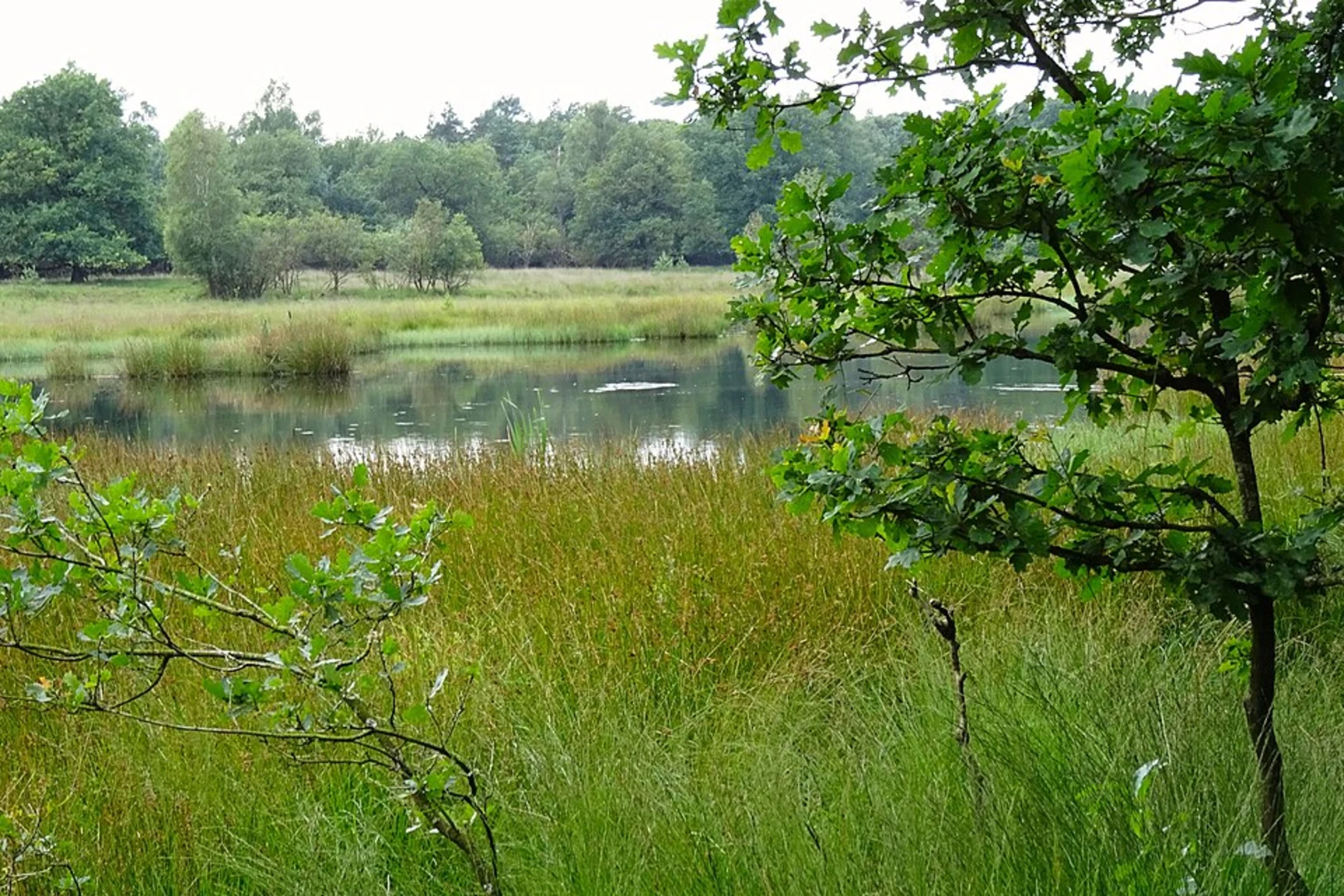
The loop begins by meandering through the dense forests of Grevenhout, characterized by towering Douglas firs and a rich understory. Approximately 1.5 kilometers (0.9 miles) into the hike, the trail opens up to the Kootwijkerveen, a serene peat lake nestled amidst the woods. This area is a haven for wildlife, including little grebes and, during winter months, the great grey shrike. (veluwe.nl)
Landmarks and Points of Interest
Kootwijkerveen: This peat lake serves as a watering hole for local wildlife and offers picturesque views, especially during sunrise and sunset.
Kootwijkerzand: As you continue, the trail leads to Kootwijkerzand, the largest sand drift area in Western Europe, spanning 700 hectares. This unique landscape features shifting sands and sparse vegetation, creating a desert-like environment. (fietsnetwerk.nl)
Historical Significance: The region is steeped in history, with the nearby Radio Kootwijk building serving as a monumental relic of early 20th-century communication. Constructed in the 1920s, it was a key transmission station for radio communications between the Netherlands and its colonies. (fietsnetwerk.nl)
Nature and Wildlife
The diverse habitats along the trail support a variety of flora and fauna. In addition to the aforementioned bird species, hikers might encounter roe deer and wild boars, particularly during the quieter hours of early morning or late afternoon. The forests are home to black woodpeckers and ravens, whose calls resonate through the trees. (veluwe.nl)
Trail Conditions and Preparation
The trail is well-marked with yellow signs, guiding hikers through the varied landscapes. The terrain is predominantly flat, with paths composed of compacted earth and sand, suitable for standard walking shoes. Facilities along the route are limited, so it's advisable to carry sufficient water and snacks. Given the open sections of the trail, sun protection is recommended during warmer months.
Navigation
For detailed maps and real-time navigation assistance, hikers can utilize HiiKER, which provides comprehensive information on the Vroome and Kootwijkerveen Loop.
Embarking on this loop offers a journey through some of the Netherlands' most captivating natural and historical landscapes, providing a memorable experience for all who traverse its paths.

Surfaces
Unknown
Dirt
Ground
Gravel
Asphalt
Wood
Sand
Comments and Reviews
User comments, reviews and discussions about the Vroome and Kootwijkerveen Loop, Netherlands.
average rating out of 5
0 rating(s)