Download
3D Flyover
Add to list
More
30.5 km
~6 hrs 6 min
0 m
Point-to-Point
“A long, level borderland ramble from quiet farms through pine reserves to Turnhout—plan for time.”
This is a long, flat, point-to-point walk of roughly 31 km / 19.3 mi with essentially 0 m / 0 ft of climbing, linking quiet borderland countryside and pine-forest nature reserves as you move from the hamlet area of Drasse Driehoek (near the Dutch–Belgian border, close to the Strijbeek/Chaam area) toward Turnhout (Belgium). Expect a mix of farm lanes, sandy forest tracks, canal-side paths, and small-town connectors—ideal for steady pacing, but long enough that foot comfort, food/water planning, and daylight timing matter more than fitness.
Getting to the start (Drasse Driehoek area)
Because “Drasse Driehoek” is a small locality rather than a single street address, the most practical “nearest known” reference point for planning is the Strijbeek / Chaam border area, where multiple minor roads and tracks converge between Chaam (NL) and Meerle/Hoogstraten (BE).
- By car: Aim for Chaam (North Brabant, Netherlands) as your navigation anchor, then continue toward the Strijbeek area near the border. Parking is typically informal in these rural zones—use designated pull-ins or village parking areas rather than blocking farm access gates. If you want a reliable “known landmark” to route toward, use Chaam village center as the last major waypoint, then follow local signage toward Strijbeek.
- By public transport: The easiest approach is usually train to Breda (NL), then a regional bus toward Chaam (services vary by day/time). From Chaam, you may need a short taxi or a longer warm-up walk to reach the Drasse Driehoek area. Check current schedules close to your date, and plan for limited evening service in rural areas.
Route character and what to expect underfoot
With negligible elevation change, the challenge is distance and surface variety: - Farm roads & village pavements: Easy walking, but watch for fast-moving local traffic on narrow lanes with limited shoulders. - Sandy forest tracks: Common in this region; they can feel soft and energy-sapping over long stretches. After rain, some sections hold water and become churned or muddy. - Canal/ditch edges and field margins: Often straight and exposed—wind can be a bigger factor than you’d expect on a “flat” hike.
Plan your pacing around time-on-feet: many hikers average 4–5 km/h (2.5–3.1 mph) on mixed surfaces. That puts this day at roughly 6–8 hours of walking, plus breaks.
Landscapes, nature, and wildlife (Chaam–Alphen corridor)
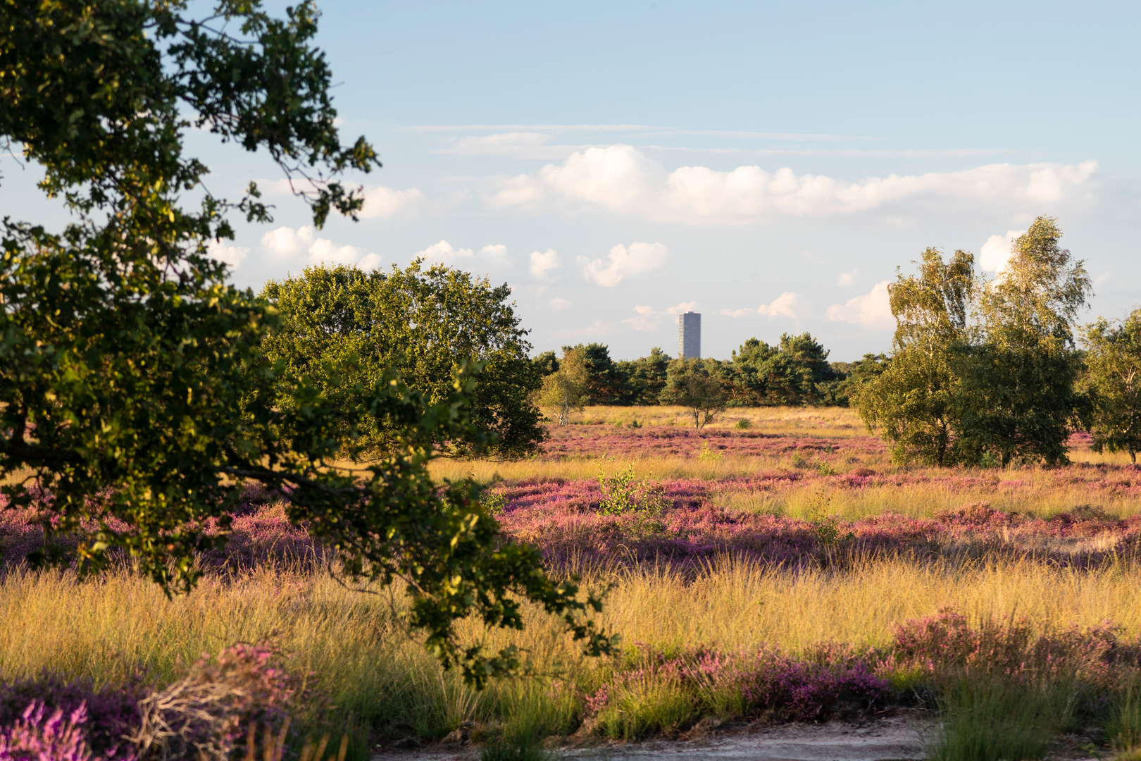
The Alphen–Chaam area sits in a classic Brabant sandy landscape: pine plantations, heath remnants, small wetlands, and a patchwork of fields and hedgerows.
What you’re likely to notice: - Pine and mixed woodland blocks with occasional open clearings. - Heathland pockets (where present) that can be striking in late summer when heather blooms. - Small streams, drainage ditches, and wet hollows—these attract birds and amphibians.
Wildlife to look out for (and how to hike responsibly around it): - Roe deer are common in quiet forest edges—most active early and late. - Foxes and hares in field margins. - Woodpeckers, jays, and finches in woodland; buzzards overhead in open country. - In wetter spots, expect frogs/newts and plenty of insect life in warm months.
Ticks can be present in grassy edges and heath/brush. Long socks, occasional checks, and staying centered on paths help reduce risk.
Through Alphen-Chaam: services and resupply strategy
As you pass near or through Alphen and Chaam, you’ll have your best chance to: - Top up water - Grab bakery snacks / lunch items - Use restrooms (when open)
Because this is a long, flat route, it’s easy to underestimate hydration—especially if the day is cool and breezy. A good baseline is 1.5–2.5 L depending on temperature and your pace, with the assumption you can refill in towns. If you’re unsure about refill points, carry a little extra capacity.
Borderland history and regional context
This walk crosses a region shaped by centuries of border changes, trade routes, and rural land use. The Netherlands–Belgium border here is famously intricate in places (the broader area includes historically complex enclaves), and even where the line is straightforward, you’ll still feel the “borderland” character: small settlements, old farmsteads, and long-established trackways that predate modern roads.
As you approach Turnhout, the landscape gradually shifts from rural quiet to a more urban edge. Turnhout is historically associated with the Kempen (Campine) region, long known for sandy soils, heathlands, and later industrial and commercial development. The transition into town often happens quickly: one moment you’re on a straight forest track, the next you’re navigating residential streets and cycle infrastructure.
Navigation and safety notes (flat doesn’t mean foolproof)
- Use HiiKER to keep an eye on junction density: forest grids can create “looks-the-same” intersections where it’s easy to take a parallel track.
- In sandy forest sections, expect occasional bike traffic (including fast e-bikes). Hold a predictable line and listen for bells.
- If you’re hiking in hunting season periods, you may see temporary

Surfaces
Asphalt
Unknown
Dirt
Paved
Wood
Comments and Reviews
User comments, reviews and discussions about the Drasse Driehoek to Turnhout via Alphen Chaam, Netherlands.
average rating out of 5
0 rating(s)