Download
3D Flyover
Add to list
More
44.1 km
~2 days
0 m
Multi-Day
“Drift beneath big skies from dike-top fields to arrow-straight rail-trail, then into whispering woods—flat, steady, and wind-tested.”
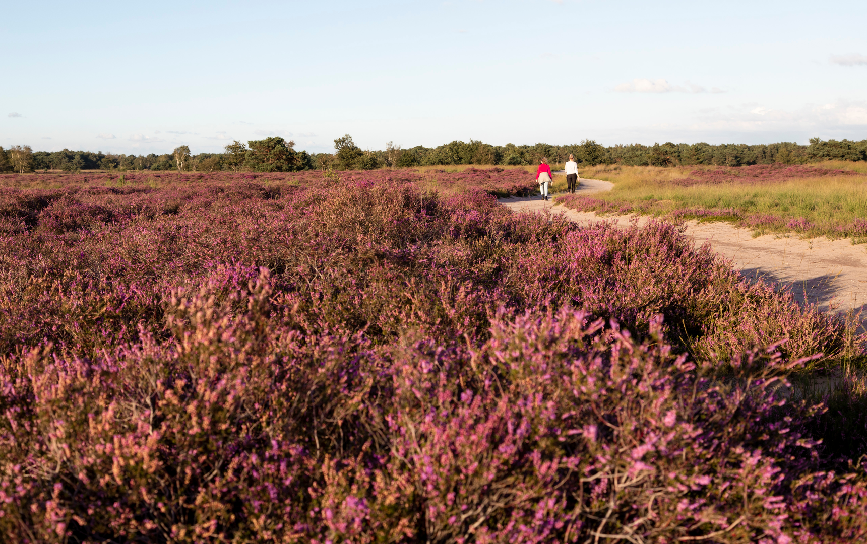
You’re looking at a long, very flat, low-stress endurance loop of about 44 km / 27 mi with essentially 0 m / 0 ft of climbing—built around three very different “spines” of the landscape: a dike-top farm road (Aatsedijk), the ruler-straight Bels Lijntje rail-trail, and the wooded lanes around Zwartvensepad / Zwartvenseweg on the edge of Tilburg’s Oude Warande area. Expect big skies, open fields, long straight sightlines, and lots of easy pacing—plus a few places where wind, mud, or monotonous surfaces can sneak up on you.
Where the hike starts (nearest landmark / address)
Because “near” wasn’t filled in, the most practical and commonly used access point for the Zwartvensepad side is by the railroad crossing on Zwartvenseweg (Tilburg), right by the entrances to the wooded area around Oude Warande / Stadsbos013. The municipality has also been developing this spot as a visitor gathering point (“Stadsboscentrum”) along Zwartvenseweg near the level crossing, which makes it a logical meet-up and start/finish area. (tilburg.nl)
If you’re building the loop to include Aatsedijk and a long section of Bels Lijntje, you’ll likely spend much of the day south/southwest of Tilburg toward the borderland landscapes around Alphen–Chaam/Baarle region, then return via the rail-trail corridor.
Getting there (car + public transport)
By car
- Aim for the Zwartvenseweg area in Tilburg near the railroad crossing (edge of the woods). This area is commonly used as an access point for the surrounding green network and is set up for short-stay parking/visiting. (tilburg.nl)
- If you prefer to start directly on the Bels Lijntje corridor, Tilburg’s side is often referenced around the city’s rail infrastructure and the route’s Tilburg access points (the corridor runs out of Tilburg toward Riel/Alphen/Baarle). (visitbrabant.com)
By public transport - Tilburg is well connected by Dutch rail. From a Tilburg station area, you can link into the green corridors leading toward Zwartvenseweg/Zwartvensepad and then onto longer-distance paths. (For turn-by-turn, load the loop in HiiKER and follow it from the nearest stop.)
What the terrain feels like over 44 km / 27 mi
This is “easy” in the sense of no climbing and generally straightforward track, but it’s still a full-day distance for most hikers. The surfaces tend to be: - Rail-trail / multi-use path (Bels Lijntje): smooth, straight, fast walking—great for steady cadence, but can feel repetitive. - Dike and farm roads (Aatsedijk): open, exposed, and wind-affected; often hard-packed or paved. - Woodland edges and park lanes (Zwartvensepad area): more shelter, more junctions, and occasional soft or leaf-covered sections.
Plan on 7–10 hours moving time depending on pace and breaks. Even with minimal elevation, your limiting factors are usually feet, wind exposure, and surface monotony (which can cause small form issues over time).
The Bels Lijntje: the straight-line “engine room” of the loop
A major highlight is time spent on ’t Bels Lijntje, a former railway line between Tilburg (NL) and Turnhout (BE) that has been repurposed into a long, linear recreation corridor. It’s famous for its arrow-straight alignment and for running through a borderland cultural landscape. (grenslanddebaronie.nl)
**Historical

Surfaces
Unknown
Asphalt
Concrete
Gravel
Dirt
Cobblestone
Sand
Wood
Paved
Comments and Reviews
User comments, reviews and discussions about the Aatsedijk, Bels Lijntje and Zwartvensepad Loop, Netherlands.
average rating out of 5
0 rating(s)