Download
3D Flyover
Add to list
More
13.8 km
~2 hrs 45 min
7 m
Point-to-Point
“Stroll flat Betuwe lanes from Tiel to De Beldert and Lingemeer—orchards, big skies, and breezes.”
This is a flat, waterside-and-orchard walk in the Betuwe/Rivierenland landscape, linking Tiel’s edge-of-town paths with two big “water wins”: De Beldert (a well-known recreation lake by Zoelen) and the Lingemeer area near the Gelderse Singel. Expect ~14 km / ~8.7 mi with essentially 0 m / 0 ft of climbing—easy on the lungs, but potentially windy and exposed on open dikes and lakeshores.
Getting to the start (public transport + car)
- By train: The most practical rail hub is Tiel railway station (Spoorstraat, 4001 CN Tiel). (g2rail.com)
- By bus (to the Lingemeer/Gelderse Singel side): There’s a bus stop listed as “Lingemeer, Gelderse Singel” (Tiel) served by bus 148—useful if you’re starting/finishing near the Lingemeer neighborhood rather than central Tiel. (en.busti.me)
- By car (for De Beldert access): A reliable, well-used access point is De Beldert, Zoelense Zandweg 1, 4011 LW Zoelen (north of Tiel). This is a common parking/entry address for the recreation area. (osvh.nl)
If you’re stitching the route exactly as named, plan your logistics so you can either:
- start near Tiel and finish near Gelderse Singel/Lingemeer, or
- park near De Beldert (Zoelense Zandweg 1) and make a loop/figure-eight using local paths.
Use HiiKER to confirm the exact start point and to keep you on the correct side of canals, singels (waterways), and private lanes—this area has many parallel paths that look “right” but dead-end at water or gates.
You’ll be walking through the Betuwe, widely known as the Netherlands’ fruit-growing region (orchards, farm lanes, seasonal blossom), and around Tiel—historically a Hanseatic trading city that benefited from river commerce and regional trade networks. (fietsnetwerk.nl)
What the route feels like (segment-by-segment)
0.0–3.5 km (0.0–2.2 mi): Town edge to open Betuwe lanes
You’ll typically leave built-up streets quickly and transition to quieter lanes and multi-use paths. Underfoot is mostly pavement or compacted path—ideal for trail runners, casual walkers, and anyone avoiding mud. Because the terrain is so flat, your main “effort” variables are wind and pace, not elevation.
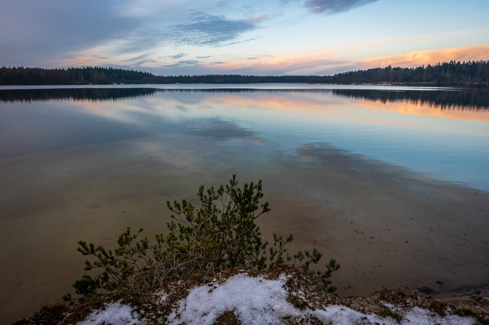
3.5–7.5 km (2.2–4.7 mi): De Beldert recreation lake (Zoelen area)
De Beldert is a large recreation area (about 70 ha) with beach facilities and open water views. (zwemindex.nl)
What to look for here:
- Big-sky water scenery: wide horizons, reed edges, and lots of bird activity depending on season.
- Busy zones vs quiet edges: near the beach/amenities it can be lively in warm weather; the perimeter paths are usually calmer.
- Water safety awareness: even if you’re only walking, expect swimmers, paddlecraft, and families crossing paths near access points.
Wildlife is typical of Dutch freshwater and lakeside habitat—waterfowl, gulls/terns in season, and fish activity visible in clear shallows. (De Beldert is also known locally as a dive site, which hints at the lake’s depth changes and underwater features—interesting context even if you stay topside.) (scubago.com)
7.5–11.5 km (4.7–7.1 mi): Between lakes—orchards, ditches, and long straightaways
This middle stretch is classic Rivierenland: straight lines, drainage channels, and orchard blocks. In spring you may pass blossom corridors; later in the year, fruit stands can appear along rural roads (timing varies). (fietsnetwerk.nl)
Because it’s flat and often exposed:
- Bring a wind layer even on mild days.
- In summer

Surfaces
Unknown
Asphalt
Concrete
Paved
Comments and Reviews
User comments, reviews and discussions about the Tiel to Gelderse Singel via De Beldert and Lingemeer, Netherlands.
average rating out of 5
0 rating(s)