
Download
3D Flyover
Add to list
More
20.5 km
~4 hrs 6 min
0 m
Loop
“A tranquil waterside loop from birdy reedbeds to breezy polders and lively marinas—weather permitting.”
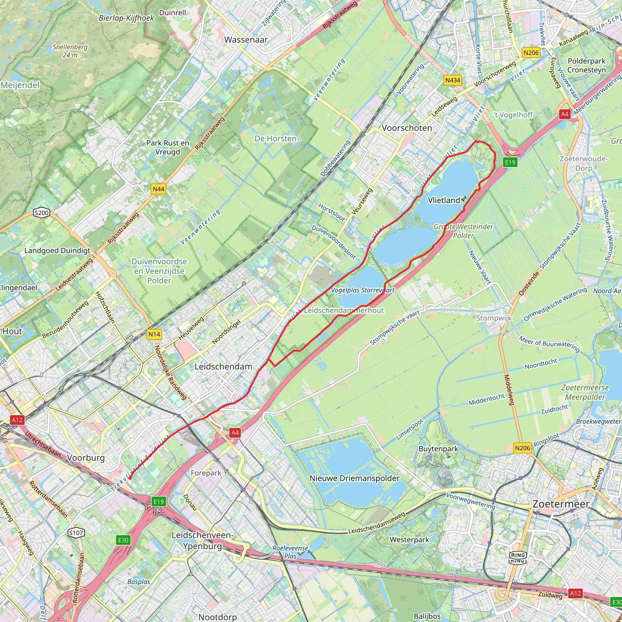
This is a mostly flat, waterside loop of roughly 20 km (12.4 mi) with essentially 0 m (0 ft) of climbing—ideal for a relaxed day that still feels varied thanks to a mix of bird-rich lakes, Dutch polder landscapes, and a large recreation area with beaches and marinas. Underfoot you’ll typically alternate between wide gravel/cycle paths, compacted dirt, and paved multi-use paths, so it’s very doable in trainers, though waterproof shoes help after rain.
Where the hike starts (nearest landmark / address)
“Vogelplas Starrevaart” is commonly associated with the bird lake and nature area by Starrevaart near Leidschendam–Voorburg. A practical, easy-to-find start point for planning is around the Starrevaart / Vogelplas Starrevaart area near Leidschendam, close to the Starrevaartseweg corridor and the Leidschendam side of the lake. If you’re using HiiKER, set your start to the Vogelplas Starrevaart (bird lake) access points near Leidschendam and confirm the exact trailhead pin on the map before you go.
Getting to the start
By public transport (from the Randstad): - The most straightforward approach is usually to travel to Leidschendam–Voorburg (or Leiden / Den Haag depending on where you’re coming from) and then continue by bus/tram toward Leidschendam. From there, it’s typically a short walk or a quick local connection to the Starrevaart/Vogelplas access points. - Plan the final leg so you arrive near the Starrevaart/Vogelplas side rather than Vlietland first—this keeps the day feeling like a gradual “build” from quiet bird lake to lively recreation area.
By car: - Aim for parking near Leidschendam on the Vogelplas Starrevaart side (small lots and roadside parking are common in this area) or, alternatively, park at Recreatiegebied Vlietland (larger, more obvious parking) and walk the loop in reverse. - Weekends and warm days can make Vlietland parking busy; arriving earlier helps.
What to expect on the route (distance markers you can plan around)
0–4 km (0–2.5 mi): Vogelplas Starrevaart—quiet water and birds - The opening kilometres are typically calm and nature-forward: still water, reed edges, and open sightlines that make birdwatching easy. - Expect waterfowl (geese, ducks, coots), and depending on season, grebes, herons, and raptors scanning the fields. Early morning and late afternoon are often the most active times for wildlife. - Paths here can be narrow in places and may have soft edges—give the waterline a bit of space, especially if it’s windy or the ground is saturated.
4–10 km (2.5–6.2 mi): Duinwaterpad / Hofpolderpad—polder corridors and canals - You’ll transition into classic polder scenery: straight drainage canals, low fields, and long, level lines that make navigation simple but can feel exposed. - Wind is the main “difficulty” factor on flat Dutch routes. Even on an easy hike, a headwind can slow your pace—pack a light shell. - Watch for fast cyclists on shared paths. Keep right, walk single-file when needed, and be extra alert at bends and bridge approaches.
Landmarks, nature, and wildlife highlights
- Reedbeds and open water around Vogelplas Starrevaart: prime habitat for nesting and feeding birds. In spring/early summer, keep noise down and stay on the path to avoid disturbing breeding areas.
- Canal bridges and sluice-like structures: small but telling features of Dutch water management—these landscapes are engineered to stay dry and productive.
- Vlietland recreation area (later in the hike): a noticeable shift in atmosphere—marinas, beaches, and open lawns. It’s a good place for a longer break, with more “human” activity and facilities than the quieter polder sections.
Mid-route: Vlietland (best place for breaks and facilities)
Around 10–14 km (6.2–8.7 mi) you’ll typically be in or near Recreatiegebied Vlietland, a large recreational zone between Leiden and The Hague regionally known for: - Lakes and sand beaches - Watersports (sailing, paddling, swimming areas in warm months) - Busier paths and more families, dogs, and runners
If you want a calmer lunch stop, pause just before entering the busiest beach/marina nodes; if you want amenities, head into the central Vlietland areas.
Navigation and safety notes (flat doesn’t mean effortless)
- Use HiiKER to confirm the correct turns where multiple parallel paths run along canals—on polder routes it’s easy to stay on the “wrong” side of a waterway and only realize it at the next bridge.
- Water edges: Many sections have minimal barriers. In wet or icy conditions, keep a safe margin from the canal/lake edge.
- Shared-use paths: This region has excellent cycling infrastructure; assume bikes may approach quickly and quietly.
- Sun and wind exposure: With few elevation changes and often limited shade, bring sunscreen and a wind layer even on mild days.
Historical context (why the landscape looks the way it does)
This hike moves through a landscape shaped by centuries of **poldering and
AI Planner
Days planned around your pace, with somewhere to stay each night.
Surfaces
Asphalt
Unknown
Grass
Comments and Reviews
User comments, reviews and discussions about the Vogelplas Starrevaart and Vlietland via Duinwaterpad and Hofpolderpad, Netherlands.
average rating out of 5
0 rating(s)


