Download
3D Flyover
Add to list
More
11.7 km
~2 hrs 20 min
0 m
Point-to-Point
“Wander from Teuge’s lively skies to serene wetlands and timeless canals, savoring Gelderland’s changing countryside.”
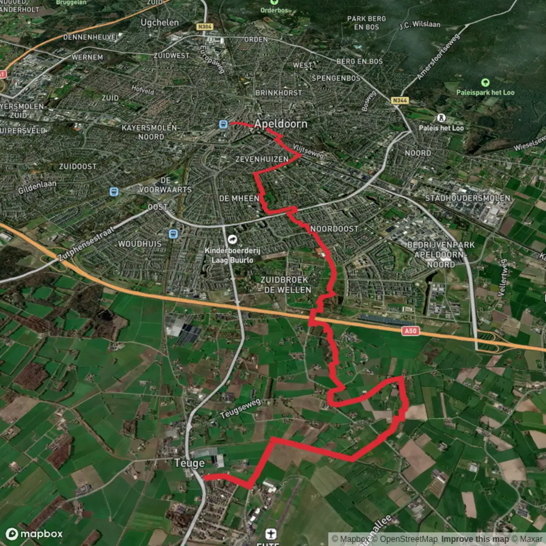
Starting from the small village of Teuge, just east of Apeldoorn in the province of Gelderland, this 12 km (about 7.5 miles) route is a gentle, flat walk with virtually no elevation gain, making it accessible for hikers of all abilities. The trailhead is conveniently located near Teuge Airport, a recognizable local landmark, and can be reached by taking a train to Apeldoorn and then a local bus (such as line 15 or 610) to Teuge, or by car with parking available near the airport.
Getting Oriented and Setting Out
The route begins near the entrance to Teuge Airport, a site with a unique history as a World War II airfield, now popular for recreational flying and skydiving. From here, the path heads south and then west, quickly leaving the bustle of the airport behind and entering the tranquil Dutch countryside. Navigation is straightforward, but for precise wayfinding and up-to-date trail conditions, HiiKER is the recommended tool.
Weteringsebroek Nature Reserve
After about 3 km (1.9 miles), the trail enters the Weteringsebroek, a restored wetland nature reserve. This area is a highlight of the hike, offering a patchwork of meadows, reed beds, and small waterways. The reserve is managed to encourage biodiversity, and depending on the season, you may spot grazing Highland cattle, Konik horses, or a variety of waterfowl such as herons, storks, and ducks. The flat, open landscape provides wide views and a sense of peace, with well-maintained paths that can be muddy after rain.
Historic Waterways and Rural Scenery
Continuing westward, the route follows the course of the Oude Wetering, an ancient drainage canal that has shaped the landscape for centuries. These waterways are a testament to Dutch ingenuity in water management, dating back to medieval times when the land was first reclaimed for agriculture. Along the way, you’ll pass traditional farmhouses, windbreaks of poplar trees, and fields that change with the seasons—tulips in spring, grazing sheep in summer, and misty vistas in autumn.
Approaching Apeldoorn
The final stretch of the hike brings you into the outskirts of Apeldoorn, a city known for its royal connections and green spaces. The route ends near the Apeldoorn railway station, making it easy to return to your starting point or continue exploring the city. Apeldoorn is home to the famous Het Loo Palace, and the city center offers plenty of options for refreshments after your walk.
Practical Considerations
The entire route is flat, with a total elevation gain of less than 5 meters (16 feet), and is suitable for families, casual walkers, and anyone looking for a relaxed day out. Surfaces are a mix of paved paths, gravel tracks, and grassy dikes; waterproof footwear is advisable in wet weather. Public transport connections at both ends make this an ideal point-to-point hike, and the open landscape means you’ll want to bring sun protection on bright days. For navigation, trail updates, and offline maps, HiiKER is the best resource to use throughout your journey.

Surfaces
Asphalt
Unknown
Concrete
Unpaved
Grass
Wood
Comments and Reviews
User comments, reviews and discussions about the Teuge to Apeldoorn via Weteringsebroek Route, Netherlands.
average rating out of 5
0 rating(s)