Download
3D Flyover
Add to list
More
5.2 km
~1 hrs 2 min
0 m
Loop
“Circle Terherne’s canals and polders on a breezy, flat stroll of boats, birds, and big skies.”
This easy loop is a flat, waterside walk of about 5 km (3.1 miles) with essentially 0 m (0 ft) of elevation gain, tracing the edges of Terherne (Terkaple/Terherne area), Friesland and the surrounding polders and canals. Underfoot you’ll mostly have paved village streets, compacted paths, and grassy dike-top tracks—all straightforward in dry weather, but potentially slick or soft on the grassy sections after rain.
Getting to the start (public transport + car)
A practical place to begin is near the village waterfront and marina area in Terherne—around Kameleondorp Terherne / the Terherne harbour (Haven Terherne), a well-known landmark in the village and easy to find on HiiKER.
- By car: Terherne is a small village with multiple small parking areas near the harbour/marina and village center. Aim for parking near the harbourfront / Kameleondorp so you can step straight onto the loop.
- By public transport: The nearest larger rail hubs are typically Sneek or Heerenveen (both have frequent Dutch rail connections). From there, you’d usually continue by regional bus toward Terherne and walk a short distance into the village center/harbour area. Check current bus routing and stop locations before you go, then pin the start point in HiiKER so you can walk cleanly from the stop to the loop.
What the route feels like underfoot
You’ll be walking in classic Frisian lowland terrain: sea-level fields, drainage ditches, canals, and broad open skies. Because the landscape is so flat, the “effort” comes less from climbing and more from wind exposure—a breezy day can feel surprisingly demanding even on an easy 5 km (3.1 mile) stroll.
Expect a mix of: - Village lanes and waterside edges around Terherne’s canals and moorings - Dike-top or embankment paths with wide views over water and pasture - Short connectors that bring you back toward the village
Use HiiKER to stay on the intended line where paths meet small bridges, farm access tracks, or waterside spurs—this area has lots of parallel waterways that can look similar at a glance.
Landmarks and scenery you’ll notice
- Terherne’s waterfront and marinas: You’ll pass moored boats, small jetties, and canal-side homes—this is a boating village at heart, and the water is never far away.
- Open polder fields: The loop skirts green pastureland divided by straight drainage ditches. In clear weather, the views feel expansive despite the short distance.
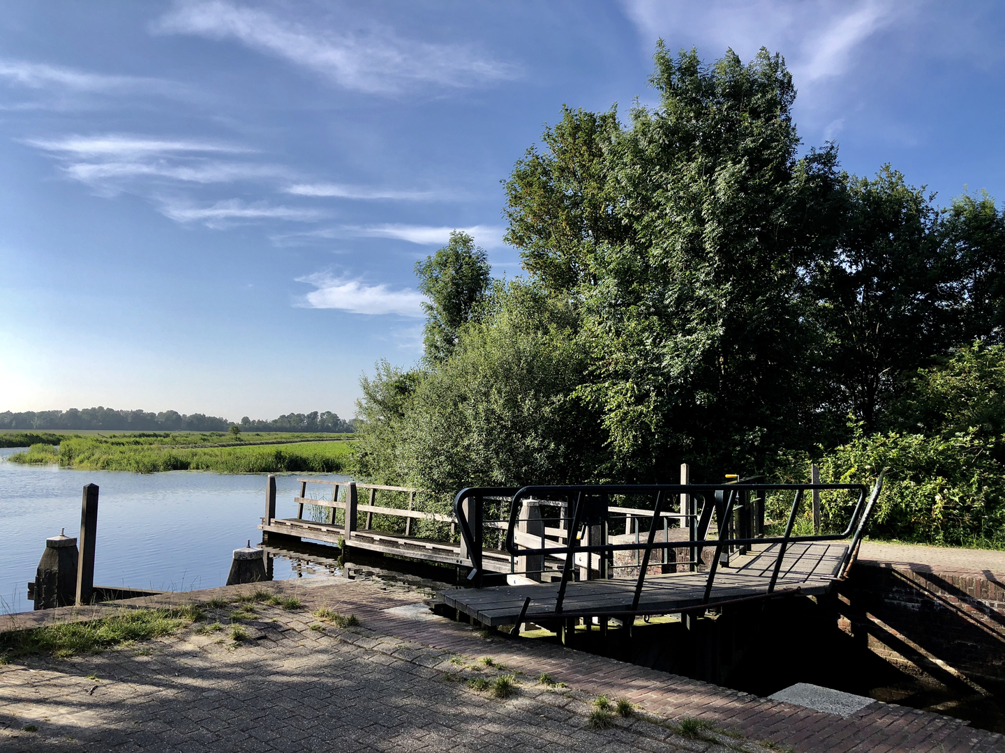
- Bridges and water crossings: Even if the loop doesn’t require major crossings, you’ll encounter small bridges and culverts typical of Dutch water management infrastructure—good spots to pause and watch boat traffic or waterbirds.
Nature and wildlife (what to look out for)
This is a strong route for everyday Dutch wetland and farmland wildlife, especially in spring and early summer: - Waterbirds: mallards, coots, moorhens, grebes, and geese are common along canals and lakeside edges. - Waders in fields and ditches: lapwings and herons are frequent sights; you may also spot egrets depending on season. - Raptors over pasture: kestrels and other birds of prey often hover over open fields hunting small mammals. - Insects and amphibians: in warmer months, expect plenty of dragonflies near still water; frogs are often heard around ditches.
Keep dogs close where livestock may be present, and be mindful that narrow dike paths can have steep, slippery sides into the ditch—especially when grass is wet.
Historical and regional context
Terherne sits in Friesland, a province shaped by centuries of living with water. The flatness you feel on this walk is the result of long-term poldering, drainage, and dike building, turning wet lowlands into workable pasture while maintaining navigable waterways for trade and transport. The dense network of canals and managed water levels you’ll see is part of that ongoing Dutch engineering tradition—quietly “working” in the background through sluices, embankments, and carefully maintained banks.
Practical planning notes (for an easy 5 km / 3.1 mi loop)
- Time on feet: Most hikers will take 1–1.5 hours, longer with stops for photos or birdwatching.
- Footwear: Light hiking shoes are fine; after rain, consider something with grip for grassy dike sections.
- Wind/rain exposure: Bring a windproof layer—there’s little shelter once you leave the village edges.
- Navigation: The area’s many parallel waterways can be confusing; keep HiiKER handy at junctions and near bridges.
- Safety around water: Stay alert on narrow banks, especially with children; edges can be undercut and slippery.
If you want, share your preferred start point (or a coordinate) and I can anchor it to the nearest named place in Terherne and describe the loop turn-by-turn with approximate segment distances.

Surfaces
Unknown
Asphalt
Grass
Wood
Concrete
Comments and Reviews
User comments, reviews and discussions about the De Herne Loop, Netherlands.
5.0
average rating out of 5
2 rating(s)