Download
3D Flyover
Add to list
More
14.7 km
~2 hrs 56 min
0 m
Loop
“Wander ancient dikes under vast Dutch skies, where history, wildlife, and tranquil meadows intertwine.”
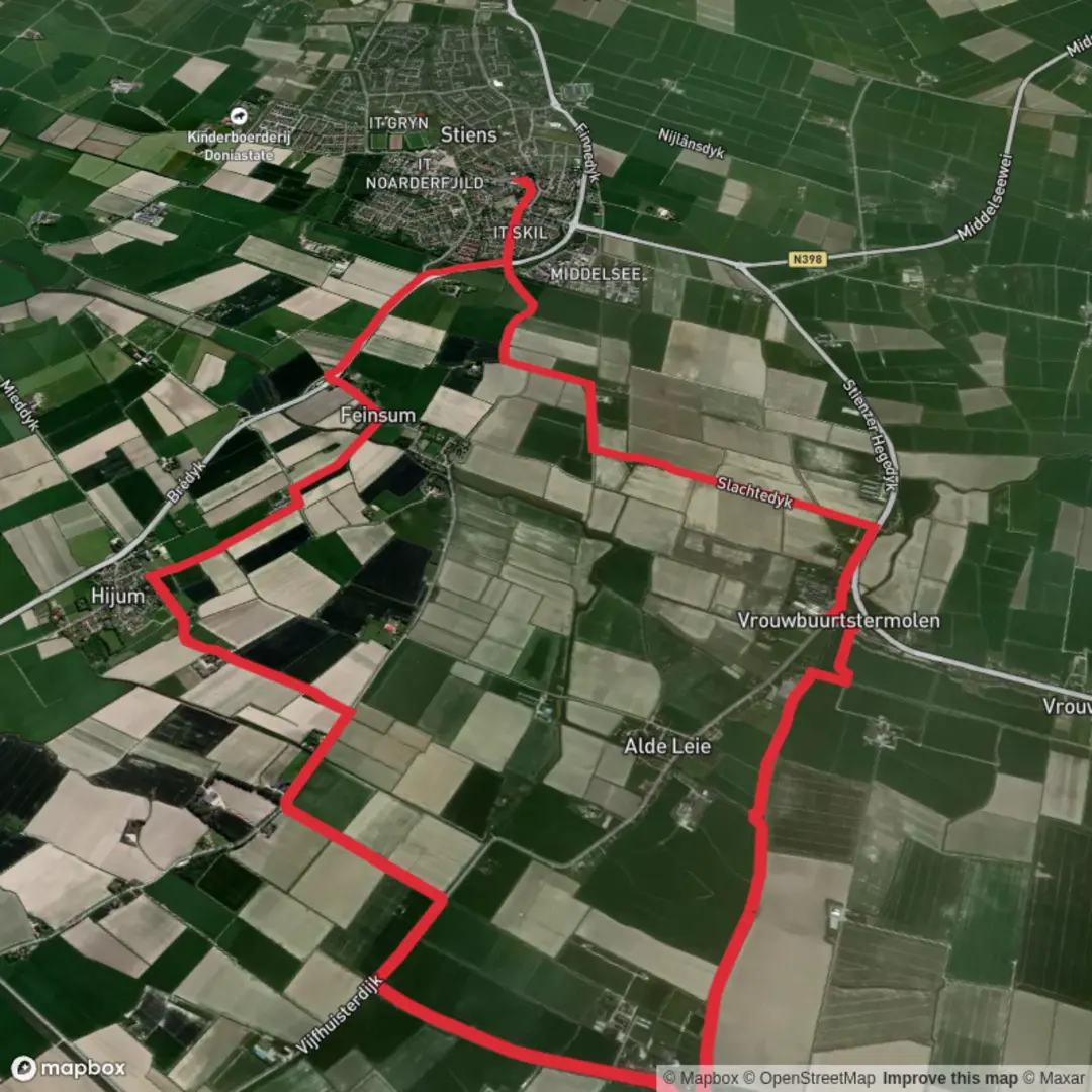
Starting near the charming village of Stiens in Friesland, the Slagdijksterpolder, Monnikebildtdijk and Monnikebilatslaan Loop offers a gentle 15 km (about 9.3 miles) circuit with virtually no elevation gain, making it accessible for hikers of all abilities. The trailhead is conveniently located near the intersection of the N357 and the Monnikebildtdijk, just north of Stiens, which is easily reached by bus from Leeuwarden (the nearest major city with a train station). For those arriving by car, parking is available in Stiens or at small lay-bys along the dike.
Navigating the Route
This loop is best navigated using HiiKER, which provides up-to-date mapping and waypoints for the entire circuit. The route follows a combination of dike paths, rural lanes, and polder tracks, all well-marked and easy to follow. The terrain is flat throughout, with the highest point barely above sea level, so there’s no need for specialized footwear beyond comfortable walking shoes.
Landmarks and Historical Significance
The Monnikebildtdijk is a centuries-old dike, constructed in the early 16th century by monks who reclaimed the land from the sea. Walking along this historic embankment, you’ll see traditional Frisian farmhouses and the characteristic wide, open skies of the Dutch polder landscape. At approximately 4 km (2.5 miles) into the hike, you’ll pass the hamlet of Oudebildtzijl, where the old lock and sluice system are reminders of the region’s ongoing battle with water.
Continuing along the Monnikebilatslaan, the route skirts the edge of the Slagdijksterpolder, a patchwork of meadows and drainage canals. This area is a haven for birdlife, especially in spring and autumn when migratory species such as lapwings, godwits, and oystercatchers flock to the wetlands. Keep an eye out for grazing sheep and the occasional stork nesting atop farm buildings.
Nature and Wildlife
The polder landscape is defined by its tranquility and biodiversity. Reed beds and wildflowers line the ditches, attracting butterflies and dragonflies in summer. The open fields are home to hares and, if you’re lucky, you might spot a fox in the early morning or late evening. The absence of significant elevation means the wind can be a constant companion, so bring a windproof layer even on mild days.
Facilities and Practical Tips
There are limited facilities directly on the route, but the villages of Stiens and Oudebildtzijl offer cafés, small shops, and public toilets. Water refill points are scarce, so carry enough for the full loop. The trail is exposed, with little shade, so sun protection is essential on clear days. The dike paths can be muddy after rain, so check the weather and trail conditions on HiiKER before setting out.
Public transport users can catch a bus from Leeuwarden to Stiens, with services running regularly throughout the day. From the Stiens bus stop, it’s a short walk to the start of the loop. For drivers, Stiens is about 10 km (6 miles) north of Leeuwarden, with easy access via the N357.
This loop offers a peaceful immersion into Friesland’s unique landscape, blending history, wildlife, and the enduring relationship between the Dutch and their reclaimed land.

Surfaces
Unknown
Asphalt
Concrete
Wood
Comments and Reviews
User comments, reviews and discussions about the Slagdijksterpolder, Monnikebildtdijk and Monnikebilatslaan Loop, Netherlands.
average rating out of 5
0 rating(s)