Download
3D Flyover
Add to list
More
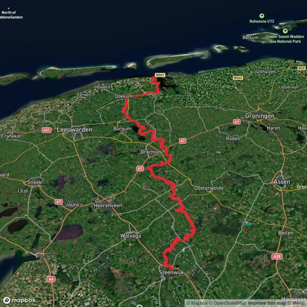
149.9 km
~5 days
93 m
Multi-Day
“A flat, wind-swept ribbon of canals and dikes, from peatland hush to Wadden sky—best savoured steadily.”
This is a long, low-relief northbound traverse across the Dutch lowlands, linking the canal-and-peat landscapes around Steenwijk with the big-sky coastal edge of the Wadden Sea at Lauwersoog. Over roughly 150 km (93 mi) you’ll only accumulate about 100 m (330 ft) of total ascent, so the challenge is less about climbing and more about distance, wind exposure, and surface variety (paved farm lanes, compacted dike tops, towpaths, and occasional softer verge).
Getting to the start (Steenwijk area)
By train (public transport):
Steenwijk is served by intercity/regional rail connections in the Netherlands. From Steenwijk Station you can walk or take a short local bus/taxi to the edge of town where rural lanes like Kerkweg typically begin. If you’re planning a multi-day hike, arriving by train is convenient because you can finish at Lauwersoog and continue onward by bus without needing to retrieve a car.
By car:
Steenwijk is easily reached via the A32 corridor. Park near Steenwijk Station or in central public parking areas (look for long-stay options if you’ll be away multiple days). If you prefer to avoid leaving a car, consider parking at the finish area in Lauwersoog and using buses/trains to reach Steenwijk first.
Route character and what the terrain feels like
Expect a flat, engineered landscape: straight drainage lines, canals, and dikes that keep your feet moving efficiently. The “ups and downs” are mostly micro-relief—dike crests, bridge ramps, and occasional overpasses—rather than hills. Because the route uses rural roads like Kerkweg and Groeneweg and a towpath-style segment like Jaachpaad (a traditional towing path), you’ll often be walking beside water.
- Surfaces: mostly firm (asphalt, brick, compacted gravel), with short stretches where grass verges can be wet or uneven after rain.
- Exposure: very open in the northern provinces—wind can be the biggest energy drain, especially on dikes and across reclaimed land.
- Wayfinding: generally straightforward due to linear canals and roads, but intersections of farm tracks can be repetitive. Load the route in HiiKER and keep an eye on small turns where a towpath switches sides of a canal or where a “Groeneweg/Kerkweg” name repeats in different municipalities.
Suggested staging (distance planning)
At 150 km (93 mi), most hikers break this into 3–5 days depending on pace and daylight.
- 3 days: ~50 km/day (31 mi/day) — long days, best with early starts and strong legs.
- 4 days: ~37–38 km/day (23–24 mi/day) — a solid, comfortable thru-hike rhythm on flat ground.
- 5 days: ~30 km/day (19 mi/day) — easiest on joints; more time for detours into villages and nature areas.
Because elevation gain is only about 100 m (330 ft) total, your pacing will be limited more by foot comfort (hard surfaces) and weather than by climbing fitness.
Landscapes, landmarks, and the feel of the regions you cross
Starting near Steenwijk, you’re on the doorstep of the northern Dutch mosaic of peatlands, canals, and meadow-polder. The area is shaped by centuries of water management—ditches, pumping, and dikes that turned wetlands into productive farmland and settlements.
As you progress north, the route increasingly reflects the Netherlands’ long relationship with the sea: - Canals and towpaths (Jaachpaad): These corridors are historically significant—before engines, boats were pulled by people or horses along towpaths. Today they’re quiet, linear walking lines with constant water views and frequent birdlife. - Farm-lane Netherlands (Kerkweg/Groeneweg): “Kerkweg” often indicates an old “church road,” historically used to reach the local church from outlying farms. “Groeneweg” commonly denotes a “green road,” often a rural lane bordered by trees, hedges, or grassy margins—pleasant walking, but sometimes narrow with local traffic. - Approaching Lauwersoog: The landscape becomes more coastal and expansive. Lauwersoog sits by the Lauwersmeer area and the edge of the Wadden Sea region, known for huge skies, strong winds, and internationally important bird habitat.
Nature and wildlife to watch for
This is prime lowland bird country. Even outside designated reserves, canals, reed edges, and wet meadows attract wildlife.
- Waterbirds: ducks, geese, swans, coots, grebes; in reedier stretches you may see herons and egrets.
- Raptors: kestrels and buzzards are common over open fields; harriers are possible near wetter areas.
- Meadow species: lapwings and other waders may appear in spring and early summer in managed grasslands.
- At the northern end (near Lauwersmeer/Wadden influence): expect higher bird density and more “coastal” feel—migration seasons can be spectacular.
Wildlife etiquette matters here: stay on the path edges, avoid flushing birds from reed margins, and keep noise low in early morning/evening when animals are most active.
Practical planning: water, food, and resupply
You’ll pass through villages often enough that you can plan daily resupply, but opening hours can be limited in smaller places and on Sundays.
- Water:

Surfaces
Unknown
Asphalt
Concrete
Sand
Grass
Gravel
Dirt
Unpaved
Ground
Paved
Cobblestone
Wood
Comments and Reviews
User comments, reviews and discussions about the Steenwijk to Lauwersoog via Kerkweg, Groeneweg and Jaachpaad, Netherlands.
average rating out of 5
0 rating(s)