Download
3D Flyover
Add to list
More
87.4 km
~3 days
7 m
Multi-Day
“A wind-swept, arrow-straight lowland loop through pines, heaths and quiet fens—endurance required.”
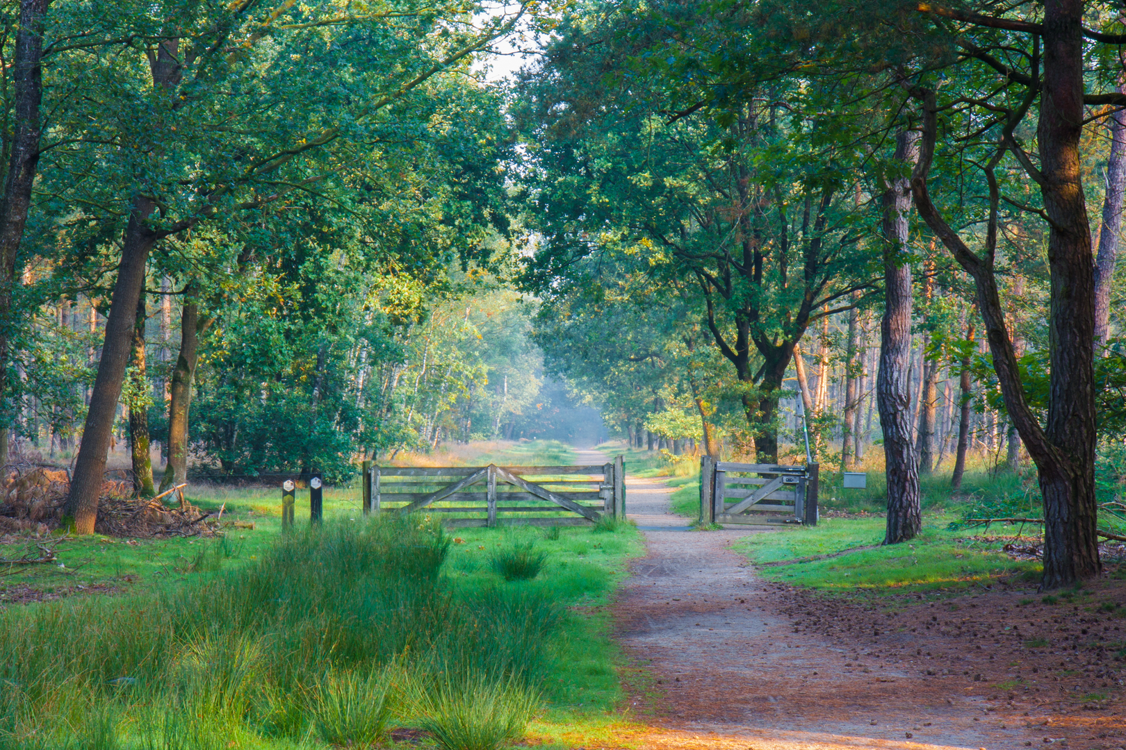
You’re looking at a long, very flat lowland loop of roughly 87 km / 54 miles with essentially 0 m / 0 ft of climbing—the kind of route where the “difficulty” comes less from hills and more from time on feet, wind exposure, and long stretches of straight farm and forest tracks. The place-names in the route title point to the Maarheeze–Weert–Someren(-Eind) area on the North Brabant/Limburg edge, skirting big nature blocks like the Weerter- en Budelerbergen & Ringselven (Natura 2000) landscape of heath, drift sands, and fens. (natura2000.nl)
A practical “hike head” landmark to plan around is the railway crossing on Maarheezerhuttendijk by Weerterbos (Weert)—this is a commonly referenced access point into the area and works well as a start/finish anchor for a loop. (eiland-van-weert.nhgl.nl)
Getting to the start (car + public transport)
By car - Aim for Maarheezerhuttendijk, Weert (near Weerterbos) and park only where permitted (small pull-offs and forest-edge parking areas exist, but they can be limited). This is a rural road with traffic; be deliberate about where you leave a vehicle. (waze.com)
By public transport - The most convenient rail hub is typically Maarheeze station (on the Eindhoven–Weert line). From there, you can connect by local bus/taxi or walk/cycle to the Maarheezerhuttendijk/Weerterbos edge depending on your exact start point and tolerance for extra distance. - If you’d rather start closer to village services (shops/cafés), Maarheeze village is a sensible staging point; notable central landmarks include the Heilige Gertrudis church (built 1909–1910). (maarheeze.nu)
For navigation, load the full loop into HiiKER and keep an offline map available—this area has many intersecting forestry tracks and long dike roads where it’s easy to follow the “right-looking” line for several kilometers before realizing you’re parallel to your intended route.
What the walking is like (surface, pacing, and “easy” reality)
Even with an “Easy” rating, 87 km / 54 miles is a serious undertaking unless you split it into 2 days (e.g., ~43–45 km / 27–28 miles per day) or plan a very long single-day push.
Expect: - Hard-packed farm lanes, dike-top roads, and forestry tracks (often straight, sometimes sandy in the heath/drift-sand sections). - Very little elevation change, so your pace can be steady—but repetitive surfaces can fatigue feet and hips. - Wind exposure across open agricultural stretches and along dikes; in the Netherlands, wind can be the main “climb.”
Footwear: choose something comfortable for long distance on firm surfaces; if conditions are dry, sandy patches can work grit into shoes—gaiters can help if you’re sensitive to that.
Route flow and key sections (with approximate distances)
Because this is a loop built around multiple named roads/areas, it helps to think of it in thirds:
1) Forest-edge approach and track maze (first ~20–30 km / 12–19 miles) - Starting near Maarheezerhuttendijk/Weerterbos, you’ll quickly be in a landscape of pine and mixed woodland with frequent junctions. - The navigation challenge here isn’t technical terrain—it’s junction density. Use HiiKER to confirm each turn, especially where wide forestry roads split into equally wide options.
2) Heath, drift sands, and fen country (middle ~25–35 km / 16–22 miles) - This is the most “signature” nature portion if your loop touches the Weerter- en Budelerbergen & Ringselven Natura 2000 area: a mosaic of dry heaths, wetter heaths, drift-sand features, and vens (fens/ponds). (eunis.eea.europa.eu) - Wildlife highlights to watch

Surfaces
Unknown
Asphalt
Gravel
Concrete
Sand
Dirt
Ground
Paved
Comments and Reviews
User comments, reviews and discussions about the Maarheezerhuttendijk, Lummesweg and Nieuwendijk Loop, Netherlands.
average rating out of 5
0 rating(s)