Download
3D Flyover
Add to list
More
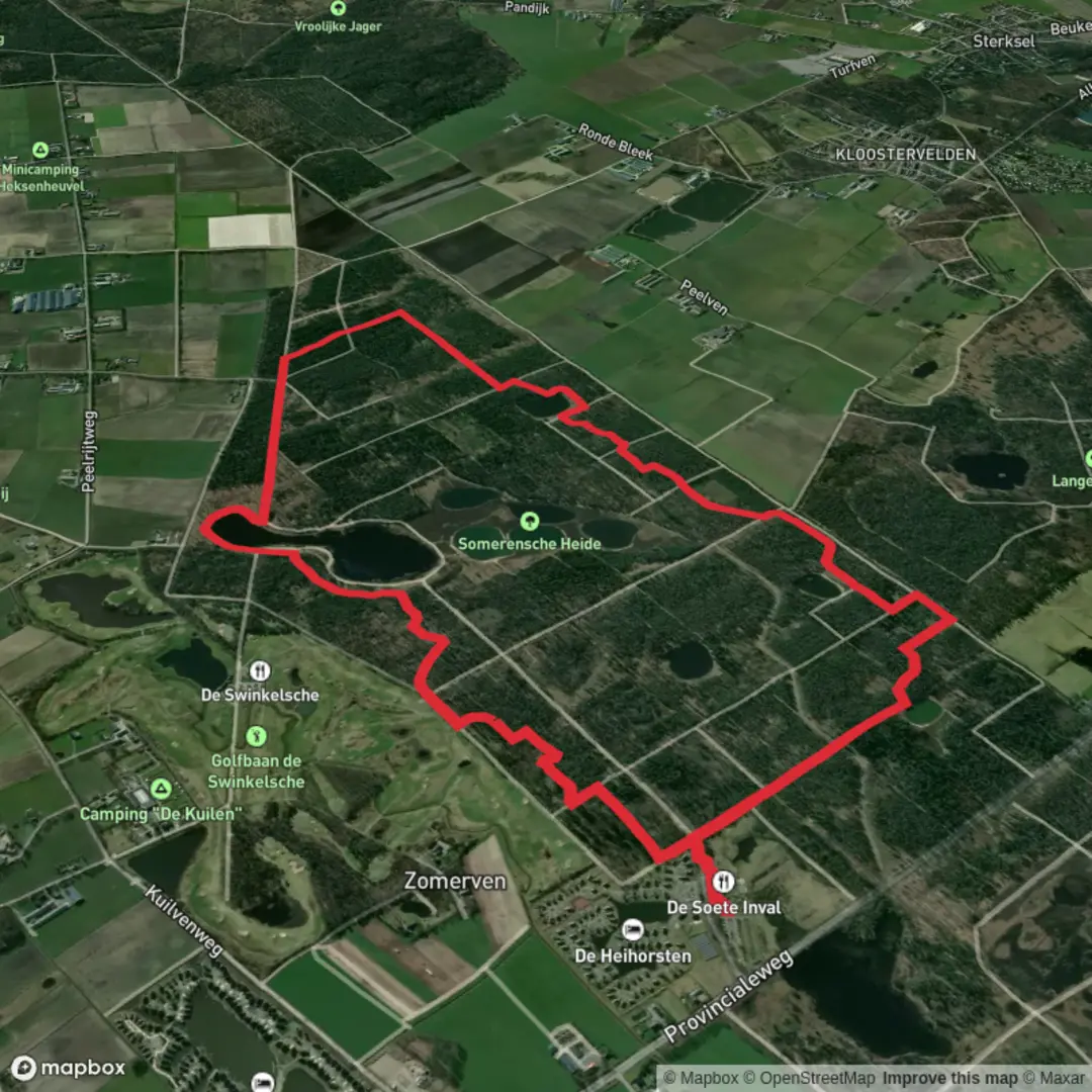
7.6 km
~1 hrs 31 min
0 m
Loop
“Wander through shimmering fens and whispering pines on a loop alive with history and vibrant wildlife.”
The Keelven Route is a scenic loop trail of approximately 7.6 kilometers (4.7 miles) with minimal elevation gain, making it accessible for hikers of all skill levels. The trail begins at Natuurpoort Vennenhorst, located at Bosrandweg 6, 5711 RJ Someren, North Brabant, Netherlands. This starting point offers ample parking and is conveniently accessible by public transport, with a bus stop nearby. (landvandepeel.nl)
Trail Overview
The route meanders through the Somerense Heide nature reserve, encompassing diverse landscapes such as forests, heathlands, and fens. A highlight of the trail is the Keelven lake, the largest of several ponds in the area. These bodies of water were formed naturally after the last ice age due to sand blowing and are sustained by an impermeable layer in the subsoil. (routeyou.com)
Historical Significance
Originally, the Somerense Heide consisted of expansive heath fields with marshy areas and ponds. In the 1930s, the land was transformed into a production forest primarily planted with Scots Pine, valued for its use in Dutch coal mines. In 1998, a nature development project aimed to restore the area to its original state, resulting in the diverse ecosystem present today. (routeyou.com)
Flora and Fauna
The Keelven area is home to a variety of plant species, including 75 types of moss. Notably, the Ruigen Zandhaarmos is a pioneer plant found in sandy spots and along forest paths. The region also supports diverse wildlife, including dragonflies, which play a crucial role in controlling fly and mosquito populations. Bird enthusiasts may spot various species, as the area is known for its rich avian life. (routeyou.com)
Trail Navigation
The trail is well-marked with signs for the Keelvenroute, ensuring easy navigation. For detailed maps and additional information, hikers can refer to HiiKER, a comprehensive resource for trail navigation.
Getting There
For those traveling by car, Natuurpoort Vennenhorst is situated along the Provincialeweg Someren-Heeze, with parking available at Bosrandweg 6, 5711 RJ Someren. Public transport users can utilize the nearby bus stop for convenient access to the trailhead. (landvandepeel.nl)
Additional Amenities
At the starting point, hikers can find Forest Café De Soete Inval, offering a place to relax before or after the hike. A free brochure detailing the Keelven walking route, including a map and descriptions of points of interest, is available at the Tourist Information Point, De Meer 21a, Someren. (landvandepeel.nl)
Trail Conditions
The Keelven Route is predominantly flat, with an elevation gain of approximately 78 meters (255 feet), making it suitable for hikers seeking an easy and enjoyable walk. The trail is accessible year-round, with the best times to visit being from July through November. (alltrails.com)
Wildlife and Conservation
The area is managed to balance nature conservation with recreational use. Grazing by ponies and Highland cattle helps maintain the heathland by controlling the spread of certain grass species like Pijpenstrootje. Visitors are encouraged to observe wildlife from a safe distance and adhere to trail guidelines to preserve the natural environment. (routeyou.com)
Preparation Tips
Hikers are advised to wear comfortable walking shoes suitable for forest and heathland terrain. Bringing water and snacks is recommended, as well as checking weather conditions before setting out. Dogs are welcome on the trail but must be kept on a leash. (alltrails.com)
Embarking on the Keelven Route offers a delightful experience through a rich tapestry of natural landscapes, historical significance, and diverse wildlife, making it a must-visit for nature enthusiasts and casual hikers alike.

Surfaces
Unknown
Ground
Unpaved
Asphalt
Gravel
Sand
Paved
Dirt
Comments and Reviews
User comments, reviews and discussions about the Keelven Route, Netherlands.
average rating out of 5
0 rating(s)