Download
3D Flyover
Add to list
More
12.1 km
~2 hrs 26 min
7 m
Point-to-Point
“Step from Amersfoort’s rail heritage into whispering pines and glowing drift-sands—flat, yet surprisingly demanding.”
From the start you’ll be on flat ground almost the entire way (around 12 km / 7.5 mi, with roughly 0 m / 0 ft of climbing), but don’t underestimate how tiring the loose dune sand can be—your effort level will feel higher than the elevation profile suggests.
Getting to the start (and where it actually is)
The most practical “trailhead” for this walk is Amersfoort Centraal Station (Stationsplein, 3818 LE Amersfoort, Netherlands), because the route is essentially a station-to-station style walk that quickly leaves the city and heads into the Soesterduinen dune complex. This matches the well-known Lange Duinen route network that links Amersfoort with the Korte and Lange Duinen. (ns.nl)
- By train (public transport): Arrive at Amersfoort Centraal; you can start walking straight from the station forecourt.
- By car: Park at/near Amersfoort Centraal (paid parking is common around the station area). Starting at the station also makes it easy to navigate the first urban stretch and finish with onward connections.
If your “’t Zwaantje” start refers to a local point-of-interest name rather than the station, it’s worth double-checking the exact pin in HiiKER before you go—there are multiple businesses in the Netherlands called “’t Zwaantje,” and at least one prominent one is far from Amersfoort. (t-zwaantje.nl)
What the route feels like underfoot
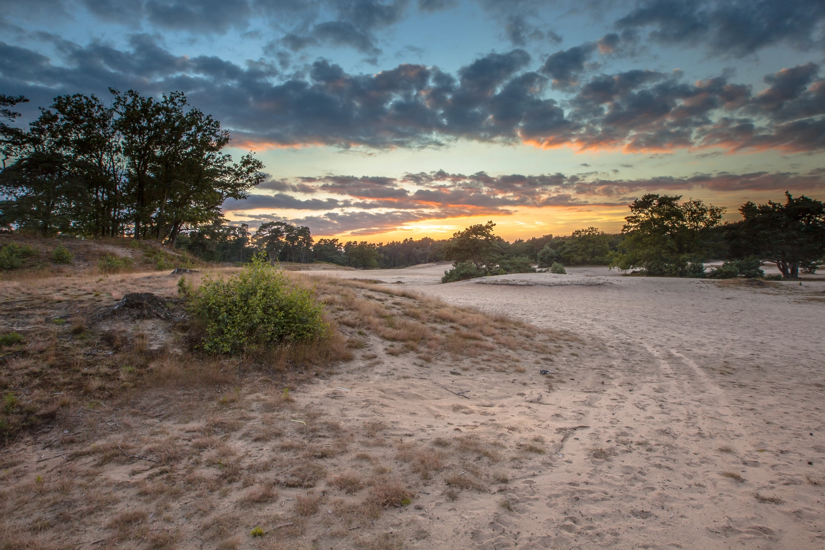
Expect a mix of surfaces: - Urban edges and cycle paths leaving Amersfoort - Forest tracks on the Utrechtse Heuvelrug - Open drift-sand sections in the Korte Duinen and Lange Duinen, where the sand can be deep, dry, and energy-sapping
Even though some route listings mention modest ups and downs on longer variants, the 12 km-style line through this area is generally perceived as easy and mostly flat—your main “difficulty” is sand and occasional narrow paths. (ns.nl)
Key middle section: Wagenwerkplaats → woodland → Soesterduinen sands
Not far from the station you pass the Wagenwerkplaats area—an industrial railway heritage site right by Amersfoort Centraal. Historically, this complex was used for rail work (maintenance/revision of rolling stock) for much of the 20th century and it closed in 2000; parts later gained protected monument status and were repurposed. It’s a distinctive early landmark because you’re walking past a piece of Amersfoort’s rail-and-industry story before the landscape turns green. (wagenwerkplaats.nl)
After the built-up fringe, the route settles into mixed woodland. You’ll notice the ground becoming sandier and lighter in color as you approach the dune fields—this is your cue that the character of the walk is about to change.
Then the headline terrain arrives: the Korte Duinen and Lange Duinen—rare inland drift-sand (stuifzand) landscapes. They’re notable enough that the province of Utrecht designated them an aardkundig monument (geological monument) in 1997, reflecting how unusual it is to have active, open sand movement on this scale away from the coast. (vvvamersfoort.nl)
Nature, wildlife, and what to look out for
This area is a classic mosaic of pine and mixed forest, sandy clearings, and open dune bowls: - In the open sand, look for wind-shaped ripples and sparse pioneer vegetation clinging to the edges. - In the forest margins, you’ll often see bird activity (songbirds and woodland species) and plenty of tracks in softer sand. - The biggest “hazard” is usually exposure: on sunny or windy days the open dunes can feel surprisingly intense—bring water, and consider eye protection if it’s very dry and breezy.
Because the dunes are actively shifting in places, paths can be less obvious across the open sand. Use HiiKER to confirm your line through the dune sections, especially if footprints scatter in multiple directions.
Planning notes (so the “easy” stays easy)
- Footwear: Trail shoes with decent grip are ideal; deep sand

Surfaces
Unknown
Asphalt
Sand
Concrete
Paved
Grass
Gravel
Ground
Dirt
Comments and Reviews
User comments, reviews and discussions about the t Zwaantje to Amersfoort Centraal via Lange Duinen and Korte Duinen, Netherlands.
average rating out of 5
0 rating(s)