Download
3D Flyover
Add to list
More
14.8 km
~2 hrs 57 min
6 m
Point-to-Point
“From Sneek’s canal charm to Oude Schouw’s bridge, follow big skies, boats, and wind-swept reedbeds.”
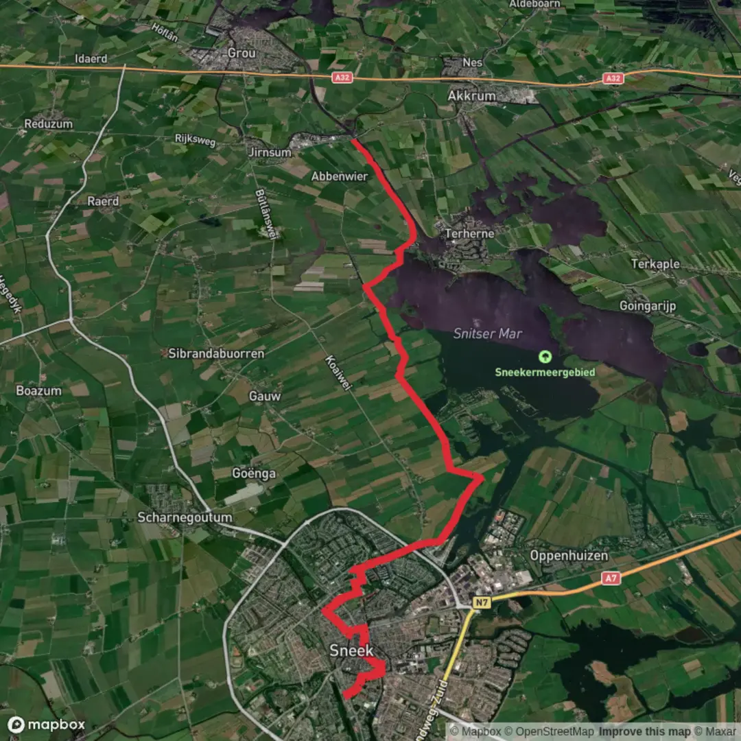
This is a flat, waterside-to-canal walk through the heart of Friesland’s lake district: historic Sneek at one end, and the Oude Schouw bridge complex on the Prinses Margriet Canal at the other. Expect a mix of town edges, dike-top paths, quiet lanes, and long open views across reedbeds, grazing meadows, and broad water—more “big sky and boats” than forest. At ~15 km (9.3 mi) with ~0 m / ~0 ft of climbing, it suits most walkers, but wind and exposed sections can make it feel longer than the numbers suggest.
Start location (nearest landmark/address): Sneek railway station area (Stationsplein, Sneek, Friesland) is the most practical trailhead for both public transport and parking access.
Finish location (nearest landmark/address): Aldskou / Oude Schouw Bridge area, Oudeschouw, 8491 MP near Akkrum/Jirnsum, spanning the Prinses Margriet Canal. (waterlandvanfriesland.nl)
Getting to the start (public transport + car)
- By train: Sneek has a main station with regional services; it’s an easy walk from the station into the canal-lined center and out toward the lake district. (en.wikipedia.org)
- By car: Sneek is well connected by the A7 and N354; use city parking near the station/center if you want a straightforward start and an easy end-of-day pickup plan. (en.wikipedia.org)
- Return logistics: Oude Schouw is a bridge location rather than a village center, so plan your return in advance using HiiKER (and consider a taxi pickup point near Akkrum/Jirnsum if you’re not doing a point-to-point car shuttle).
What the walk feels like (surface, exposure, and pacing)
From Sneek you’ll quickly trade brick streets and canals for the watery fringe of the Snitser Mar (Sneekermeer). Underfoot is typically firm: paved cycle paths, compacted gravel, and short grassy dike sections. After rain, the grassy edges and field-side tracks can be slick, and in shoulder seasons you may find muddy pinch points where farm access meets the path.
Because the landscape is low and open, wind is the main “difficulty multiplier.” A calm day makes this feel like a gentle ramble; a stiff headwind across the lake margins can slow your pace noticeably.
Route breakdown with approximate distances
0.0–2.0 km (0.0–1.2 mi): Sneek’s canals and the city edge
Starting near the station, you’ll skirt waterways that explain Sneek’s long relationship with trade and transport. If you detour slightly, the Waterpoort (water gate) is the signature landmark—originally tied to the city’s defensive works and later reshaped into the iconic structure seen today. (en.wikipedia.org)
Even if you don’t detour, you’ll still feel the “water-city” layout: bridges, quays, and boat traffic channels guiding you outward.
2.0–7.0 km (1.2–4.3 mi): Along the Snitser Mar (Sneekermeer) margins
As you approach the lake district, views open up across the Snitser Mar—officially also called the Sneekermeer—lying between Sneek and villages such as Terherne. (sneek.nl)
This area is part of a Natura 2000 protected landscape, shaped over centuries by peat extraction and land reclamation, and valued today for birdlife and wet grassland ecology. (ensie.nl)
What to look for here:
- Birdlife: The protected “Sneekermeergebied” is designated under the Birds Directive; depending on season you may see (or hear) reedbed and open-water species, plus wintering geese. (eunis.eea.europa.eu)
- **Reed edges and wet

Surfaces
Unknown
Asphalt
Concrete
Paved
Wood
Comments and Reviews
User comments, reviews and discussions about the Sneek to Oude Schouw via Snitser Mar, Netherlands.
average rating out of 5
0 rating(s)