Download
3D Flyover
Add to list
More
5.6 km
~1 hrs 7 min
0 m
Loop
“Wander Pettemerduinen’s sandy ridges to Derde Korfwater’s reed-fringed waters, with occasional soft-sand surprises.”
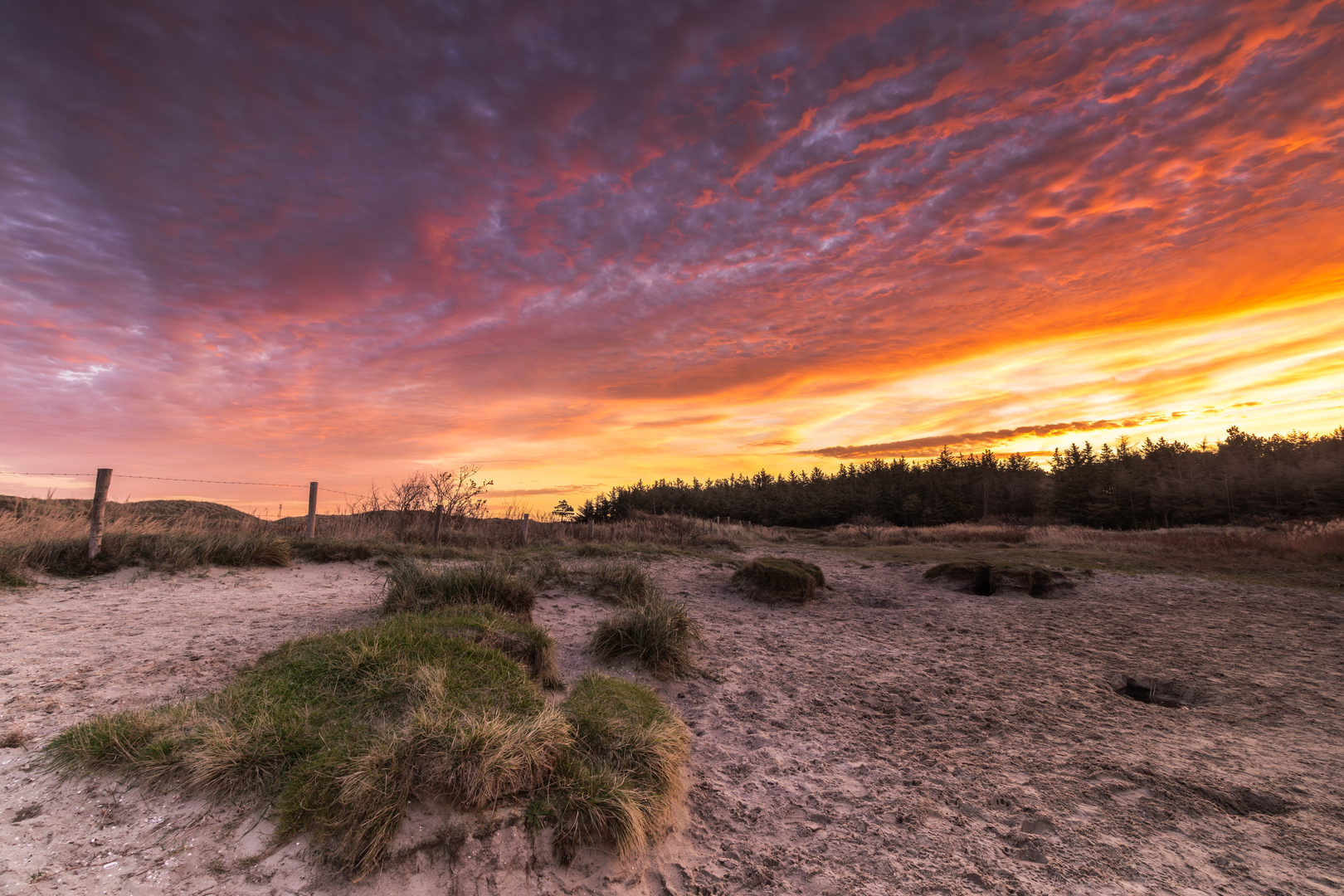
This easy, mostly level loop of about 6 km (3.7 mi) winds through the Pettemerduinen dune belt and around the Derde Korfwater area, giving you a classic North Holland mix of sandy dune ridges, sheltered dune slacks, and open water edges. With roughly 0 m (0 ft) of elevation gain overall, it’s a great choice for a relaxed half-day outing—but expect soft sand in places, which can make short sections feel more tiring than the stats suggest.
Getting to the start (car + public transport)
Because your start point is listed only as “near” (no coordinates provided), the most practical way to plan is to aim for the main access points to the Pettemerduinen dunes near Petten (North Holland, Netherlands).
- By car: Navigate to Petten village and look for signed dune/beach access near the Hondsbossche Zeewering (the prominent sea defense dike). Common parking is typically around central Petten and the beach/dune access roads; from there you can walk into the dune network and pick up the loop.
- By public transport: The nearest larger rail hubs are typically Alkmaar or Schagen, with onward bus connections toward Petten. Plan your final stop for Petten, Centrum (or the closest Petten bus stop shown in your route plan), then walk to the dune entrance.
If you share the lon/lat for the exact trailhead, I can convert it to the nearest known address/landmark precisely and tailor the approach walk.
What the route feels like underfoot
For the first 1–2 km (0.6–1.2 mi) you’ll usually be on a mix of firm sandy paths and compacted dune tracks, often bordered by dune grasses and low shrubs. Even on an “easy” loop, the dunes can hide short patches of loose, energy-sapping sand—especially on exposed crests or where wind has drifted sand across the path.
As you arc toward the Derde Korfwater section (roughly the middle third of the loop), the terrain tends to feel more open and airy, with water and reedbeds nearby. The final 2 km (1.2 mi) typically returns you through dune vegetation again, with occasional wider tracks that make for straightforward walking.
Landmarks, nature, and wildlife to look for
Dune landscapes (Pettemerduinen):
These dunes are part of a dynamic coastal system shaped by wind and sea. You’ll see classic dune plants—marram grass stabilizing sand, plus hardy shrubs and seasonal wildflowers in more sheltered pockets. In calmer hollows (dune slacks), the vegetation can shift quickly to greener, moisture-loving species.
Derde Korfwater (water + reed edges):
This portion is often the most “wildlife-rich” feeling section. Expect:
- Waterfowl (ducks, geese, coots) and, depending on season, migrating birds using the wetlands as a stopover.
- Reedbed birds—you may hear them more than you see them.
- Insects in warmer months; bring repellent if you’re sensitive, especially on still days near water.
Best moments for views:
Even without big elevation, dune crests can give brief, satisfying sightlines across the dune belt and toward the coastal defenses. Wind exposure can be noticeable here—pack a light shell even on mild days.
Navigation and wayfinding
The dune trail network can have many intersecting tracks that look similar. Before you start, download the route in HiiKER for offline use and keep an eye on: - Frequent junctions where a wider track splits into multiple sandy options. - Unmarked side paths that lead to viewpoints or dead-end into soft sand.
A good habit is to confirm your direction at each major junction rather than “following the most worn path,” since that can drift away from the loop.
Practical planning: timing, footwear, and conditions
- Time on trail: Most hikers will take about 1.5–2 hours for 6 km (3.7 mi) at an easy pace, longer if you stop for birdwatching or if sand is soft.
- Footwear: Trail shoes are fine, but choose something that handles sand well. If it has rained, some low areas near water can feel damp or slightly muddy.
- Wind and sun: Coastal dunes can be windy and exposed. Sunglasses and a wind layer help; in summer, sun protection matters even on cooler days.
- Water/food: Short route, but bring at least 500 ml–1 L of water, more on warm days or if you plan to linger.
Things to watch out for
- Soft sand sections: Short but can be tiring; slow your pace and keep steps shorter.
- Slippery edges near water: Banks can be undercut or slick, especially after rain.
- Seasonal closures or restricted areas: Dune and wetland habitats sometimes have protected zones. Stick to established paths and any posted signage.
- Ticks: Dune grass and scrub can harbor ticks in warmer months—long socks and a post-hike check are smart.
Historical significance of the area
This stretch of coast is closely tied to the Netherlands’ long history of coastal defense and land management. Near Petten, the Hondsbossche Zeewering is a major sea defense structure—part of the broader system of dikes and engineered coastline that has protected inland communities from storm

Surfaces
Unknown
Asphalt
Gravel
Sand
Paved
Comments and Reviews
User comments, reviews and discussions about the Pettemerduinen and Derde korfwater Circle, Netherlands.
average rating out of 5
0 rating(s)