Download
3D Flyover
Add to list
More
24.7 km
~4 hrs 58 min
14 m
Point-to-Point
“A long, level Maasduinen ramble from Siebengewald to Op den Hamer—pines, heath, sandy ridges, and shimmering Reindersmeer.”
This is a mostly level, point-to-point day hike of about 25 km (15.5 mi) with roughly 0 m (0 ft) of sustained climbing—more of a long, steady walk through heath, pine forest, and dune-like sand ridges than a “hill” hike. Expect a mix of compact forest paths, sandy stretches that can feel slower underfoot, and well-managed nature reserve tracks around open water.
Start location (nearest landmark/address): the route begins by Siebengewald village center, near Siebengewald railway stop area and the main village streets around Kerkstraat/Stationsweg (Siebengewald, Limburg, Netherlands)—a practical meet-up point with services nearby.
Finish location (nearest landmark): Op den Hamer is a small settlement area near Wellerlooi / the Maasduinen edge, commonly associated with the recreation/holiday-park zone and rural lanes around Op den Hamer (near Wellerlooi, Limburg).
Getting to the start (public transport and car)
- Public transport: The easiest approach is to travel by train toward Siebengewald (regional rail connections via Nijmegen/Venlo corridors are typical for this part of Limburg). From the station area, it’s a short walk to the village edge where paths enter the Maasduinen landscape. Check same-day rail/bus timing before you commit, because rural services can be less frequent outside commuting hours.
- By car: Drive to Siebengewald and park near the village center or designated parking areas on the edge of town (look for signed parking near trail access points into Nationaal Park De Maasduinen). If you’re doing this as a point-to-point, plan a shuttle or use public transport for one end.
You’ll want HiiKER loaded before you set off—this area has many intersecting forest tracks and reserve paths that can look similar, especially where sandy lanes braid through pines.
From Siebengewald, the first 4–6 km (2.5–3.7 mi) ease you out of farmland edges and into the Maasduinen terrain. “Duinen” here aren’t coastal dunes; they’re inland sand ridges formed by wind-blown sands along the Maas (Meuse) valley over long periods. Underfoot, you’ll notice the change quickly: firmer paths alternate with soft sand where your pace may drop. Even with negligible elevation gain, the sand can make the day feel longer than the profile suggests.
As you settle into the park, the landscape becomes a classic mosaic of: - Pine and mixed woodland (straight trunks, open understory in places) - Heath patches (low shrubs; late summer can bring purple heather blooms) - Open sandy clearings that feel surprisingly “dune-like” inland
Wildlife is often subtle but rewarding. In quieter stretches you may spot roe deer, and you’ll commonly hear woodland birds. Around heath and open edges, keep an eye out for raptors riding thermals. In warmer months, the sandy, sunny margins can be good habitat for reptiles—watch where you place hands if you stop on warm logs or sandy banks.
Maasduinen forest and sand ridges (navigation and footing)
Between roughly 6–14 km (3.7–8.7 mi) you’re in the heart of the Maasduinen feel: long, straight forestry lines intersecting with curving nature paths. The main things to plan for here: - Footing: sand can be energy-sapping; trail shoes with decent grip help, and gaiters can be nice if you dislike sand in shoes. - Wayfinding: intersections can be frequent and unsigned in places; rely on HiiKER rather than assuming the “main” track is correct. - Exposure: even in forest, some sandy corridors are open and can feel hot and bright—carry more water than you’d expect for a flat hike.
You’ll also pass through areas shaped by centuries of human land use. The Maas valley region has long been a corridor for settlement, agriculture, and trade, and the current patchwork of forest, heath, and managed tracks reflects changing land management—wood production, grazing/heath maintenance, and modern conservation. The “inland dune” character itself is tied to historical river dynamics and wind action on sandy deposits.
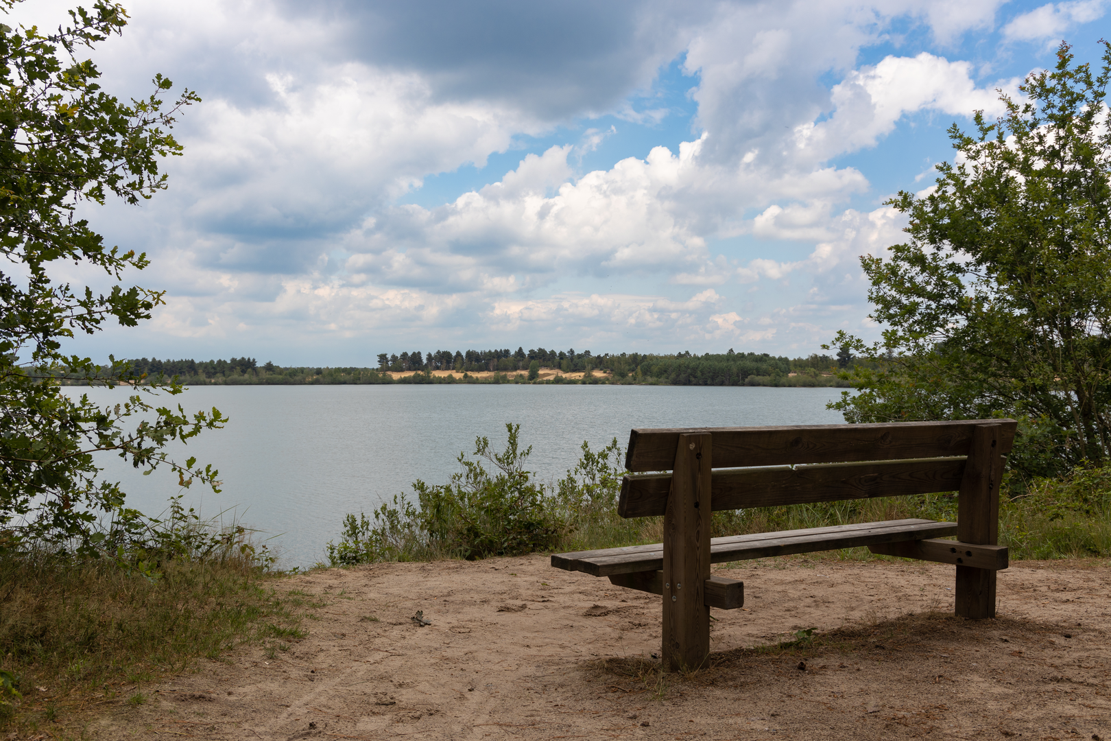
Reindersmeer and lakeside nature (landmarks and hazards)
Around 14–20 km (8.7–12.4 mi) you reach the highlight: Reindersmeer, a striking lake within the Maasduinen system. The water and surrounding reedbeds/woodland edges create a different atmosphere—cooler, more open, and often busier with birdlife.
What to look out for here: - Bird activity: waterfowl and reedbed birds are common; bring binoculars if you enjoy wildlife. - Narrower paths and shared use: some lakeside sections can be tighter, and you may meet cyclists on broader tracks—stay alert at bends. - Wet edges: after rain, low spots can be muddy; stick to established paths to protect fragile shoreline vegetation.
Reindersmeer and nearby waters in this region are also tied to the area’s more recent land history—parts of the Maasduinen landscape include former extraction sites and reshaped terrain that have been reclaimed by nature and conservation management, leaving today’s mix of clear water, sandy banks, and regenerating woodland.
From the lake area, the route continues through quieter forest lanes and reserve tracks toward Op den Hamer for the final 5–7 km (3.1–4.3 mi). This last portion tends to feel straightforward and steady,

Surfaces
Unknown
Unpaved
Sand
Asphalt
Grass
Dirt
Gravel
Comments and Reviews
User comments, reviews and discussions about the Siebengewald to Op den Hamer via Maasduinen and Reindersmeer, Netherlands.
average rating out of 5
0 rating(s)