Download
3D Flyover
Add to list
More
12.7 km
~2 hrs 34 min
12 m
Point-to-Point
“Meandering through wildflower meadows, ancient farms, and whispering woods, this route celebrates Groningen’s pastoral heart.”
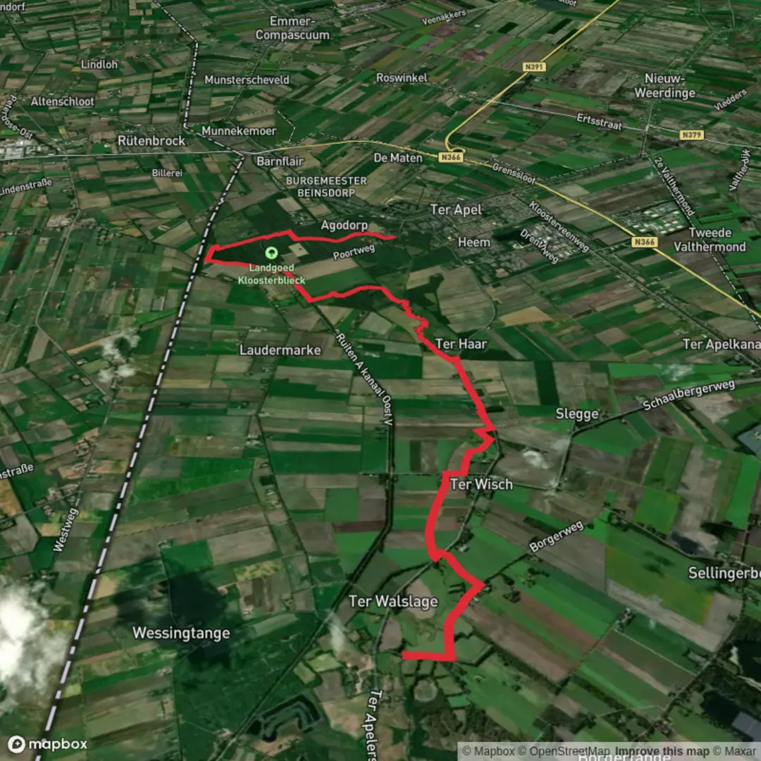
Starting from the village of Laude, nestled in the tranquil province of Groningen, this 13 km (about 8 miles) route follows the Noaberpad and Westerwoldepad, two of the Netherlands’ most scenic long-distance trails. With virtually no elevation gain, this easy walk is perfect for those seeking a leisurely day immersed in the rural beauty and cultural history of the Dutch-German borderlands.
Getting There
Laude is accessible by public transport via the nearby town of Sellingen, which is served by regional buses from Emmen or Stadskanaal. From Sellingen, it’s a short taxi or bike ride to Laude. If arriving by car, parking is available in the village center near the intersection of Lauderstraat and Dorpsstraat, close to the local church—a recognizable landmark and a good spot to begin your walk.
Trail Experience and Navigation
The route is well-marked, but for peace of mind and detailed navigation, HiiKER offers comprehensive mapping and waypoint information for both the Noaberpad and Westerwoldepad. The path meanders through a patchwork of farmland, heath, and woodland, with the tranquil Ruiten Aa river valley providing a constant companion for much of the journey.
Landmarks and Points of Interest
- Ruiten Aa Valley: Early in the walk, you’ll follow the Ruiten Aa, a meandering stream that has shaped the landscape for centuries. The valley is a haven for birdlife, including kingfishers, herons, and sometimes even storks. The area is also known for its wildflowers in spring and summer.
- Historic Farms and Hamlets: The trail passes several centuries-old farms and tiny hamlets, each with its own story. Many of these buildings are constructed in the traditional Saxon style, with thatched roofs and timber frames.
- Sellingen: Around the halfway mark, you’ll skirt the edge of Sellingen, a village with a medieval church and a history dating back to the 12th century. The church tower is visible from a distance and makes a good spot for a rest.
- Westerwolde Forests: The latter part of the hike enters the Westerwolde region, known for its mixed forests and peat bogs. This area is rich in wildlife—roe deer, foxes, and a variety of woodland birds are commonly seen.
- Ter Apel Monastery: The route culminates at the historic Ter Apel Monastery (Klooster Ter Apel), a UNESCO-listed site dating to the 15th century. The monastery is surrounded by ancient woodland and offers a café, museum, and peaceful gardens.
Nature and Wildlife
The Westerwolde region is one of the most biodiverse in the northern Netherlands. Expect to see marshland plants, dragonflies, and butterflies along the watercourses. In autumn, the forests are alive with mushrooms and the calls of migratory birds.
Practical Tips
The trail is mostly flat and well-maintained, suitable for all fitness levels. Waterproof footwear is recommended in wetter months, as some sections near the river can be muddy. There are several benches and picnic spots along the way, especially near Sellingen and the monastery grounds. Public toilets are available at Sellingen and Ter Apel.
For those relying on public transport at the end of the hike, Ter Apel is well-connected by bus to Emmen and Winschoten, making it easy to return to your starting point or continue your journey elsewhere.

Surfaces
Unpaved
Unknown
Asphalt
Gravel
Sand
Concrete
Wood
Comments and Reviews
User comments, reviews and discussions about the Laude to Ter Apel via Noaberpad and Westerwoldepad, Netherlands.
average rating out of 5
0 rating(s)