Download
3D Flyover
Add to list
More
15.7 km
~3 hrs 13 min
45 m
Point-to-Point
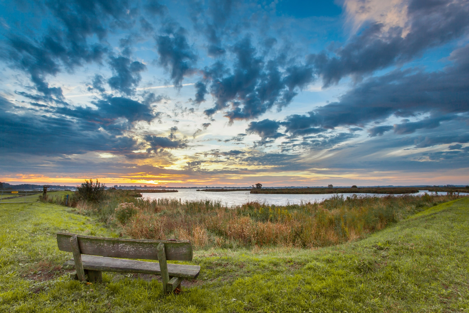
“From Westlaren to Zuidlaardermeer, drift through big skies, reedbeds, and quiet farmland—wind permitting.”
This is a low‑stress, mostly flat lakeside and farmland walk in Drenthe/Groningen country, linking the village edge of Westlaren with the Zuidlaardermeer (Southlaarder Lake) and finishing near De Bongerd. At roughly 16 km / 10 miles with about 0 m / 0 ft of climbing, it suits beginners, families, and anyone wanting big skies, reedbeds, and waterfowl rather than hills.
Getting to the start (Westlaren)
By car - Aim for the village of Westlaren (near Zuidlaren, Drenthe). A practical “known point” to navigate to is Zuidlaren village center (Brink, Zuidlaren), then continue a few minutes toward Westlaren. Parking is typically easiest on village streets or near local access points to the countryside paths (look for signed walking routes and small pull-ins).
By public transport - The most straightforward rail hub is Groningen. From there, regional buses run toward Zuidlaren; you can then continue by bus or a short taxi ride/walk to Westlaren depending on the exact stop your route uses that day. - If you’re planning precisely, check the nearest bus stop to your intended trailhead in HiiKER and match it to current bus timetables.
(You mentioned “Hike head: near” but didn’t include coordinates or a specific point. If you share a lon/lat for the start and finish, I can pin them to the nearest named place—e.g., a church, bridge, trail gate, or parking area—and tighten the directions.)
What the route feels like (surface, scenery, and pacing)
Expect a mix of: - Village lanes and quiet rural roads leaving Westlaren - Farm tracks and field-edge paths (often grassy or compacted dirt) - Lakeside and wetland paths around the Zuidlaardermeer area, where conditions can be softer underfoot
Because the elevation change is negligible, the main “effort” variables are wind exposure (it can be surprisingly strong near open water) and underfoot conditions after rain (muddy patches near reedbeds and drainage ditches).
A comfortable pacing plan for most hikers: - 16 km / 10 miles in 3.5–5 hours, depending on stops for birdwatching and photos
Route breakdown with approximate distances
0–3 km (0–1.9 mi): Westlaren out to open countryside - You’ll transition quickly from village edges into classic northern Dutch rural landscape: long sightlines, drainage channels, and fields divided by hedgerows and ditches. - Watch for cyclists on shared lanes—this region is bike-friendly, and bikes can move fast and quietly.
3–8 km (1.9–5 mi): Approaching Zuidlaardermeer - The landscape begins to feel wetter and more open. You’ll likely notice more reeds, wetter meadows, and the first good views toward the lake basin. - This is where footwear matters most: even on an “easy” route, waterlogged edges can force you onto narrower, firmer lines.
8–13 km (5–8.1 mi): Zuidlaardermeer shoreline and wetland zone - This is the scenic core: broad water, reedbeds, and big-sky horizons. - Expect the most wildlife here, plus the most exposure to wind and weather. If it’s a bright day, there’s little shade—sun protection can matter even on cooler days.
13–16 km (8.1–10 mi): Leaving the lake toward De Bongerd - The route typically returns to a more sheltered patchwork of tracks and lanes as you near settlement again. - If “De Bongerd” refers to a local facility/area name (common in the Netherlands for community spaces, care locations, or neighborhood greens), it’s often near built-up areas—expect more paved surfaces and junctions near the end.
Landmarks, nature, and wildlife to look for
Zuidlaardermeer (Southlaarder Lake) - A well-known lake-and-wetland system on the Drenthe/Groningen border area, valued for waterbirds and reedbed habitat. - Likely sightings (season-dependent): geese, ducks, swans, coots, grebes, and a variety of waders along shallows and wet meadows. In migration periods, numbers can increase dramatically.
Reedbeds, wet meadows, and drainage channels - These are prime for bird activity and also explain why the route can feel “damp” even when nearby fields look dry. - In warmer months, expect insects (bring repellent if you’re sensitive), and keep an eye out for frogs and other small wetland life near ditches.
Farmland edges - You’ll pass working agricultural land. Stay on the path, close gates if you encounter any, and give space to farm vehicles. - Dogs: if you bring one, keep it controlled—ground-nesting birds and livestock areas can be sensitive.
Historical and cultural context (what you’re walking through)
This part of the northern Netherlands has long been shaped by the relationship between people and water: - Land drainage and water management define the landscape—ditches, canals, and managed water levels are not just scenery; they’re the infrastructure that made settlement and farming reliable here. - Villages like Zuidlaren/Westlaren sit in a region with deep rural roots, where historic movement between higher, drier ground

Surfaces
Unknown
Asphalt
Sand
Concrete
Grass
Paved
Ground
Gravel
Comments and Reviews
User comments, reviews and discussions about the Westlaren to De Bongerd via Zuidlaardermeer, Netherlands.
average rating out of 5
0 rating(s)