Download
3D Flyover
Add to list
More
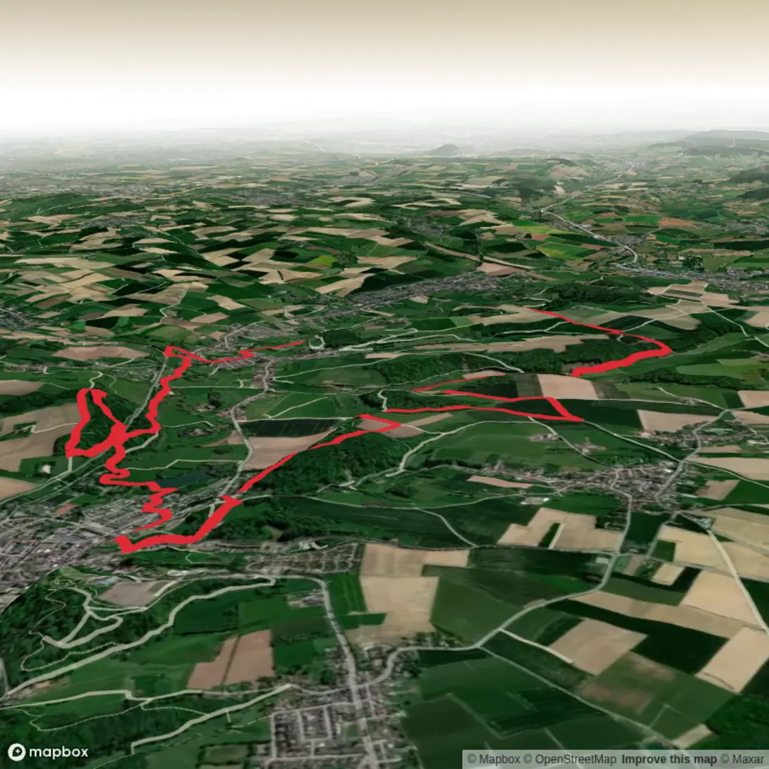
18.1 km
~4 hrs 4 min
276 m
Loop
“Wander through Limburg’s rolling hills, ancient castles, and wildflower meadows on a storybook journey.”
Starting near the historic town of Valkenburg, this 18 km (about 11 miles) loop with approximately 300 metres (984 feet) of elevation gain offers a gentle yet rewarding journey through the rolling hills and lush woodlands of Limburg, the southernmost province of the Netherlands. The trailhead is conveniently located close to Valkenburg’s train station, making it easily accessible by public transport from Maastricht or Heerlen. For those arriving by car, parking is available near the station and in the town center.
Getting Oriented and Setting Out
The route begins just steps from Valkenburg’s charming old town, renowned for its medieval castle ruins and marlstone caves. Hikers can use HiiKER for precise navigation, ensuring a smooth start and accurate wayfinding throughout the loop. The initial stretch leads you through cobbled streets lined with cafés and historic buildings before quickly transitioning into the countryside.
Landmarks and Natural Highlights
After leaving the town, the path ascends gently through the Geul Valley, a region celebrated for its wildflower meadows and the meandering Geul River. At around 3 km (1.9 miles), you’ll pass the centuries-old Sint Gerlachuskerk in Houthem, a baroque church with beautiful frescoes and a tranquil monastery garden. The trail continues through mixed deciduous forests, where you may spot roe deer, woodpeckers, and a variety of songbirds, especially in spring and early summer.
Scenic Vistas and Historical Sites
Between 6 and 10 km (3.7–6.2 miles), the route climbs to the plateau above Valkenburg, offering panoramic views over the Limburg hills and patchwork farmland. This area is dotted with traditional half-timbered farmhouses and ancient field boundaries. At about 8 km (5 miles), you’ll encounter remnants of Roman roads and, if you detour slightly, the Schaloen Castle—a moated manor house dating back to the 14th century.
Wildlife and Flora
The trail’s varied habitats support a rich diversity of flora and fauna. In the spring, the forest floor is carpeted with wild garlic and bluebells, while summer brings butterflies and dragonflies to the riverbanks. The Geul Valley is also home to rare orchids and, with luck, you might glimpse a kingfisher darting along the water.
Final Stretch and Return to Valkenburg
The final 5 km (3.1 miles) descend gradually back toward Valkenburg, passing through orchards and open fields. The approach to town offers a last look at the limestone cliffs and the iconic Wilhelminatoren observation tower perched above the valley. The loop concludes near the train station, where hikers can easily catch a train or bus, or return to their parked car.
For navigation, HiiKER provides up-to-date trail maps and waypoints, ensuring you stay on track and don’t miss any of the region’s highlights. The route’s easy rating and moderate elevation gain make it suitable for most walkers, including families and those new to longer hikes.

Surfaces
Asphalt
Unknown
Dirt
Gravel
Sand
Unpaved
Ground
Grass
Concrete
Paved
Wood
Comments and Reviews
User comments, reviews and discussions about the Pelgrimspad 2 and Valkenburg Loop, Netherlands.
average rating out of 5
0 rating(s)