Download
3D Flyover
Add to list
More
14.5 km
~2 hrs 54 min
0 m
Point-to-Point
“Circle Westerplas from airy dune crests to reedbed hush, where soft sand slows and light lingers.”
A flat, coastal-and-dune circuit of roughly 15 km / 9.3 mi with essentially 0 m / 0 ft of climbing, linking open dune ridges, sheltered woodland edges, and calm water around Westerplas, then looping through the low-lying Laagte of Rede area. Expect mostly wide, sandy or compacted paths with a few softer dune sections where footing gets loose and pace slows.
Getting to the start (and where “near” usually means here)
Because the start point is listed only as “near” (no coordinates provided), the most practical way to plan is to anchor your start at the most obvious access point for this route: the main public access around Westerplas / the dune entrances on the north side of the island of Schiermonnikoog (a common staging area for Noorderduinen–Westerplas loops). If you share a lon/lat pin (or a HiiKER link), I can convert it to the nearest named access point and tailor the directions precisely.
By public transport (typical approach): - Travel by train/bus to Lauwersoog (Groningen/Friesland), then take the ferry to Schiermonnikoog. - From the ferry terminal on Schiermonnikoog, local buses and taxis run toward the village and main recreation areas; many hikers also walk or cycle from the terminal depending on where you choose to start.
By car (typical approach): - Drive to Lauwersoog ferry port and park there (cars generally do not go to the island unless you have a permit/exception). - Take the ferry as a foot passenger; on the island, continue by bus, taxi, bike rental, or on foot to the trailhead area near Westerplas/dune access.
What the terrain feels like underfoot
- 0–3 km (0–1.9 mi): Easy, level warm-up on broad paths—often a mix of firm sand, shell grit, and compacted track. If you start near Westerplas, you’ll likely have calm water to one side and low vegetation to the other.
- 3–8 km (1.9–5.0 mi): The most “dune-like” portion: gentle undulations rather than true climbs, but soft sand patches can make it feel harder than the elevation profile suggests. Wind exposure increases on open dune crests.
- 8–12 km (5.0–7.5 mi): Transition into lower, more sheltered ground around the Laagte of Rede area—expect damper sections after rain, occasional puddling, and more reed/grass edges.
- 12–15 km (7.5–9.3 mi): Return leg on easy, fast surfaces—often the most straightforward navigation, especially if you keep the water features as handrails.
Navigation and wayfinding (use HiiKER)
This is the kind of landscape where paths braid and rejoin—especially in dunes—so it’s worth having the route loaded in HiiKER before you set off. Two practical tips: - In open dunes, pick the correct junction early; a wrong turn can still “work” but may add distance through softer sand. - Around water edges and low-lying reedbeds, stay on the main track where it’s signed/obvious; smaller side paths can dead-end at wet ground or sensitive habitat.
Landmarks you’ll notice
- Noorderduinen: Open dune scenery with low shrubs and grasses; views can feel surprisingly big for such a flat hike. On breezy days, you’ll hear wind moving through marram grass and see sand drift patterns on the path edges.
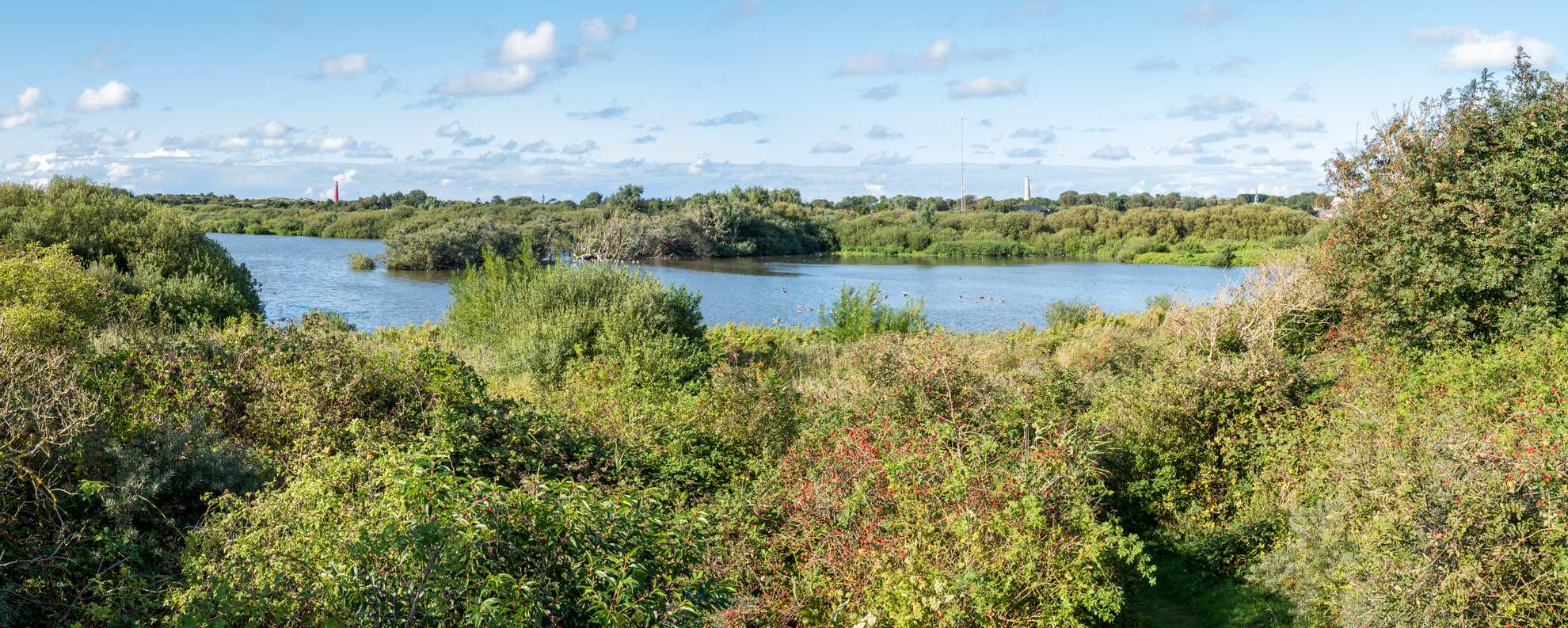
- Westerplas: A calm freshwater feature that draws birds and creates a distinct change in atmosphere—more sheltered, more reflective light, and often a noticeable temperature difference on still days.
- Laagte of Rede: “Laagte” indicates a low-lying area; expect wetter ground, reedbeds, and a more enclosed feel compared with the dunes. This contrast—dry, airy dunes to damp, vegetated lowland—is the signature rhythm of the route.
Nature and wildlife to look out for
- Birdlife: Water and reed edges commonly attract ducks, geese, and waders; dunes and open scrub can hold smaller songbirds and raptors cruising on wind. Bring binoculars if you have them—this is a high-reward route for casual birdwatching.
- Dune vegetation: Marram grass stabilizing sand, low shrubs, and hardy coastal plants adapted to wind and salt. Stay on established paths to avoid trampling fragile dune systems.
- Insects and seasonal factors: In warmer months, expect more insects near still water and reedbeds; a light layer and repellent can make breaks more comfortable.
Historical significance and sense of place
This landscape reflects a long Dutch relationship with coastal dynamics—sand, wind, and water shaping land use. Dune systems have historically acted as natural coastal defenses, while low-lying areas and freshwater bodies influenced where people could travel, graze animals, and manage water. Place names like “Laagte” (low area) are a reminder that micro-topography matters here even when the hike shows “0 m” of gain—water management and natural drainage patterns have always been central to how these coastal environments function.
Practical planning: time, gear, and conditions
- Time estimate: Most hikers will take 3–4 hours for 15 km / 9.3 mi at an easy pace, longer if you stop for birdwatching or if sand is soft.
- Footwear: Trail shoes are fine

Surfaces
Unknown
Sand
Grass
Asphalt
Comments and Reviews
User comments, reviews and discussions about the Noorderduinen, Westerplas and Laagte of Rede, Netherlands.
average rating out of 5
0 rating(s)