Download
3D Flyover
Add to list
More
16.6 km
~3 hrs 19 min
0 m
Point-to-Point
“Wander through meadows, woodlands, and history, as wildlife and centuries-old tales enrich every step.”
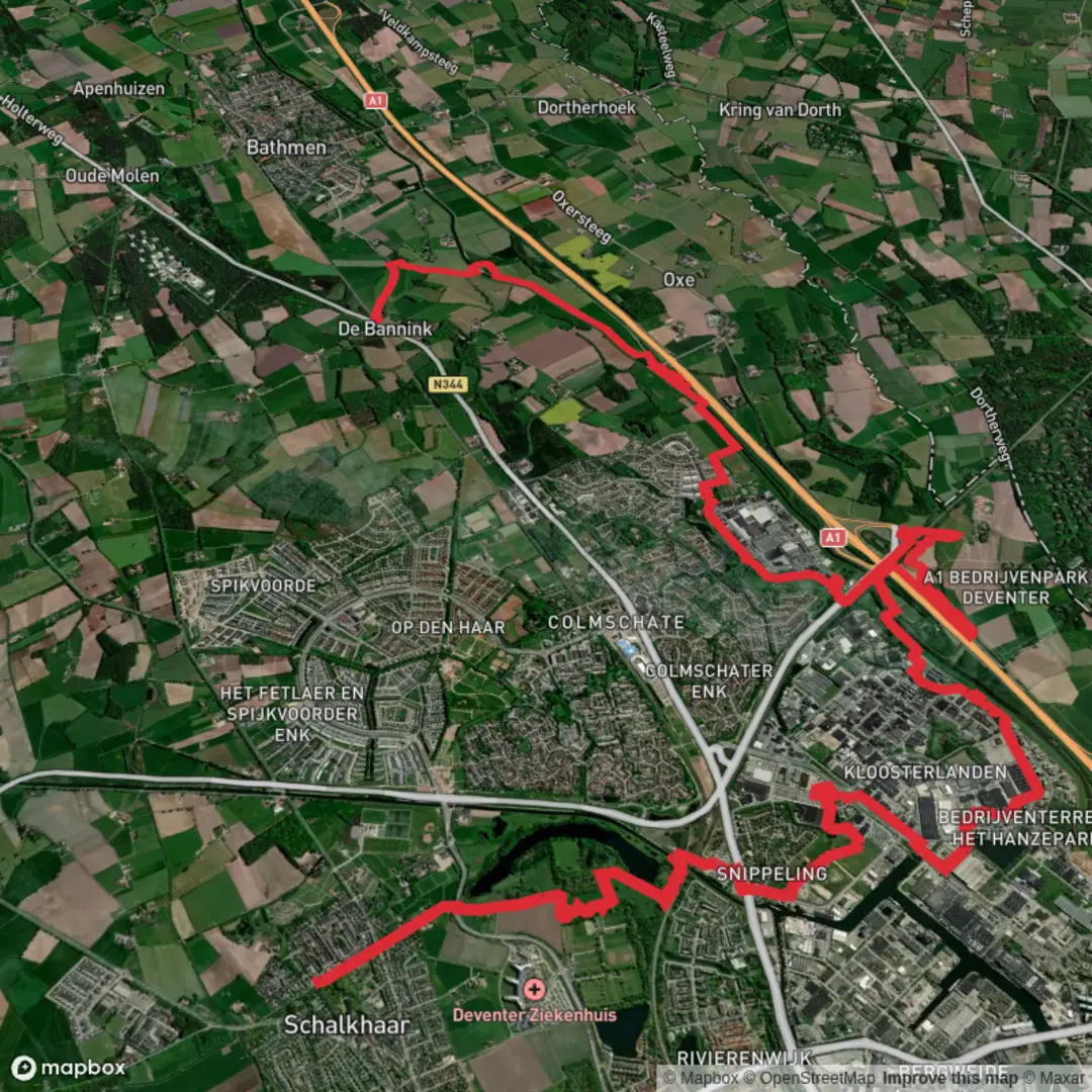
Starting from the outskirts of Schalkhaar, a small village just northeast of Deventer in the Dutch province of Overijssel, this 17 km (about 10.5 miles) route is a gentle, flat walk with virtually no elevation gain—perfect for those seeking a leisurely day outdoors. The trailhead is conveniently located near the Schalkhaar village center, which is accessible by local bus from Deventer’s main train station, or by car with parking available near the village church.
Navigating the Route
The path heads eastward, quickly leaving the village behind and entering a patchwork of open farmland, hedgerows, and small wooded groves. Navigation is straightforward, but for peace of mind and to track your progress, HiiKER offers detailed mapping and GPS guidance for this route. The first few kilometers are characterized by quiet country lanes and the occasional farmstead, with the flat Dutch landscape stretching out in all directions.
Track Moelle and Hanzepark
After about 4 km (2.5 miles), the route intersects with Track Moelle, a scenic section that skirts the edge of a small woodland. Here, you might spot roe deer in the early morning or late afternoon, and the air is filled with birdsong from blackbirds, robins, and the occasional woodpecker. The woodland gives way to open meadows, where wildflowers bloom in spring and summer, attracting butterflies and bees.
Continuing onward, the trail passes through Hanzepark, a green corridor that follows the course of an old trade route. This area is rich in history, as the Hanseatic League once dominated trade in this region during the Middle Ages. Interpretive signs along the way provide insight into the area’s mercantile past and the significance of Deventer as a Hanseatic city. The park itself is a haven for local wildlife, including herons and storks, which can often be seen foraging in the wetlands.
Approaching Olde Tolhuus
The final stretch leads toward Olde Tolhuus, a historic inn and former tollhouse located near the banks of the IJssel River. The building dates back several centuries and once served as a checkpoint for goods traveling along the river and nearby trade routes. Today, it stands as a picturesque reminder of the region’s trading heritage, surrounded by tranquil fields and the gentle flow of the river.
Practical Considerations
The entire route is well-marked and mostly follows paved or gravel paths, making it suitable for all fitness levels and accessible year-round. There are several benches and picnic spots along the way, particularly in Hanzepark and near Olde Tolhuus, where you can rest and enjoy the scenery. Public transport options are available for the return journey from Olde Tolhuus, with local buses connecting back to Deventer and Schalkhaar.
Wildlife enthusiasts should bring binoculars for birdwatching, and those interested in history will appreciate the interpretive panels detailing the Hanseatic League’s influence on the region. The flat terrain and well-maintained paths make this an ideal hike for families, casual walkers, and anyone interested in exploring the Dutch countryside at a relaxed pace.

Surfaces
Asphalt
Unknown
Ground
Grass
Concrete
Wood
Comments and Reviews
User comments, reviews and discussions about the Schalkhaar to Olde Tolhuus via Track Moelle and Track Hanzepark, Netherlands.
average rating out of 5
0 rating(s)