Download
3D Flyover
Add to list
More
12.3 km
~2 hrs 27 min
0 m
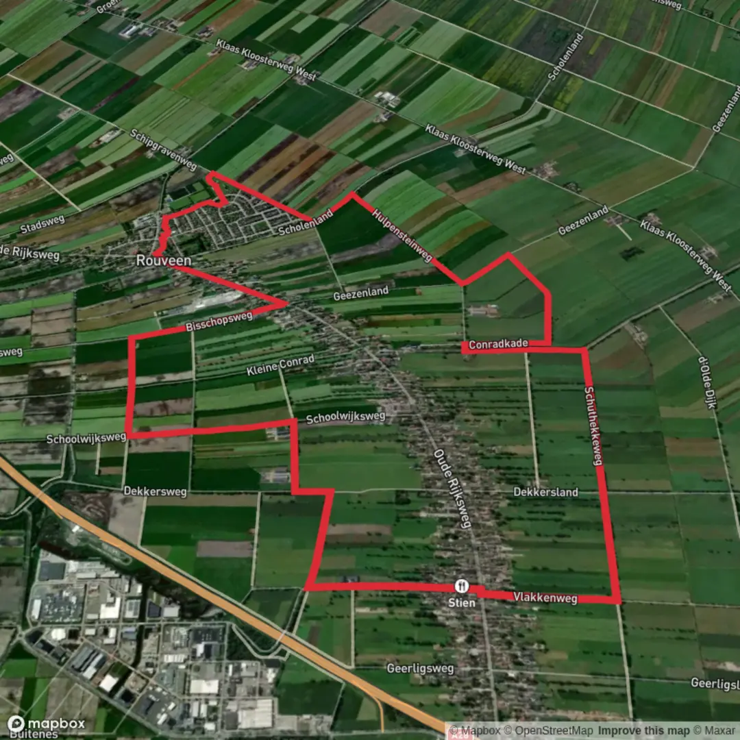
Loop
“Circle Luverne’s scenic heart on the Luverne Loop, where prairie vistas and local history await discovery.”
The Luverne Loop is a 7.4-mile (approximately 12-kilometer) multi-use trail encircling the city of Luverne, Minnesota. With virtually no elevation gain, this easy trail is suitable for hikers, cyclists, and families seeking a leisurely outdoor experience.
Trailhead and Access
The primary trailhead is located at 601 E. Main Street, Luverne, MN. Amenities at this location include parking, public restrooms, water fountains, Wi-Fi access, and a bike repair station. For those driving, the trailhead is easily accessible via U.S. Highway 75 or Interstate 90. Public transportation options may be limited; it's advisable to check local transit services for the most current information.
Trail Navigation
Beginning at the trailhead, the loop can be traversed in either direction. Heading north, the trail connects with the Blue Mounds Trail, leading to Blue Mounds State Park. The trail is well-marked, but utilizing a navigation tool like HiiKER can enhance your experience by providing real-time maps and updates.
Points of Interest
Sanford Healing Garden: A serene spot ideal for relaxation and reflection.
Veterans Pond and Fishing Pier: Offers opportunities for fishing and wildlife observation.
Kolbert Park: Features recreational facilities and green spaces perfect for picnics.
The Lake: A picturesque body of water providing scenic views and a habitat for local wildlife.
Blue Mound Ice Arena: A hub for local ice sports and events.
Redbird Field: A sports complex hosting various athletic activities.
Flora and Fauna
The trail meanders through diverse landscapes, including native grasslands, wetlands, and wooded areas. Hikers can expect to see a variety of plant species characteristic of the tallgrass prairie ecosystem. Wildlife sightings may include deer, foxes, and numerous bird species, making it a rewarding experience for nature enthusiasts.
Historical Significance
Luverne is rich in history, with several landmarks near the trail. The Rock County Courthouse, built in 1900, is an architectural gem worth visiting. Additionally, the nearby Blue Mounds State Park is home to ancient quartzite cliffs and a bison herd, offering a glimpse into the region's geological and cultural past.
Trail Conditions and Safety
The Luverne Loop is predominantly paved, ensuring a smooth journey for all users. However, certain sections may be under construction or maintenance; it's advisable to check local resources for the latest trail conditions. Always carry sufficient water, wear appropriate footwear, and be mindful of weather conditions.
Getting There
By Car: From Interstate 90, take Exit 12 onto U.S. Highway 75 South. Continue for approximately 2 miles to reach the trailhead at 601 E. Main Street.
By Public Transport: Public transportation options to Luverne are limited. It's recommended to consult local transit authorities for the most current routes and schedules.
Embarking on the Luverne Loop offers a delightful blend of natural beauty, recreational opportunities, and historical exploration, making it a must-visit for outdoor enthusiasts.

Surfaces
Unknown
Concrete
Asphalt
Sand
Comments and Reviews
User comments, reviews and discussions about the Reuveen Loop, Netherlands.
average rating out of 5
0 rating(s)