Middenkous, Koningshaven and Nieuwer Maas via Willemkade and Westzeedijk
Download
3D Flyover
Add to list
More
10.6 km
~2 hrs 8 min
8 m
Loop
“Discover Rotterdam’s dazzling blend of riverside views, bold architecture, and leafy parks on this vibrant urban loop.”
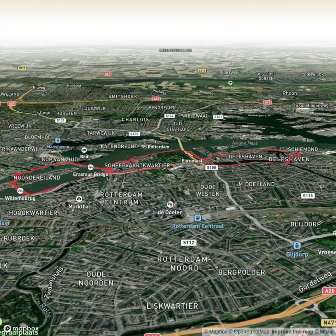
Starting from the vibrant Willemkade, just steps from Rotterdam’s iconic Erasmusbrug, this urban loop hike covers approximately 11 km (about 6.8 miles) with virtually no elevation gain, making it accessible for all fitness levels. The route weaves through some of Rotterdam’s most dynamic neighborhoods and waterfronts, offering a unique blend of modern architecture, historic docks, and riverside views.
Getting There
Willemkade is easily reached by public transport. Rotterdam Centraal Station is the main hub, and from there, tram lines 7 or 20, or Metro lines D and E to Leuvehaven station, will bring you within a short walk of the starting point. For those arriving by car, parking is available at the Erasmusbrug or nearby parking garages such as Parkeergarage Erasmusbrug.
Route Highlights and Navigation
Leaving Willemkade, the trail heads west along the Nieuwe Maas river, passing the striking De Rotterdam building and the historic Hotel New York on the Kop van Zuid. The route then crosses the Koningshaven via the famous Koningshavenbrug, also known as “De Hef,” a monumental vertical-lift railway bridge that stands as a symbol of Rotterdam’s industrial past.
Koningshaven and Maritime Heritage
As you follow the path along Koningshaven, you’ll notice the blend of old and new: modern residential towers rise beside preserved warehouses and shipyards. The area is rich in maritime history, with the nearby Maritime Museum Rotterdam offering insight into the city’s longstanding relationship with the sea. Keep an eye out for the SS Rotterdam, a retired ocean liner now moored as a hotel and museum, visible from the riverside.
Westzeedijk and Urban Green Spaces
Turning north, the trail follows Westzeedijk, a major thoroughfare lined with cultural landmarks. The Kunsthal Rotterdam and Museum Boijmans Van Beuningen are both situated along this stretch, offering opportunities for a cultural detour. The adjacent Museumpark provides a green oasis, with landscaped gardens and art installations—a perfect spot for a rest.
Nature and Wildlife
Despite its urban setting, the route offers pockets of nature, especially along the riverbanks and in the park areas. Waterfowl such as swans, coots, and herons are commonly seen along the Nieuwe Maas, and the tree-lined avenues attract songbirds. In spring and summer, the parks are alive with wildflowers and buzzing with pollinators.
Navigation and Safety
The entire route is paved and well-marked, suitable for walking year-round. Use HiiKER for detailed navigation and real-time updates on the trail. There are frequent crossings and some busy intersections, so remain alert, especially near the bridges and main roads.
Historical Significance
Rotterdam’s waterfronts have been central to its development as one of the world’s largest ports. The Koningshavenbrug, completed in 1927, survived the WWII bombings that devastated much of the city and remains a testament to Rotterdam’s resilience and engineering prowess. The Westzeedijk itself was historically a flood defense, protecting the city from the tidal forces of the North Sea.
Facilities and Refreshments
Cafés and restaurants are plentiful along the route, particularly near Willemkade, Kop van Zuid, and Museumpark. Public toilets can be found at major museums and some parks. The flat, accessible terrain makes this hike suitable for families, casual walkers, and those seeking a leisurely exploration of Rotterdam’s urban landscape.

Surfaces
Unknown
Asphalt
Cobblestone
Paved
Concrete
Comments and Reviews
User comments, reviews and discussions about the Middenkous, Koningshaven and Nieuwer Maas via Willemkade and Westzeedijk, Netherlands.
average rating out of 5
0 rating(s)