Download
3D Flyover
Add to list
More
11.3 km
~2 hrs 15 min
0 m
Loop
“From Rotterdam’s vibrant heart to serene lakeside paths, this loop blends city energy with tranquil nature.”
Starting from Rotterdam Centraal, this urban-to-nature loop covers approximately 11 km (about 6.8 miles) with virtually no elevation gain, making it accessible for all fitness levels. The route begins at the bustling Rotterdam Centraal railway station, a major transport hub easily reached by train, tram, metro, or bus from anywhere in the city or surrounding regions. For those arriving by car, parking is available at or near the station, though public transport is highly recommended due to central city traffic and limited parking.
Urban Departure and City Parks
Leaving the station, the route heads northeast through Rotterdam’s vibrant cityscape. Early on, you’ll pass through or near the Lijnbaan shopping district and the stately Westersingel canal, lined with modern sculptures and historic architecture. After about 2 km (1.2 miles), the urban environment gives way to the leafy avenues of Kralingen, one of Rotterdam’s most elegant neighborhoods, known for its 19th-century villas and tree-lined streets.
Kralingse Bos and Plas
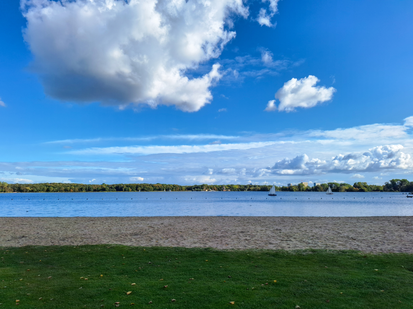
At roughly 4 km (2.5 miles), you’ll enter Kralingse Bos, Rotterdam’s largest urban park. The centerpiece is Kralingse Plas, a broad lake popular for sailing, rowing, and birdwatching. The lakeshore path is flat and well-maintained, ideal for walking, running, or cycling. Keep an eye out for the two historic windmills—De Lelie and De Ster—on the northern shore, both still in operation and occasionally open to visitors. The park is home to a variety of waterfowl, including swans, grebes, and herons, and the wooded areas shelter songbirds and squirrels.
Nature and Wildlife
The Kralingse Bos is a haven for urban wildlife. In spring and summer, wildflowers bloom along the trails, and the lake’s reed beds are alive with the calls of coots and moorhens. The park’s mixed woodlands feature beech, oak, and chestnut trees, providing shade and a sense of escape from the city. Benches and picnic spots are scattered throughout, making it easy to pause and enjoy the scenery.
Historical Context
The Kralingse Plas area has a rich history. The lake itself was formed by peat extraction in the 17th and 18th centuries, which supplied fuel for Rotterdam’s growing population. The surrounding parkland was developed in the early 20th century as a recreational escape for city dwellers, and the windmills are reminders of the area’s agricultural and industrial past.
Return to Rotterdam Centraal
After circling the lake, the route retraces its steps through Kralingen and back toward the city center. The total distance remains around 11 km (6.8 miles), with the entire walk on paved or well-maintained gravel paths, ensuring accessibility for strollers and wheelchairs. Navigation is straightforward, but for added confidence, use HiiKER to follow the route and locate points of interest along the way.
Getting There and Preparation
Rotterdam Centraal is the ideal starting point, with frequent trains, trams, and buses connecting from all parts of the city and beyond. If driving, use the parking facilities at or near the station, but be aware of city center congestion. Bring water, snacks, and weather-appropriate clothing, as amenities are plentiful in the city but more limited once in the park. The flat terrain and well-marked paths make this hike suitable for families, beginners, and anyone seeking a peaceful escape within Rotterdam’s urban landscape.

Surfaces
Asphalt
Unknown
Comments and Reviews
User comments, reviews and discussions about the Kralingse Plas from Rotterdam Centraal, Netherlands.
average rating out of 5
0 rating(s)