Download
3D Flyover
Add to list
More
7.8 km
~1 hrs 33 min
0 m
Loop
“Wander through blooming heather, ancient mounds, and whispered wartime echoes on this evocative heathland loop.”
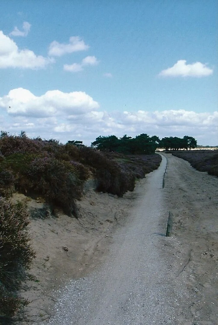
The Balloërveld Loop via Stroet Weg is an approximately 8-kilometer (5-mile) circular trail with negligible elevation gain, making it accessible for hikers of all skill levels. Situated within the Drentsche Aa National Park in the province of Drenthe, Netherlands, this trail offers a journey through expansive heathlands, historical landmarks, and diverse ecosystems.
Getting There
The trailhead is located near the village of Balloo. For those traveling by car, Balloo is accessible via the N33 highway. From the N33, take the exit toward Rolde and follow signs to Balloo. Parking is available near the Schaapskooi Balloërveld (Balloo Sheepfold), which serves as a convenient starting point for the hike. If using public transportation, the nearest train station is in Assen. From Assen, you can take a bus to Rolde and then a local bus or taxi to Balloo.
Trail Overview
Beginning at the Schaapskooi Balloërveld, the trail is well-marked and primarily consists of sandy paths that traverse the open heathland. The terrain is predominantly flat, with some areas of loose sand that may require moderate effort to navigate. The loop takes you through a variety of landscapes, including heath, forests, and along the Gasterensche Diep, a meandering stream that is part of the Drentsche Aa river system.
Significant Landmarks
Galgenberg: Approximately 2 kilometers (1.2 miles) into the hike, you'll encounter the Galgenberg, a notable burial mound offering panoramic views of the surrounding heathland. This site provides insight into the area's ancient human activity.
Sheepfold (Schaapskooi Balloërveld): Near the trailhead, the sheepfold is home to a flock of sheep that graze the heath, playing a crucial role in maintaining the landscape. Visitors can observe traditional sheep herding practices and may even join guided walks with the shepherds. (nationaleparken.nl)
Tank Trench: Remnants of a World War II tank trench are visible along the trail, serving as a historical reminder of the area's strategic significance during the war. (strootman.net)
Nature and Wildlife
The Balloërveld is renowned for its expansive heathlands, which bloom with vibrant purple heather during late summer. The area supports a variety of wildlife, including birds such as the European stonechat and skylark. The diverse habitats also provide opportunities to spot roe deer and foxes. The Gasterensche Diep adds to the ecological diversity, with its reed beds and aquatic life.
Historical Significance
The region is rich in history, with evidence of human habitation dating back thousands of years. The Galgenberg burial mound is a testament to prehistoric activity. Additionally, the area features ancient cart tracks from the Middle Ages and remnants of Celtic fields, reflecting its long-standing agricultural use. The World War II tank trench highlights the area's more recent historical significance. (strootman.net)
Trail Conditions and Safety
The trail is well-maintained and marked, making navigation straightforward. However, some sections consist of loose sand, which can be challenging to walk through. It's advisable to wear sturdy footwear and carry sufficient water, especially during warmer months. While the trail is generally safe, always stay on marked paths to protect both yourself and the delicate heathland ecosystem.
Facilities
Facilities along the trail are limited. The Schaapskooi Balloërveld offers a small café where hikers can enjoy refreshments before or after their hike. Restrooms are available at the sheepfold. It's recommended to carry any additional supplies you may need during the hike.
For detailed maps and navigation assistance, consider using HiiKER, which provides comprehensive trail information and GPS guidance.

Surfaces
Sand
Unknown
Comments and Reviews
User comments, reviews and discussions about the Balloerveld Loop via Stroet Weg, Netherlands.
average rating out of 5
0 rating(s)