Download
3D Flyover
Add to list
More
21.5 km
~4 hrs 27 min
87 m
Point-to-Point
“A long, rolling Drenthe loop from Roderesch—forests, heath and peat waters, with ancient echoes underfoot.”
This is a lowland Drenthe walk of about 22 km / 13.7 mi with roughly 100 m / 330 ft of total ascent—more “rolling” than hilly, with most of the effort coming from distance, soft forest paths, and occasional wet ground around the veen (peatland). Expect a classic North Drenthe mix: esdorp edges (old village farmland), conifer-and-broadleaf forest blocks, heath/rough grass, and peatland water.
Getting to the start (Roderesch area)
Start area landmark: the village of Roderesch (postcode 9305), municipality Noordenveld, Drenthe. (en.wikipedia.org)
A practical “pin” for planning is around the village core near Herberg Van Es (Roderesch) (a well-known local landmark in the village). (en.wikipedia.org)
- By car: Roderesch sits just west of Roden (the main town in the municipality), so most drivers approach via Roden and then local roads into Roderesch. Roden is about 16 km / 10 mi southwest of Groningen, which helps if you’re navigating from a bigger hub. (en.wikipedia.org)
- By public transport: The easiest strategy is typically train/bus to Roden area (or Groningen, then onward) and a regional bus/taxi to Roderesch. For exact stop names and the cleanest walking line from the stop to the trailhead, build the route in HiiKER.
What the route feels like underfoot (and how the 22 km tends to break down)
Because this is a loop/through-walk linking small nature areas and a historic bell structure, it usually alternates between: - Quiet lanes and farm tracks leaving/returning to Roderesch (firm footing, fast pace) - Forest paths (needle duff, roots, occasional sand) - Veen margins (spongy ground, puddles after rain, narrow trods)
A sensible way to think about the day is in four legs:
Roderesch → forest and field edges (approx. 5–6 km / 3.1–3.7 mi)
Roderesch is an esdorp that developed in the 19th century during peat excavation, so the landscape story here is tied to turf cutting and reclamation. (en.wikipedia.org)
You’ll likely start on easy-going tracks past shelterbelts and small woods—good warm-up terrain with minimal elevation change.
Look out for:
- Open agricultural edges where wind can make it feel cooler than expected
- Soft verges if you step off the track (ditches are common in Drenthe farmland)
Toward Schillenveen (approx. 5–6 km / 3.1–3.7 mi)
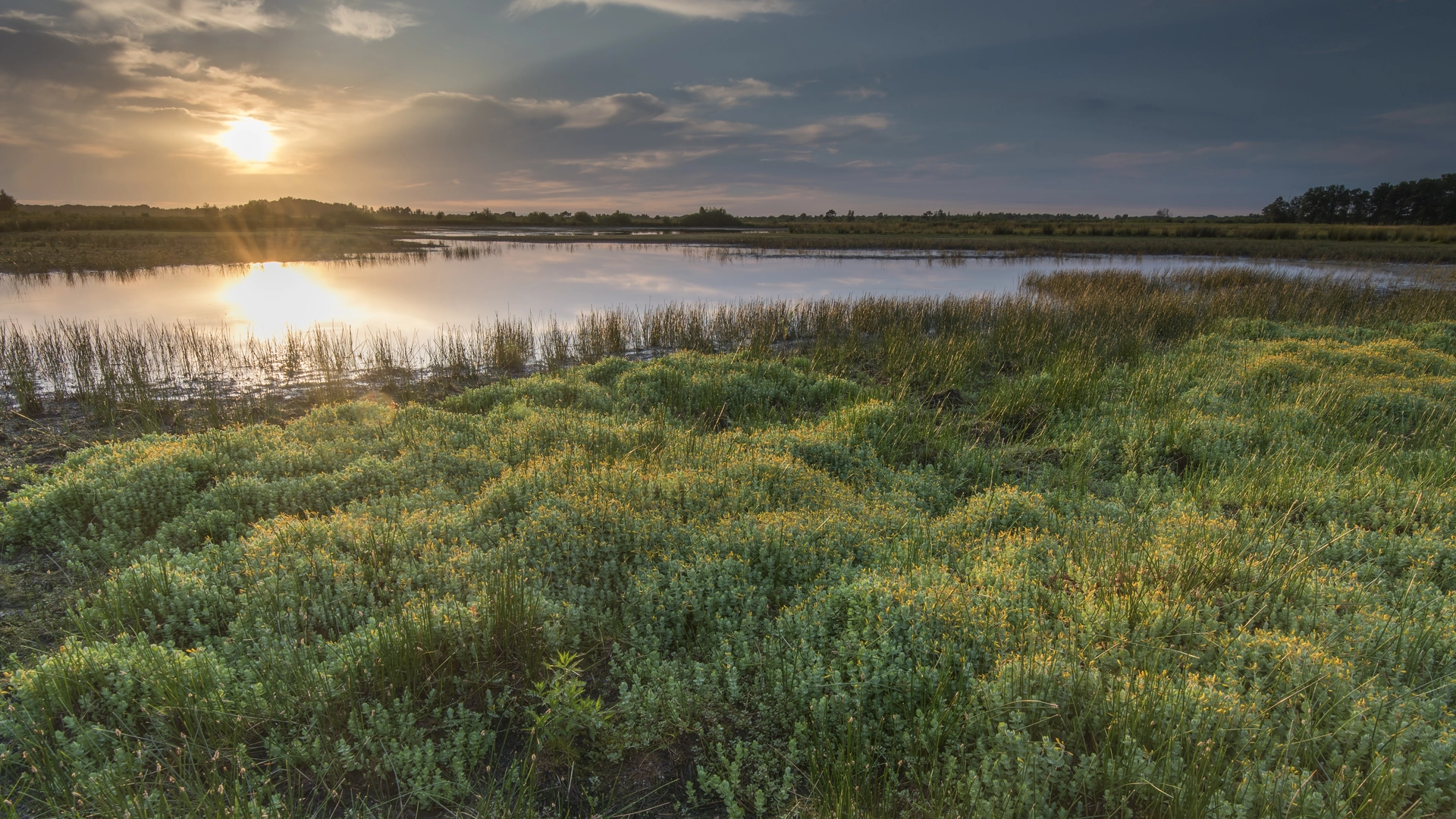
Schillenveen is notable as a pingoruïne—a round lake/peat feature formed from a pingo (an ice-cored hill) that collapsed as the climate warmed after the last ice age. (ivn.nl)
This is one of the most distinctive “why does the land look like this?” moments on the walk: you’re seeing a landform whose origin reaches back to the last glacial period. (ivn.nl)
Terrain & conditions:
- Expect narrower paths and wetter patches near the veen margins.
- After rain, the peatland edges can hold water; waterproof footwear or at least quick-drying trail shoes help.
Wildlife/nature cues:
- Peatland and wet woodland edges often bring busy birdlife (listen for constant calls rather than expecting big sightings).
- Insect activity can spike in warm months near still water—pack repellent if you’re sensitive.
Schillenveen → Tonckenbosch (approx. 6–7 km / 3.7–4.3 mi)
Tonckensbos (often spelled Tonckensbos/Tonckenbosch) near Zuidvelde is a compact but varied area—woods, small waters, and heath—and it’s also archaeologically important. (drenthe.nl)
Within the forest parcel are burial mounds (cremation barrows) from the Iron Age, and the whole complex has been a protected archaeological monument since 2002.

Surfaces
Unknown
Sand
Asphalt
Ground
Concrete
Paved
Dirt
Gravel
Grass
Wood
Comments and Reviews
User comments, reviews and discussions about the Roderesch to Klokkenstoel via Schillen Veen and Tonckenbosch, Netherlands.
average rating out of 5
0 rating(s)