Download
3D Flyover
Add to list
More
12.6 km
~2 hrs 31 min
0 m
Loop
“Meandering through shady forests, tranquil canal banks, and blooming heath, this loop teems with Dutch charm.”
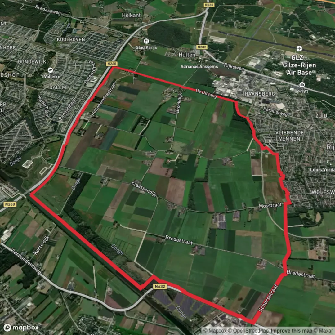
Starting from the outskirts of Rijen, a small town in North Brabant, the Rijen and Wilhelminakanaal via Vierbunders Weg loop offers a gentle 13 km (about 8 miles) circuit with virtually no elevation gain, making it accessible for hikers of all abilities. The trailhead is conveniently located near the Rijen railway station, which is easily accessible by train from Breda or Tilburg, and there is ample parking available for those arriving by car.
Getting Oriented and Setting Out
The route begins close to the intersection of Stationsstraat and Julianastraat, just a short walk from the Rijen train station. This area is well-marked and serves as a practical starting point for both local and visiting hikers. For navigation, HiiKER provides detailed mapping and waypoints for the entire loop.
Woodlands, Heath, and Canal Views
The first section leads you through the leafy Vierbunders forest, a patchwork of pine and deciduous trees that provide shade and shelter for local wildlife. Keep an eye out for roe deer, foxes, and a variety of woodland birds, especially in the early morning or late afternoon. After about 3 km (1.9 miles), the trail opens up to heathland, where you may spot wildflowers in spring and summer, and the occasional buzzard circling overhead.
Wilhelminakanaal and Historical Context
At roughly the halfway point, around 6.5 km (4 miles), the path meets the Wilhelminakanaal, a historic waterway constructed in the early 20th century to support regional industry and transport. The canal is lined with poplars and willows, and you’ll often see pleasure boats and barges making their way along the water. The towpath here is flat and wide, perfect for a relaxed stroll. Interpretive signs along the canal provide insight into its construction and the role it played in the economic development of North Brabant.
Returning via Rural Landscapes
Leaving the canal, the route loops back toward Rijen through a patchwork of farmland and small hamlets. This section, covering the final 4 km (2.5 miles), offers open views across fields and meadows, with the occasional windmill or traditional Dutch farmhouse dotting the landscape. Depending on the season, you might see storks nesting on platforms or flocks of geese grazing in the fields.
Trail Conditions and Preparation
The entire loop is well-maintained, with mostly flat, hard-packed paths and occasional paved sections. There are no significant climbs or descents, and the total elevation gain is negligible—less than a meter (about 3 feet) over the entire route. Sturdy walking shoes are recommended, especially after rain, as some forested sections can become muddy. Public benches are scattered along the canal and in the forest, providing spots for rest or a picnic.
Facilities and Navigation
Rijen offers several cafes and shops near the station for pre- or post-hike refreshments. Public toilets are available at the station and at a small park near the canal. For navigation, HiiKER’s digital maps are highly recommended, as they provide real-time location tracking and highlight all key junctions and points of interest along the route.
This loop is ideal for those seeking a peaceful walk through varied landscapes, with a blend of natural beauty and local history, all easily accessible from the heart of North Brabant.

Surfaces
Unknown
Asphalt
Concrete
Unpaved
Sand
Comments and Reviews
User comments, reviews and discussions about the Rijen and Wilhelminakanaal via Vierbunders Weg, Netherlands.
average rating out of 5
0 rating(s)